Regeneration of Tropical Storm Gabrielle

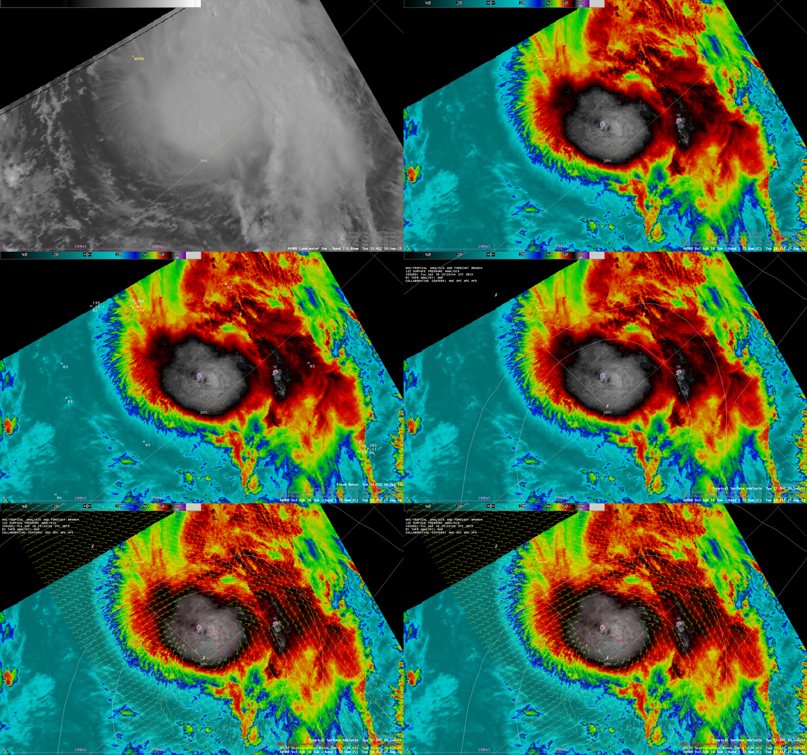
POES AVHRR 0.84 µm visible channel and 12.0 µm IR channel images (with overlays of surface buoy, surface analysis, and ASCAT winds)
After a four and a half day hiatus, Tropical Storm Gabrielle began to regenerate south of Bermuda on 10 September 2013. AWIPS images of 1-km resolution POES AVHRR 0.86 µm visible channel and 12.0 µm IR channel data at 13:41 UTC (above) showed overlays of surface buoys, surface analysis, and ASCAT surface scatterometer winds. A number of these ASCAT winds exhibited speed values of 45-46 knots, prompting NHC to adjust the intensity of Gabrielle upward:
TROPICAL STORM GABRIELLE SPECIAL DISCUSSION NUMBER   9
NWS NATIONAL HURRICANE CENTER MIAMI FL       AL072013
130 PM AST TUE SEP 10 2013

A PAIR OF ASCAT PASSES FROM 1342Z AND 1436Z INDICATE THAT GABRIELLE
IS STRONGER THAN PREVIOUSLY ESTIMATED. BOTH PASSES SHOWED SEVERAL
45-KT WIND RETRIEVALS...AND THAT IS THE INITIAL INTENSITY FOR THIS
SPECIAL ADVISORY. THE INTENSITY FORECAST HAS BEEN ADJUSTED UPWARD
AT 12 AND 24 HOURS TO 50 KT BASED ON THE INCREASE IN THE INITIAL
INTENSITY. THE ANALYZED 34-KT WIND RADII HAVE ALSO BEEN ADJUSTED
OUTWARD BASED ON THE ASCAT DATA...AND THEIR FORECAST HAS BEEN
MODIFIED AS WELL TO REFLECT THE LARGER WIND FIELD. AN AIR FORCE
RESERVE AIRCRAFT WILL INVESTIGATE GABRIELLE LATER THIS AFTERNOON TO
PROVIDE MORE DETAILED INFORMATION ON THE STRENGTH AND STRUCTURE OF
THE CYCLONE.
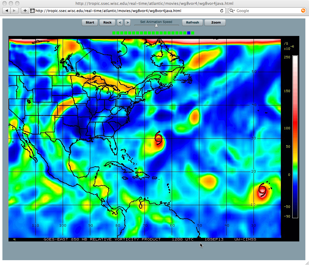
A sequence of 6-hour interval 850 hPa relative vorticity product images from the CIMSS Tropical Cyclones site (above; click image to play animation) showed that the lower-tropospheric vorticity feature associated with Tropical Storm Gabrielle remained fairly intact during the 06-10 September period (between the times when Gabrielle had exhibited tropical cyclone organization and intensity).
McIDAS images of 1-km resolution GOES-13 0.63 µm visible channel data (above; click image to play animation) revealed a well-defined central dense overcast (CDO) convective burst early in the day, followed by the emergence of the low-level circulation of Gabrielle as the middle and high-altitude cloud layers were sheared off to the northeast.


