McIDAS images of GOES-13 0.63 µm visible channel data (above; click image to play animation) showed the smoke plume emanating from a large fire that was burning in the Okefenokee Swamp in far southern Georgia on 06 May 2011. This fire originally began... Read More
")
GOES-13 0.63 µm visible channel images (click image to play animation)
McIDAS images of GOES-13 0.63 µm visible channel data (above; click image to play animation) showed the smoke plume emanating from a large fire that was burning in the Okefenokee Swamp in far southern Georgia on 06 May 2011. This fire originally began on 28 April as a result of a cloud-to-ground lightning strike.
AWIPS images of GOES-13 3.9 µm shortwave IR data (below; click image to play animation) displayed the rapid growth in size of the associated fire “hot spot” (black to red to yellow color enhancement). The hot spot first became apparent around 17:31 UTC (1:31 pm local time), and quickly grew as drier air moved across the region in the wake of a passing cold frontal boundary.
")
GOES-13 3.9 µm shortwave IR images (click image to play animation)
A comparison of AWIPS images of 1-km resolution POES AVHRR 3.7 µm and 4-km resolution GOES-13 3.9 µm shortwave IR data (below) demonstrated the advantage of better spatial resolution for locating the fire boundaries. CIMSS participation in GOES-R Proving Ground activities includes making a variety of POES AVHRR images and products available for National Weather Service offices to add to their local AWIPS workstations. A “POES and AVHRR Satellite Products in AWIPS” VISIT training lesson is also available to help users understand the products and their applications to weather analysis and forecasting.

POES AVHRR 3.7 µm + GOES-13 3.9 µm shortwave IR image comparison
===== 07 MAY UPDATE =====
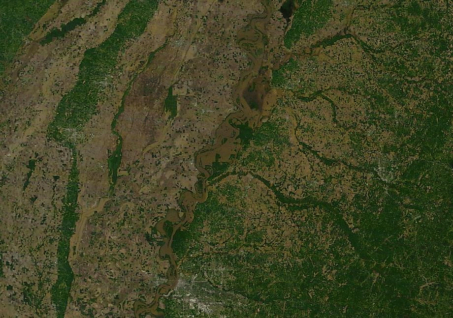
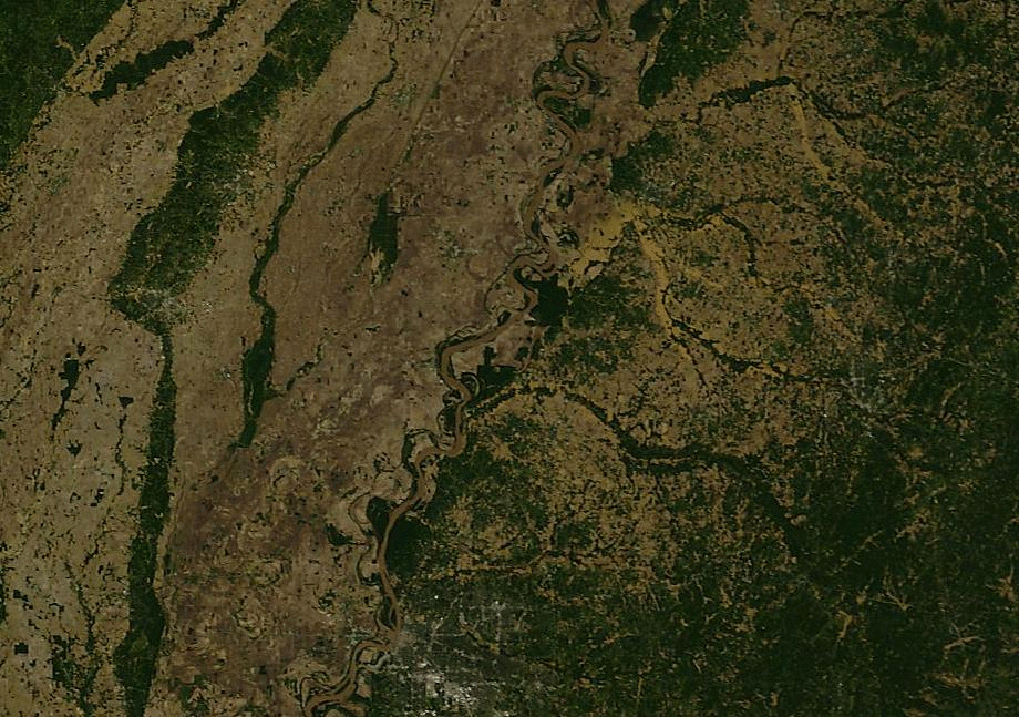
On the following day, a comparison of 250-meter resolution MODIS true color and false color Red/Green/Blue (RGB) images from the SSEC MODIS Today site (below) revealed the dense smoke plume (which appeared as varying shades of gray on the true color image), as well as the large size of the burn scar (which appeared as darker shades of darker red to brown on the false color image) resulting from this fire that had been burning for several days. Also evident was the fact that several active, very hot fires were burning at this time along the edges of the burn scar — these hot fires appeared as the brighter pink areas on the false color image. Many of these fire “hot spots” could even be detected through the dense smoke.

MODIS true color and false color images
View only this post
Read Less

")

")
")

")

 images")
