Using MODIS and AVHRR imagery in AWIPS to interrogate snow cover and cloud features across Idaho and Montana
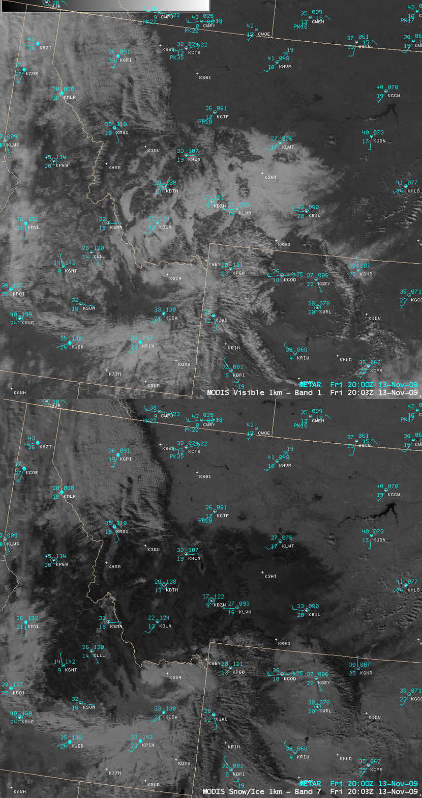
CIMSS has been distributing MODIS imagery and products in AWIPS (via LDM subscription) since 2006 — and we are now in the process of testing and evaluating AVHRR imagery and products for distribution to NWS forecast offices via a similar process. Let’s now utilize a few of these MODIS and AVHRR products to interrogate snow cover and cloud features across parts of Idaho and western Montana on 13 November 2009. A comparison of the 1-km resolution MODIS visible channel and 2.1 µm near-IR “snow/ice channel” images (above) showed a broad area of snow cover across the region, which fell during the previous 2 days. Snow cover (in addition to dense tree cover, and water) are strong absorbers at the 2.1 µm wavelength, so these features appear much darker on the snow/ice channel image — therefore, bright features on the visible image that are also dark on the snow/ice image are indeed snow. The maximum snow depth at the time was 17 inches (43 cm) at Bozeman (station identifier KBZN), located near the center of the images.
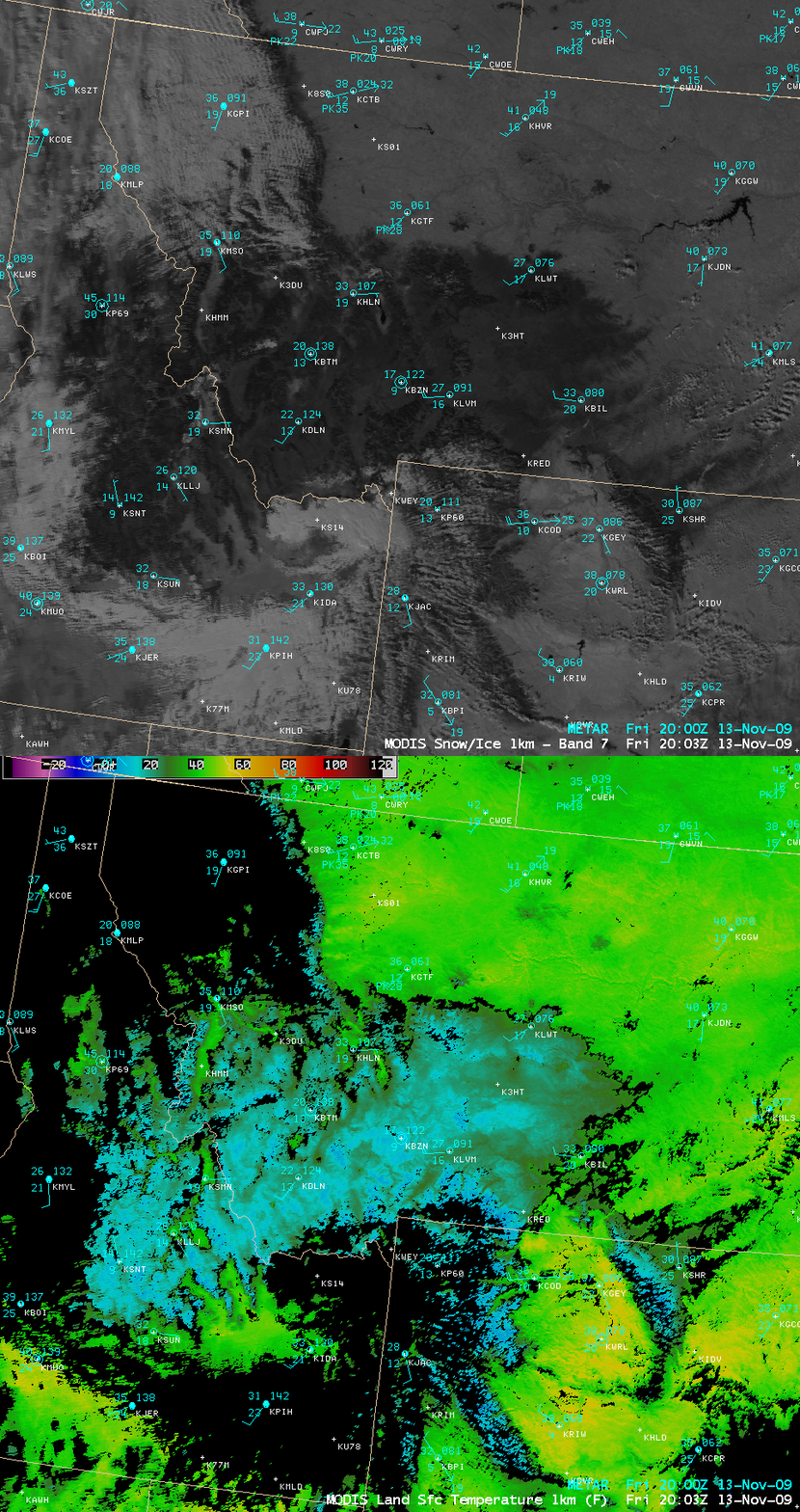
A comparison of the 1-km resolution MODIS snow/ice channel and the MODIS Land Surface Temperature (LST) product (below) revealed that this area of snow cover was having an obvious effect on Land Surface Temperatures across the state of Montana: LST values in the bare ground portions of the east were in the 40º to 50º F range (green to yellow colors), while the areas with deep snow on the ground exhibited LST values in the +5º to +15º F range (cyan to blue colors). The daily high temperatures across the state of Montana on 13 November ranged from 20º F at Three Forks in the southwest to 44º F at Glendive in the far east — and the coldest morning low was -14º F at Wisdom in the far west.
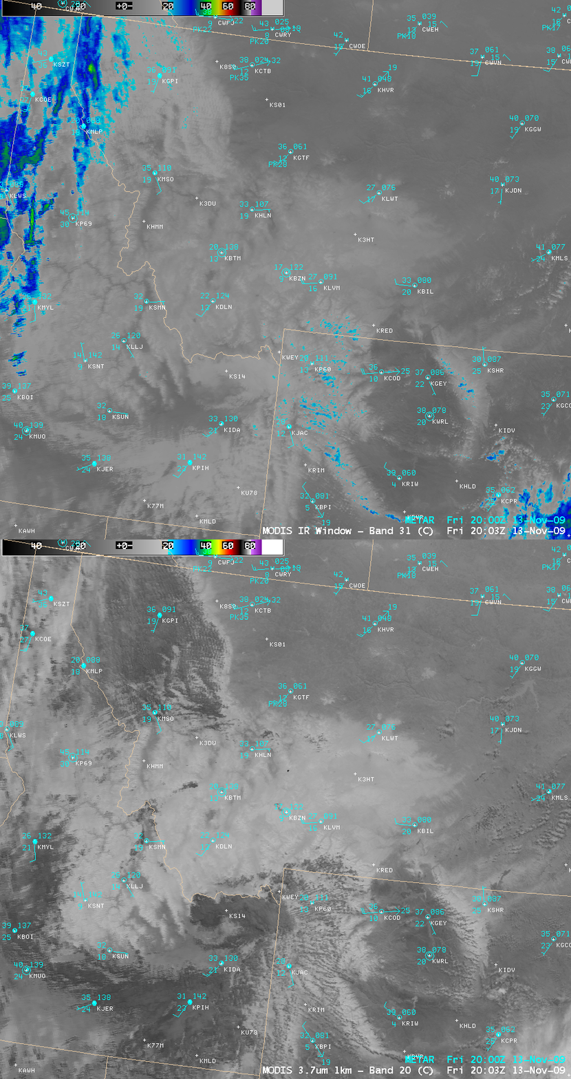
Now let’s focus our attention on the cloud features that were over parts of Idaho and Montana at that time. A comparison of the 1-km resolution MODIS 11.0 µm “IR window” and 3.7 µm “shortwave IR” images (below) showed that there were some very cold cloud features that were likely cirrus (brightness temperatures of -30º to -40º C, blue to green colors) over northern Idaho and far northwestern Montana on the IR window image — however, there was a large area of clouds located just to the east of those cirrus clouds that exhibited significantly warmer (+15º to +25º C, darker gray) appearance on the 3.7 µm shortwave IR image. The shortwave IR channel is very sensitive to the reflection of solar radiation of the tops of supercooled water droplet clouds — so a quick comparison of the IR window and the shortwave IR channels offers some cursory information on the character and composition of various cloud features. Note that there also appeared to be a few other darker patches of supercooled water droplet clouds located over parts of southwestern Montana and southern Idaho.
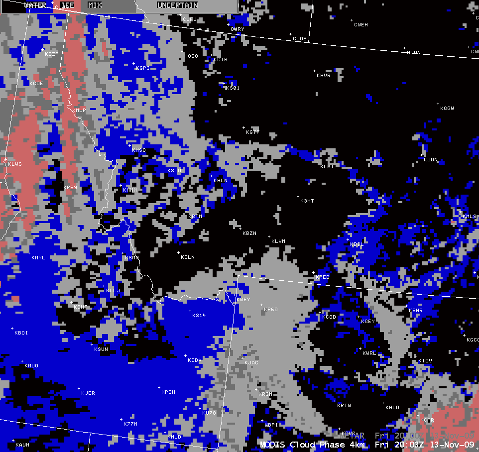
The 4-km resolution MODIS Cloud Phase product (below) offered confirmation about the presence of ice crystal cirrus clouds (salmon color enhancement) over northern Idaho and far northwestern Montana, with supercooled water droplet clouds (blue color enhancement) located farther to the east.
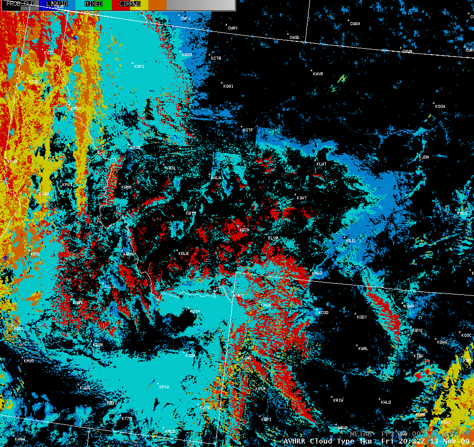
The 1-km resolution AVHRR Cloud Type product (below) supported the MODIS Cloud Phase product, indicating supercooled water droplet cloud (cyan color enhancement) to the east of the various classifications of ice crystal cloud (yellow, orange, and red color enhancements) over northern Idaho and far northwestern Montana.
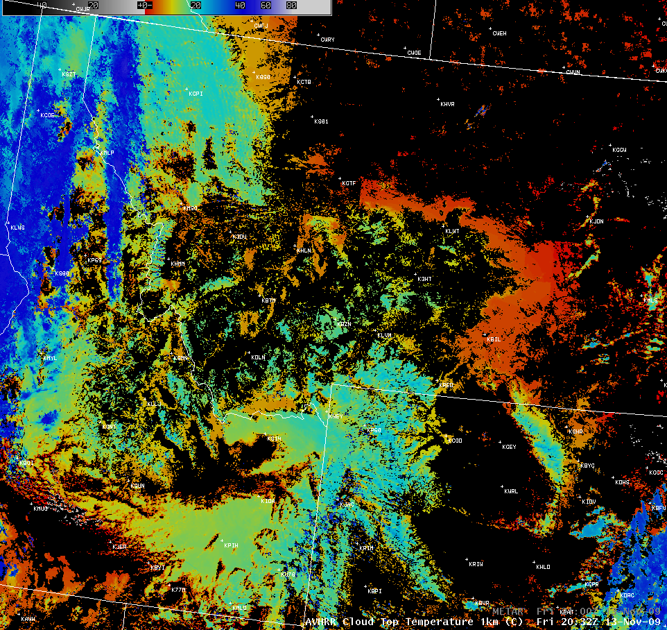
The 1-km resolution AVHRR Cloud Top Temperature (CTT) product (below) showed that the area of supercooled water droplet cloud exhibited CTT values of -18º to -20º C (cyan colors), with the cirrus cloud features farther to the west exhibiting CTT values as cold as -40º to -50º C (darker blue colors).
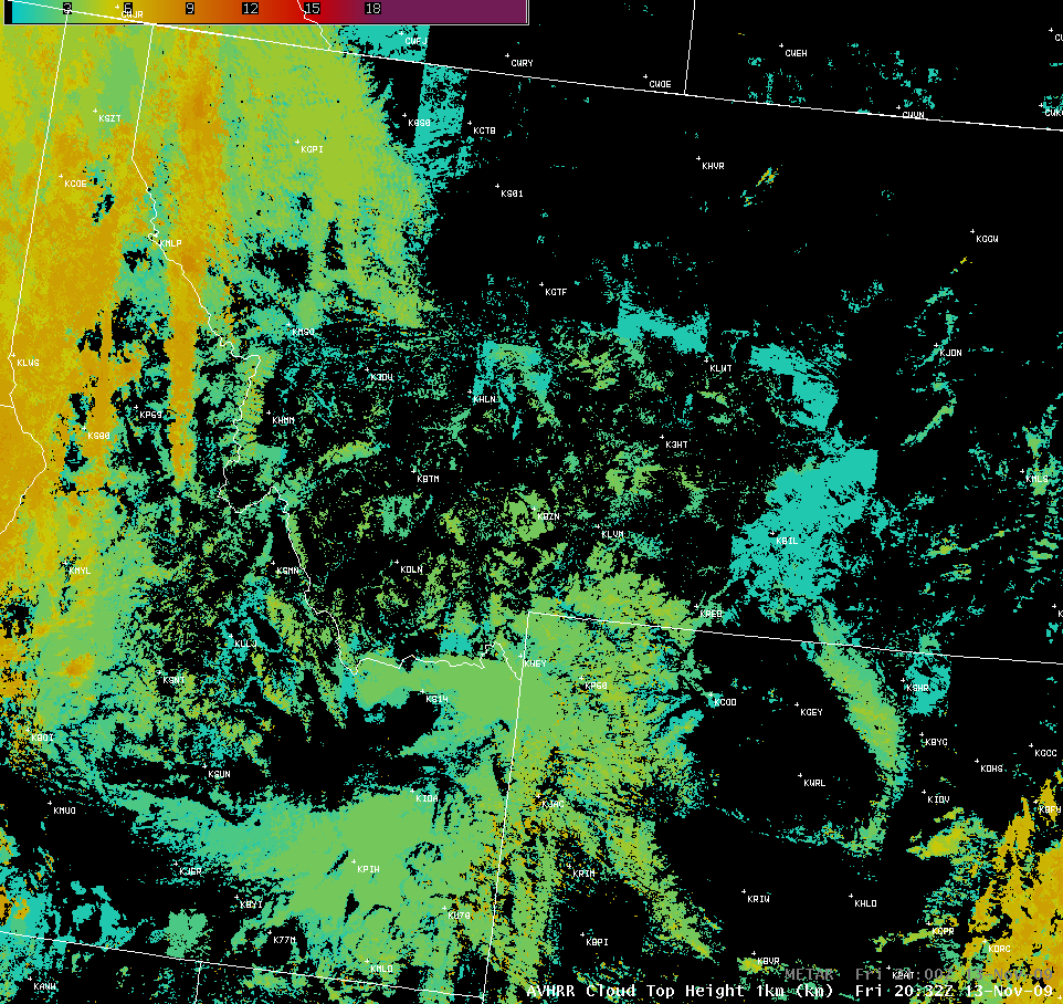
The 1-km resolution AVHRR Cloud Top Height product (below) indicated that the tops of the supercooled water droplet clouds over northwestern Montana were around 4 km or 13,000 feet (light yellow color enhancement), with the tops of the cirrus clouds farther to the west at a much higher 8 km or 26,000 feet (darker orange color enhancement).
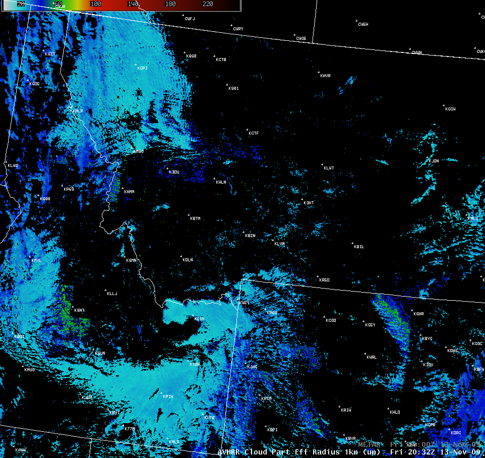
The 1-km resolution AVHRR Cloud Particle Effective Radius product (below) indicated that the supercooled water droplet cloud particles in northwestern Montana were generally in the 20-25 micrometer range (cyan colors), with the cirrus cloud ice crystals farther west at a much larger 40-50 micrometers (darker blue colors).
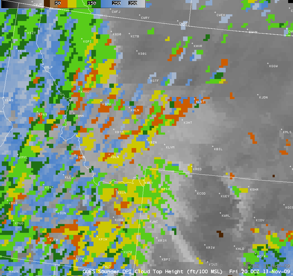
For the sake of comparison, let’s also examine the corresponding “10 km” resolution GOES Sounder Cloud Top Height (CTH) derived product image (below), which actually has an effective field of view closer to 20 km for large satellite viewing angles over the northern Lower 48 states — Sounder CTH values ranged from 7,000-12,000 feet (orange to yellow to green colors) for the supercooled water droplet clouds in northwestern Montana up to 35,000 feet (lighter cyan colors) for the cirrus clouds located just to the west.
Note that the GOES Sounder Cloud Top Height product (as well as some of the AVHRR cloud products shown above) indicated a number of “false cloud features” in the area of the deep snow cover over southwestern Montana — the large temperature gradients associated with the edges of such areas of snow cover can sometimes fool the cloud product algorithms into portraying cloud top height or cloud top temperature data where no clouds actually exist.


