")
GOES-13 0.63 µm visible channel images (click image to play animation)
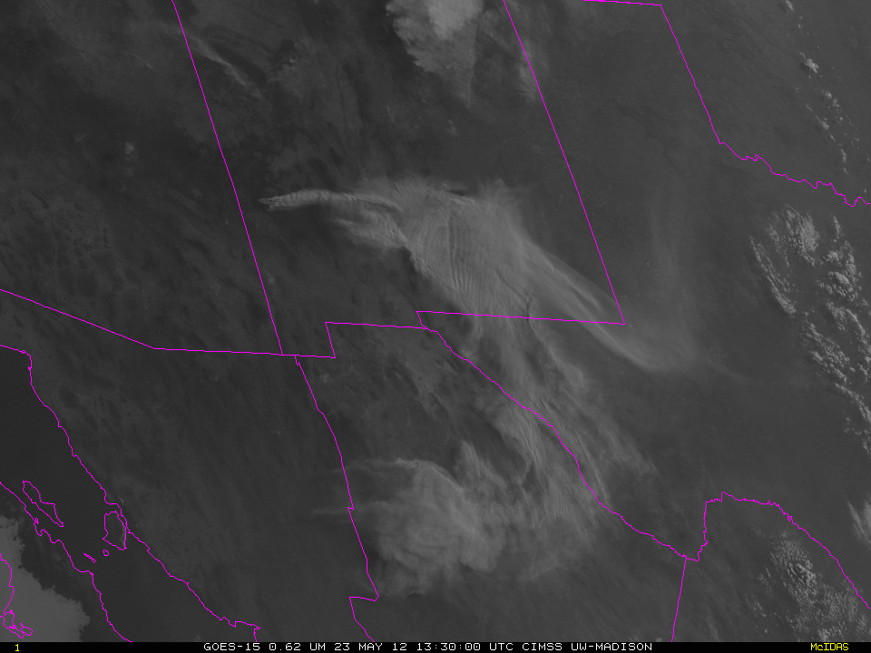
On 30 May 2012, the Whitewater-Baldy Fire complex was declared to be the largest fire on record for the state of New Mexico, having burned over 170,000 acres. On the previous day (29 May), GOES-13 0.63 µm visible channel images (above; click image to play animation) showed a vary large column of smoke that was drifting eastward across New Mexico into Texas.
A sequence of daily (early afternoon) 250-meter resolution MODIS true color Red/Green/Blue (RGB) images from the SSEC MODIS Today site (below; click image to play animation) displayed the variability in smoke plume size and direction as the fire continued to grow after 15 May. Much of the thicker smoke was confined to higher altitudes, but some smoke did settle into the boundary layer and create air quality problems downwind of the fire complex.
 images (click image to play animation)")
Daily MODIS true color Red/Green/Blue (RGB) images (click image to play animation)
A night-time AWIPS comparison of Suomi NPP VIIRS 3.74 µm shortwave IR and 0.7 µm Day/Night Band (DNB) images (below) revealed the ring of “hot spots” (red to yellow to black pixels on the shortwave IR image) and the glow of the active fires (bright white on the DNB image) around the periphery of the large fire complex. The lights of the surrounding cities and towns could also be seen on the DNB image.

Suomi NPP VIIRS 3.74 µm shortwave IR and 0.7 µm Day/Night Band images
===== 01 June Update =====
A relatively thin veil of smoke on 01 June 2012 (as seen on the 250-meter resolution MODIS true-color image) allowed the size of the Whitewater-Baldy fire burn scar to be revealed on the corresponding MODIS false-color Red/Green/Blue (RGB) image (below).
 images")
MODIS true-color and false-color Red/Green/Blue (RGB) images
View only this post Read Less
")
")


