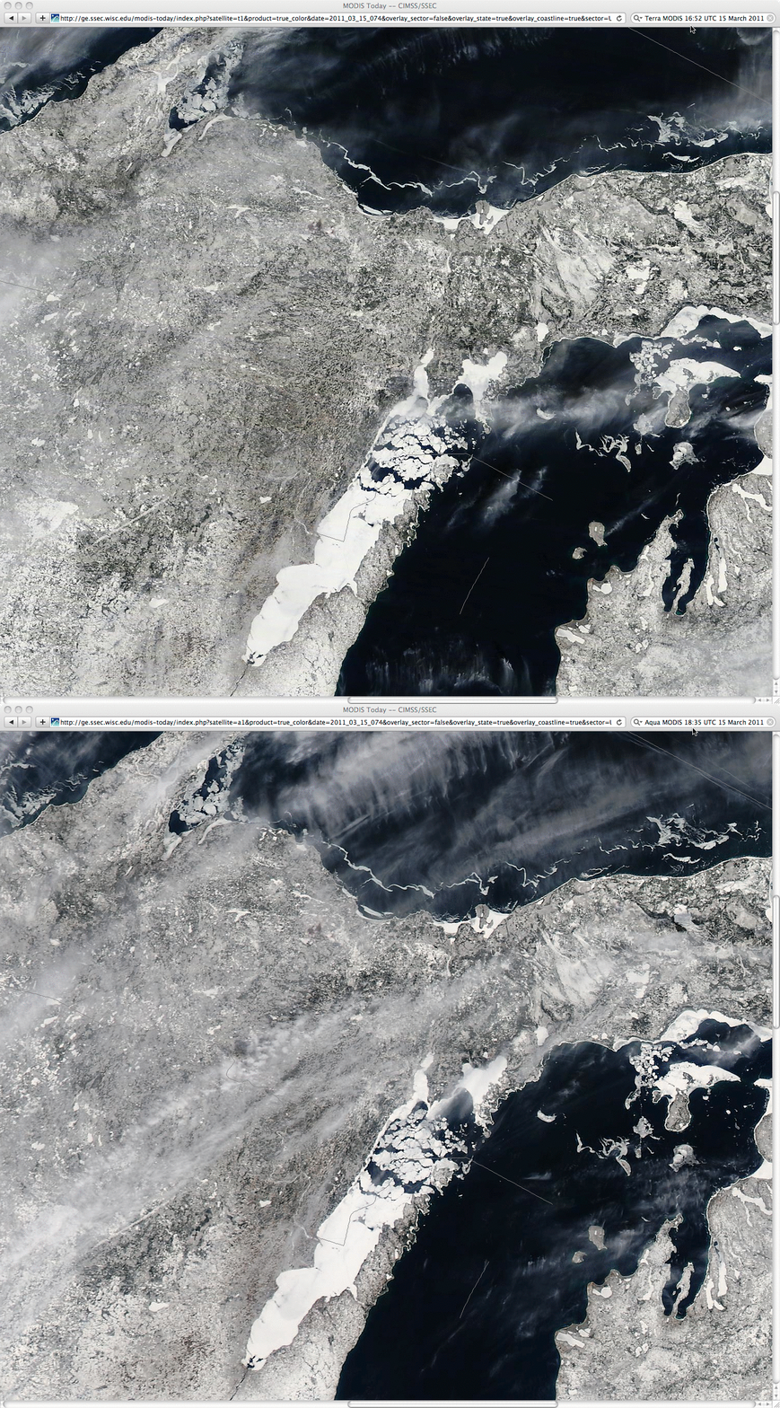
Ice breakup in the northern portion of Green Bay
A comparison of 250-meter resolution MODIS true color Red/Green/Blue (RGB) images from the SSEC MODIS Today site (above) shows the breakup of ice in the northern portion of Green Bay, Wisconsin. It can be seen that there is a significant amount of ice motion (due to southwesterly winds) in the time between the 16:52 UTC Terra MODIS image and the 18:35 UTC Aqua MODIS image — and other smaller ice floes can also be seen moving in portions of northern Lake Michigan and southern Lake Superior. Also note that the southwest-to-northeast oriented long-track tornado damage path from the 07 June 2007 severe convection event could still be clearly identified about 100 km to the west of the ice-covered portion of Green Bay.
An animation of McIDAS images of 1-km resolution GOES-13 0.63 µm visible channel data (below; click image to play animation) does show the movement of the ice in the northern portion of Green Bay during the day — but even at an image interval of 15 minutes, errors in the Image Navigation and Registration (INR) tend to produce a bit of “wobble” which makes tracking the ice motion more difficult.
With the next-generation Advanced Baseline Imager (ABI) on the future GOES-R satellite, the spatial resolution of the visible channel will be improved to 500 meters — and the nominal temporal resolution of images over the continental US will be every 5 minutes (although 30-second image intervals will be available for special weather situations). CIMSS participation in GOES-R Proving Ground activities includes the creation of model-simulated ABI visible images, as well as model simulations of 9 other ABI InfraRed (IR) band images.


