
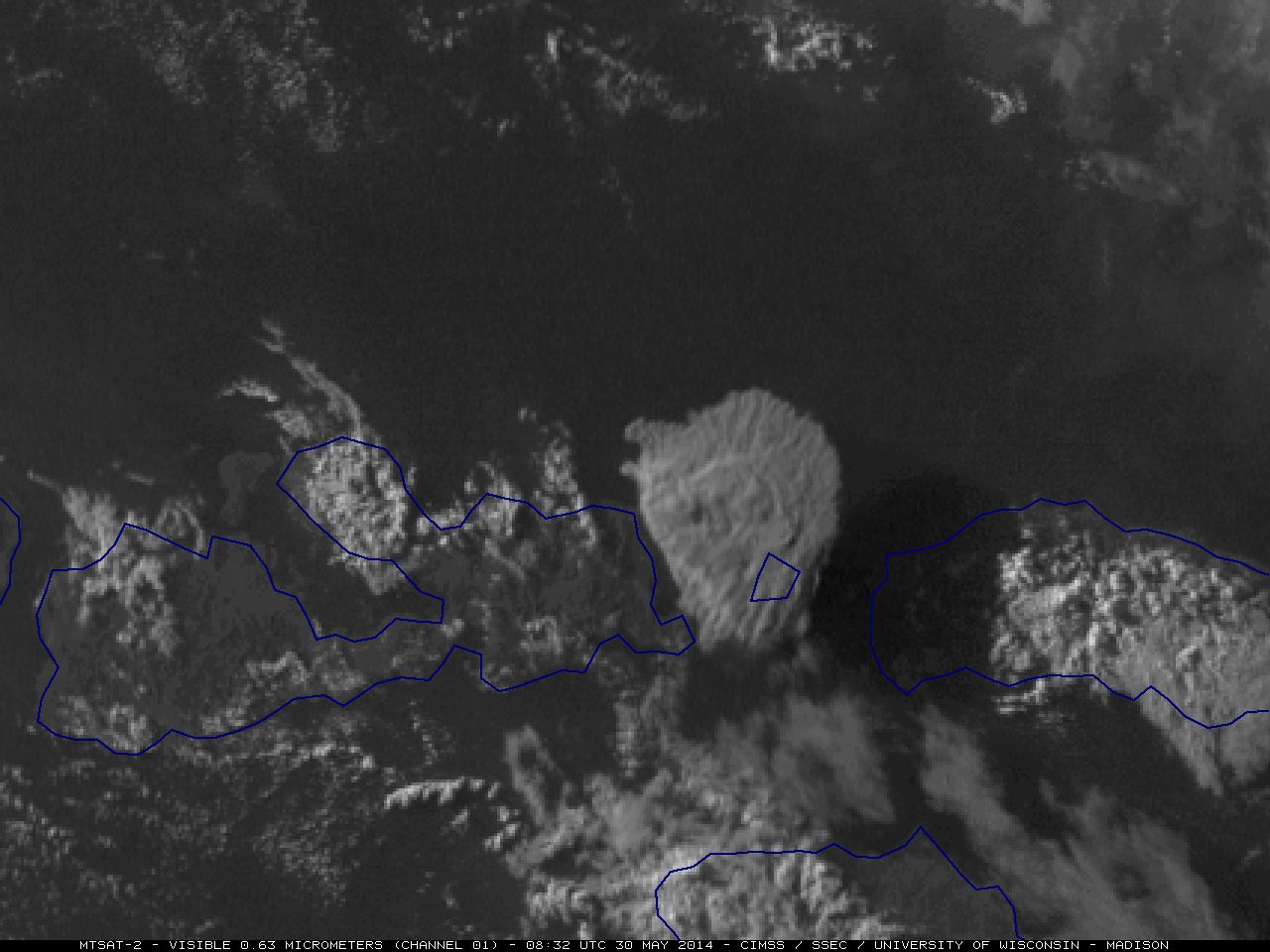
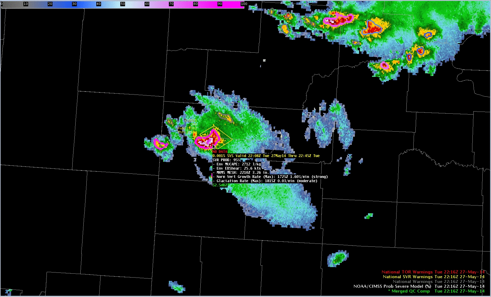
MTSAT-2 0.63 µm visible channel and 10.8 µm IR channel images at 08:32 UTC
A comparison of McIDAS images of MTSAT-2 0.63 µm visible channel and 10.8 µm IR channel data at 08:32 UTC on 30 May 2014 (above) showed the volcanic cloud from the first in a series of eruptions of the Sangeang Api volcano in Indonesia (aircraft photos). The coldest cloud-top IR brightness temperature at that time was -74.5º C; note that the tall volcanic cloud was casting a large shadow toward the east-southeast in the visible image.
An animation of MTSAT-2 10.8 µm IR images (below; click image to play animation; also available as an MP4 movie file) revealed that there were a number of smaller eruptions that followed the initial, larger eruption.
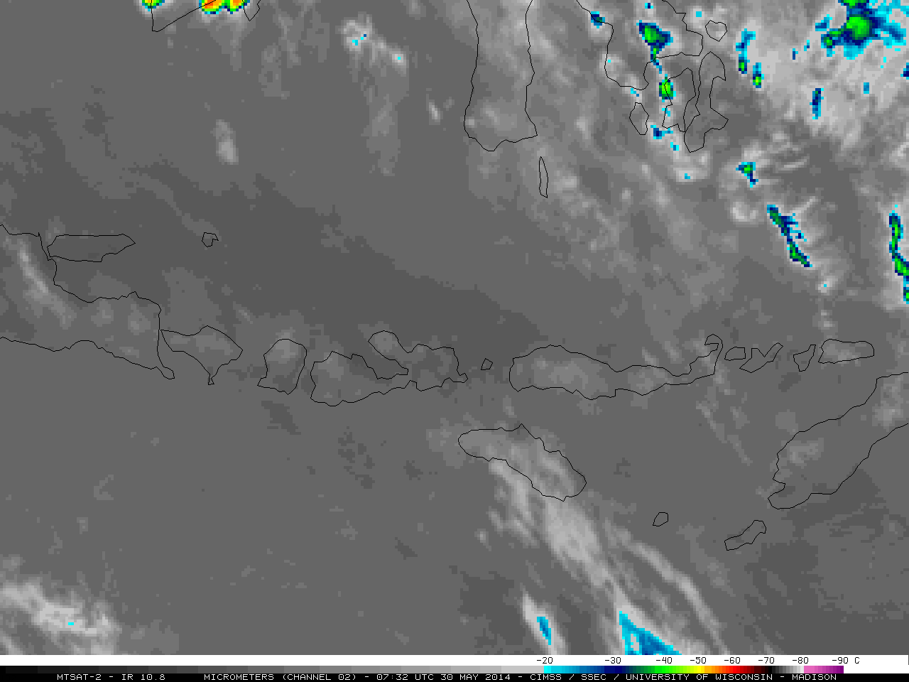
MTSAT-2 10.8 µm IR channel images (click to play animation)
———————————————————————————————————
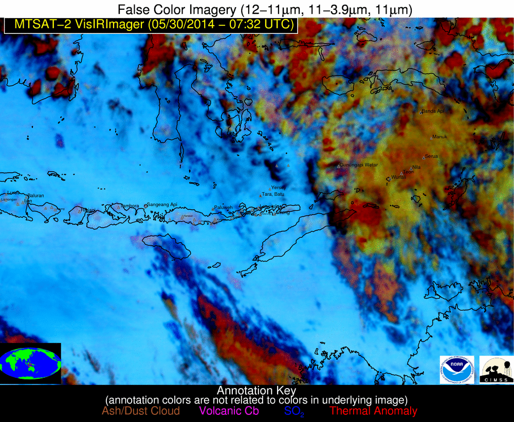
MTSAT-2 false-color RGB images (click to play animation)
The NOAA/CIMSS Volcanic Cloud Monitoring MTSAT-2 false-color Red/Green/Blue (RGB) images (above; click image to play animation) showed the southeastward spread of volcanic ash cloud from the first 2 eruptions, while the Volcanic Ash Height product (below; click image to play animation) indicated that the ash may have reached altitudes of at least 12-14 km. Pilot reports in the vicinity placed the height of the volcanic cloud at 65,000 feet or 19.8 km.
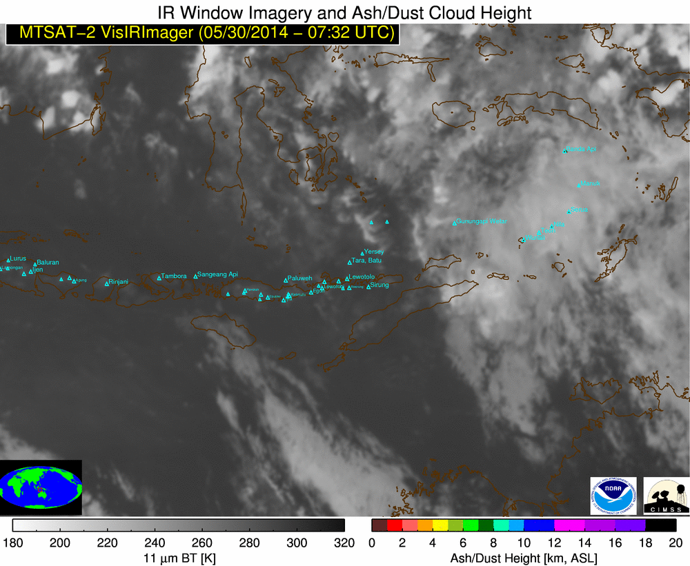
NOAA/CIMSS Volcanic Ash Height product (click to play animation)
Night-time McIDAS-V images of Suomi NPP VIIRS 11.45 µm IR, 3.9 µm shortwave IR, and 0.7 µm Day/Night Band (DNB) images of one of the secondary eruptions at 17:43 UTC on 30 May (below; courtesy of William Straka, SSEC) showed a cloud-top IR brightness temperature as cold as -77º C, along with the yellow-enhanced “hot spot” on the shortwave IR and the bright glow on the DNB image from the hot volcano vent and lava flows.
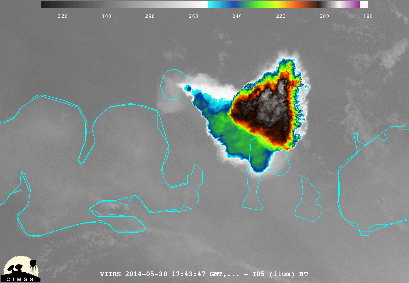
Suomi NPP VIIRS 11.45 µm IR, 3.9 µm shortwave IR, and 0.7 µm Day/Night Band images
A composite of Suomi NPP VIIRS true-color RGB images from 31 May, viewed using the SSEC RealEarth web map server (below) showed the widespread extent of the volcanic ash cloud from the ongoing eruption.
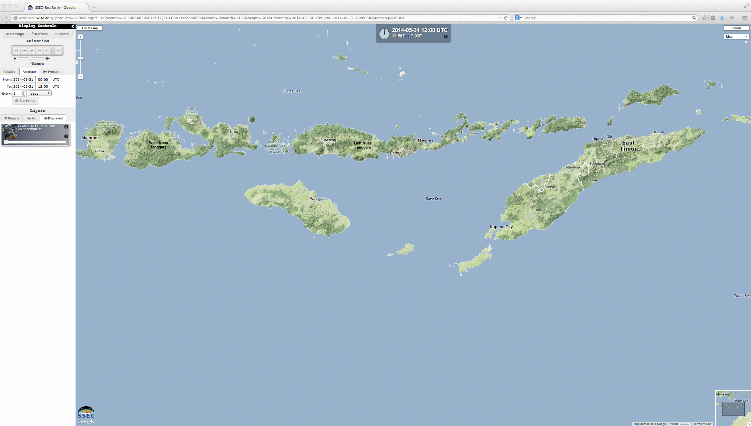
Suomi NPP VIIRS true-color RGB image composite
Due to the southeastward drift of the primary volcanic ash plume toward Australia, flights were cancelled at the Darwin airport. MTSAT-2 visible and IR images with polygons of Volcanic Ash Advisories are shown below (click image to play animation).

MTSAT-2 visible and IR images, with Volcanic Ash Advisory polygons
===== 01 June Update =====
A comparison of Suomi NPP VIIRS true-color images from 31 May and 01 June (below) showed that while the eruption was still ongoing, the amount of ash output had dramatically decreased.
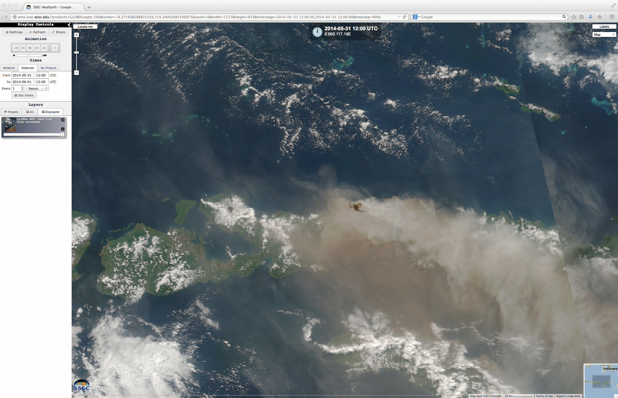
Suomi NPP VIIRS true-color images
View only this post Read Less
![GOES-15 (left), GOES-14 (center), and GOES-13 (right) 0.63 µm visible channel images [click to play animation]](https://cimss.ssec.wisc.edu/satellite-blog/wp-content/uploads/sites/5/2014/05/1405235_goes15_goes14_goes13_visible_amanda_anim.gif)


