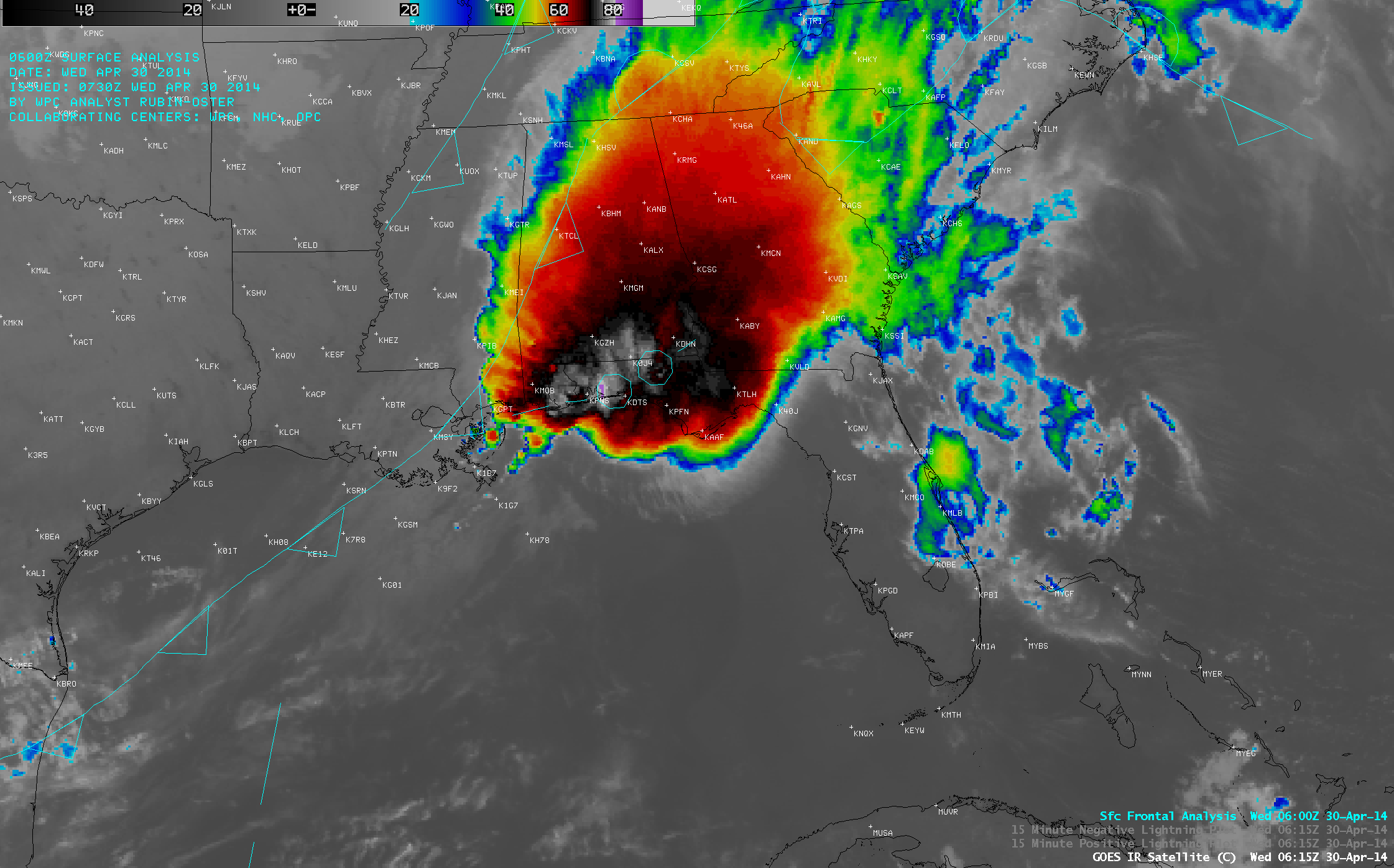
Mesoscale Convective System along the Gulf Coast region
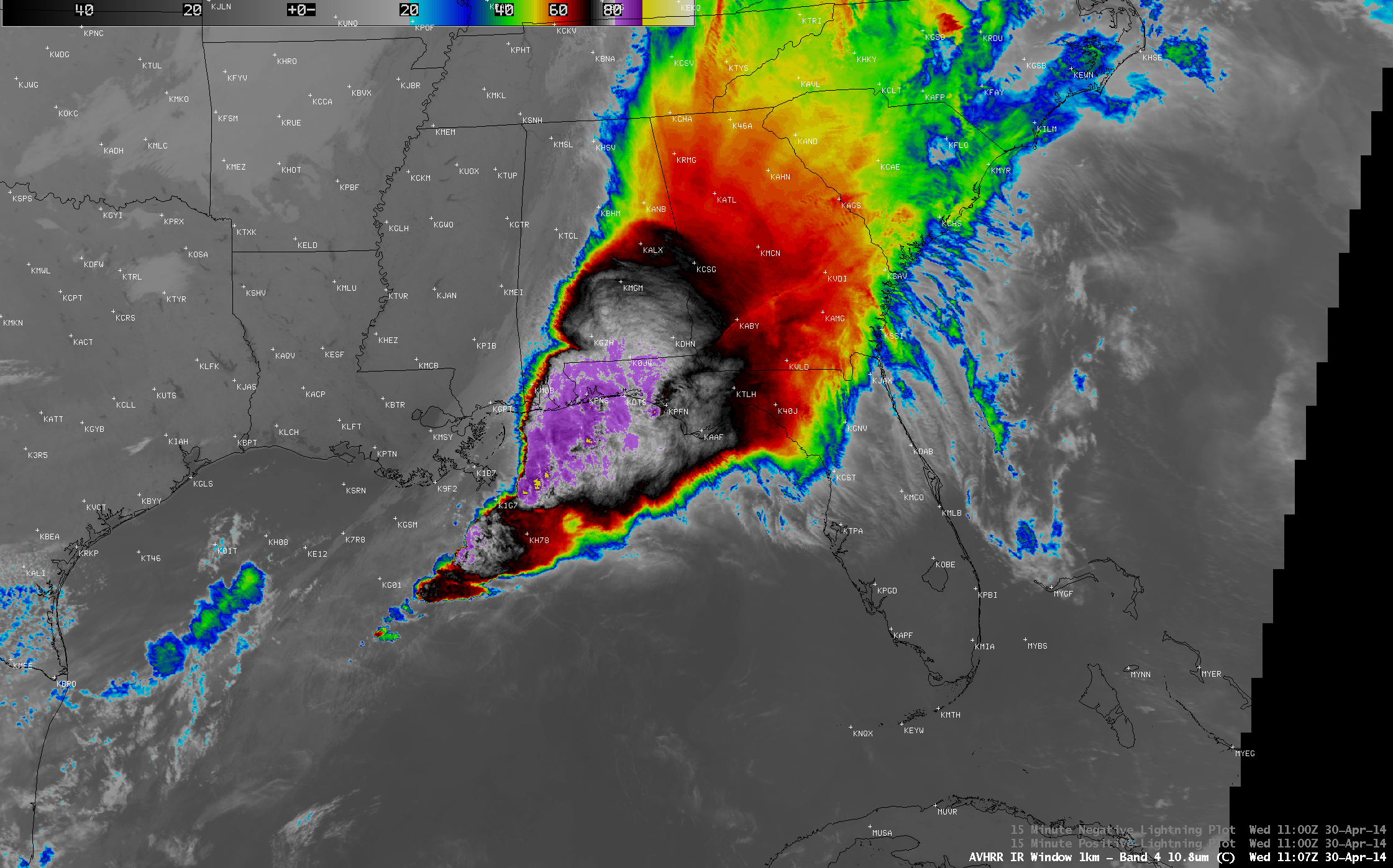
A large Mesoscale Convective System (MCS) developed ahead of a slow-moving cold front and moved over the Gulf Coast region of the US on 29 April – 30... Read More
A large Mesoscale Convective System (MCS) developed ahead of a slow-moving cold front and moved over the Gulf Coast region of the US on 29 April – 30... Read More

A Suomi NPP VIIRS true-color Red/Green/Blue (RGB) image visualized using the SSEC RealEarth web map server (above) showed large areas of blowing dust across parts of the central Plains states on the afternoon of 27 April 2014.... Read More
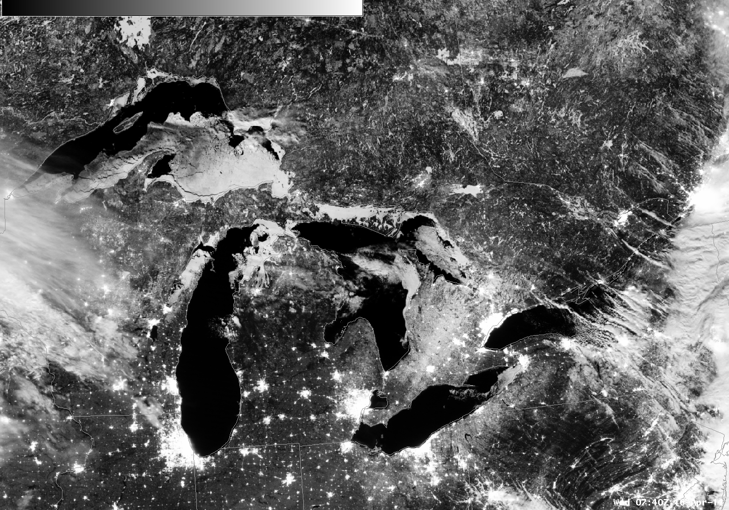
Mostly clear skies over the Great Lakes and a near-Full Moon allowed the Suomi NPP VIIRS Day/Night Band (DNB) imager to record the remaining extent of ice on the five Great Lakes with remarkable clarity at night.Portions of Georgian Bay (Lake Huron), Green Bay (Lake Michigan) and southeastern Lake Superior... Read More
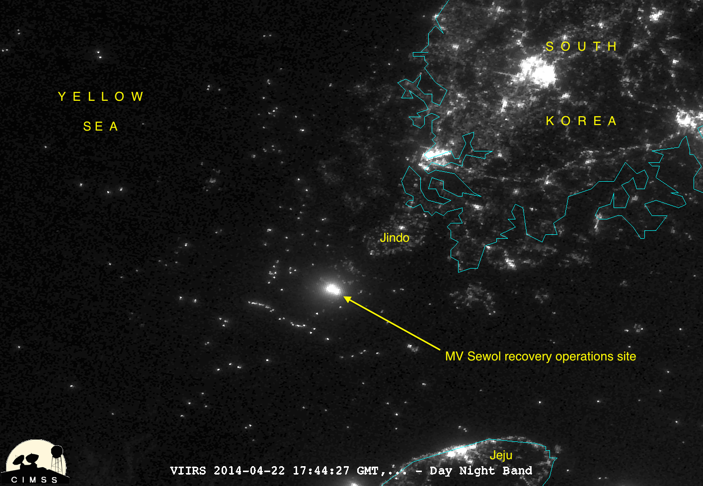
