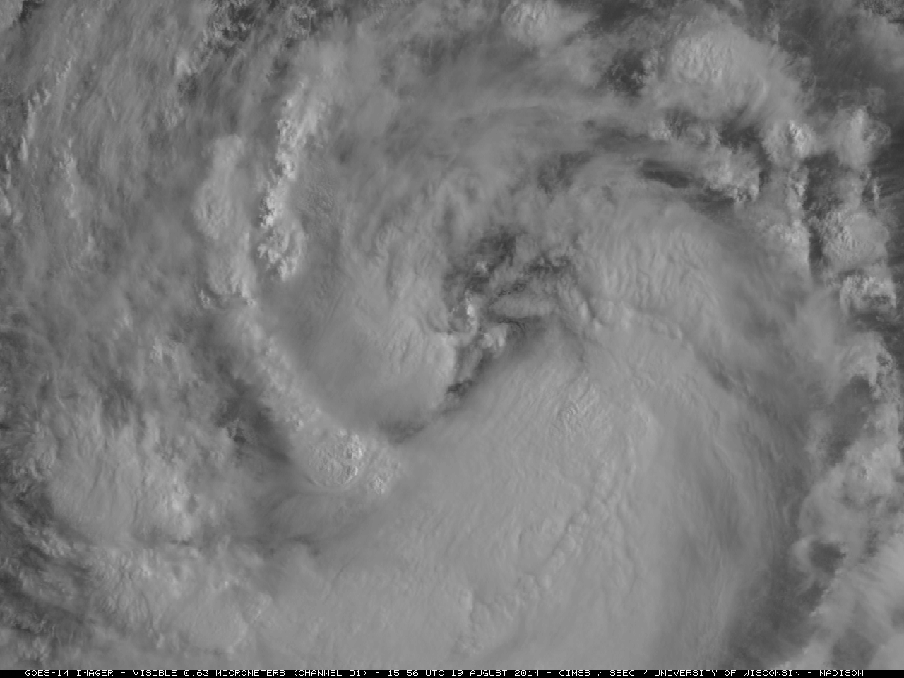

GOES-14 0.63 µm visible channel images (click to play Animated GIF)
The GOES-14 satellite was in Super Rapid Scan Operations for GOES-R (SRSOR) mode, providing coverage of Tropical Storm Lowell in the East Pacific Ocean on 19 August 2014; an animation of 0.63 µm visible channel images (Animated GIF | MP4 movie file | YouTube) showed a gradual increase in the organization of a convective banding structure during the day. At 12 UTC Tropical Storm Lowell was located several hundred miles southwest of Baja California, with a center at 15.5º North latitude, 119.5º West longitude.
GOES-15 10.7 µm IR channel images with an overlay of Metop ASCAT surface scatterometer winds from the CIMSS Tropical Cyclones site (below) showed the the strongest winds (40.0-49.9 knots, yellow barbs) were in the southeastern quadrant of Lowell at 17:11 UTC.
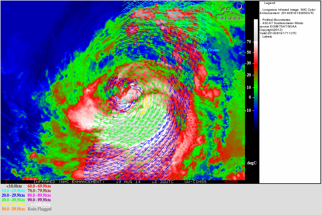
GOES-15 10.7 µm IR images with Metop ASCAT surface scatterometer winds
A comparison of the 16 UTC GOES-15 10.7 µm IR channel image with the corresponding DMSP SSMIS 85 GHz microwave image (below) indicated that the highest rainfall rates were associated with the convective banding (and coldest cloud tops) within the southern semicircle of the storm.
GOES-15 10.7 µm IR image and DMSP SSMIS 85 GHz microwave image
View only this post Read Less

