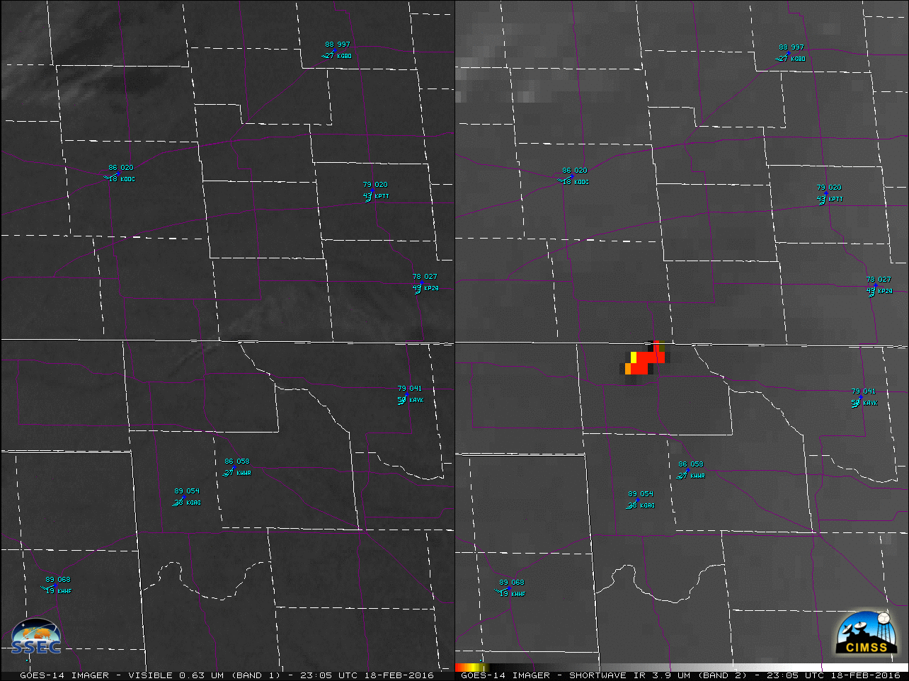
![GOES-14 0.63 µm Visible (top) and 3.9 µm Shortwave Infrared (bottom) images [click to play MP4 animation]](https://cimss.ssec.wisc.edu/satellite-blog/wp-content/uploads/sites/5/2016/02/480x1280_AGOES14_B12_GOES14_VIS_SWIR_OK_AR_FIRE_18FEB_2016049_225800_0002PANELS.GIF)
GOES-14 0.63 µm Visible (top) and 3.9 µm Shortwave Infrared (bottom) images [click to play MP4 animation]
Extensive wildfires (
well-forecast by the Storm Prediction Center) occurred over the southern Plains on Thursday
18 February 2016, while GOES-14 was operating in
SRSO-R mode. A comparison of 1-minute GOES-14 Visible (0.63 µm) and Shortwave Infrared (3.9 µm) images (above; also available as a large 112 Mbyte
animated GIF) showed the broad areal coverage of smoke plumes and fire hot spots (dark black to yellow to red pixels) during the day over eastern Oklahoma.
![GOES-14 0.63 µm Visible (left) and 3.9 µm Shortwave Infrared (right) images [click to play MP4 animation]](https://cimss.ssec.wisc.edu/satellite-blog/wp-content/uploads/sites/5/2016/02/960x640_AGOES14_B12_GOES14_VIS_SWIR_OK_FIRE_ZOOM_18FEB_2016049_230500_0002PANELS.GIF)
GOES-14 0.63 µm Visible (left) and 3.9 µm Shortwave Infrared (right) images [click to play MP4 animation]
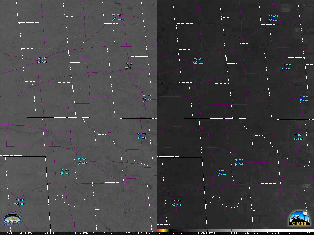
Of particular interest was a rapidly-intensifying and fast-moving grass fire over northwestern Oklahoma, in Harper County just west-northwest of the town of Buffalo, which burned 17,280 acres (
media report). Note the warm air temperatures as seen in the surface plots — the high of 90º F at Gage OK (KGAG, south of the fire) tied for the warmest February temperature on record at that site. A closer view of the Buffalo fire is shown above — county outlines are shown as dashed white lines, while US and State highways are plotted in violet (also available as a large 63 Mbyte
animated GIF). The shortwave infrared images revealed the initial appearance of a color-enhanced fire hot spot (exhibiting an IR brightness temperature of 327.5 K) at 2045 UTC; three minutes later (at 2048 UTC), the IR brightness temperature had already increased to 341.2 K (red enhancement) which is the saturation temperature of the GOES-14 shortwave IR detectors. The hot spots could also be seen racing northeastward toward the Oklahoma/Kansas border, with the fire eventually crossing US Highway 183 (which runs south-to-north through Buffalo and across the Kansas border). The early detection and subsequent accurate tracking of such rapid fire intensification and propagation could only have been possible using 1-minute imagery.
The two plots below show GOES-14 pixel values of 3.9 µm IR brightness temperature at the initial Buffalo fire site (top plot, at 36:51º N, 99:48º W) and at a site just to the northeast (bottom plot, at 36:54º N, 99:43º W) through which the moving fire propagated. The blue line shows every value, nominally at 1-minute intervals. The red dots show points sampled every five minutes. Very small temporal scale changes in the fire cannot be captured with a 5-minute sampling interval.
![GOES-14 Shortwave Infrared (3.9 µm) Brightness Temperatures at 36:51:36º N, 99:48:27º W, 2040-2230 UTC on 18 February 2016 [click to enlarge]](https://cimss.ssec.wisc.edu/satellite-blog/wp-content/uploads/sites/5/2016/02/BufFirePixel1_Toggle.gif)
GOES-14 Shortwave Infrared (3.9 µm) Brightness Temperatures at 36:51:36º N, 99:48:27º W, 2040-2230 UTC on 18 February 2016 [click to enlarge]
![GOES-14 Shortwave Infrared (3.9 µm) Brightness Temperatures at 36:54:44º N, 99:43:22º W, 2115-2200 UTC on 18 February 2016 [click to enlarge]](https://cimss.ssec.wisc.edu/satellite-blog/wp-content/uploads/sites/5/2016/02/BufFirePropagatePixel_Toggle_45minutes.gif)
GOES-14 Shortwave Infrared (3.9 µm) Brightness Temperatures at 36:54:44º N, 99:43:22º W, 2115-2200 UTC on 18 February 2016 [click to enlarge]
![GOES-15 (left), GOES-14 (center), and GOES-13 (right) 3.9 µm Shortwave Infrared images covering the initial period 2030-2100 UTC [click to play animation]](https://cimss.ssec.wisc.edu/satellite-blog/wp-content/uploads/sites/5/2016/02/160218_G15_G14_G13_SWIR_BUFFALO_OK_FIRE_027.GIF)
GOES-15 (left), GOES-14 (center), and GOES-13 (right) 3.9 µm Shortwave Infrared images covering the initial period 2030-2100 UTC [click to play animation]
For the Buffalo fire, a three-satellite comparison of Shortwave Infrared (3.9 µm) images from GOES-15 (operational GOES-West), GOES-14, and GOES-13 (operational GOES-East) is shown for the initial 30-minute time period 2030-2100 UTC (above). The images are displayed in the native projection of each satellite. In terms of the first unambiguous fire hot spot detection (via a hot color-enhanced image pixel) during that initial period, it would appear from the image time stamps that both GOES-14 and GOES-13 detected the fire at 2045 UTC — however, because GOES-14 was scanning a much
smaller sector, it did indeed scan the fire at 20:45 UTC (while GOES-13 scanned the fire at 2049 UTC, 4 minutes after its larger scan sector began in southern Canada). Also note that there were no GOES-15 images during that 30-minue period between 2030 and 2100 UTC, due to the satellite having to perform various “housekeeping” activities — so if a NWS forecast office AWIPS were localized to use GOES-15, initial fire detection would not have been posible until reception of the 2100 UTC image (which actually scanned the fire at 2104 UTC).
A faster animation covering a longer 2.5-hour period from 2030-2300 UTC is shown below. Again, a true sense of the fast northeastward speed of fire propagation could only be gained using 1-minute imagery.
![GOES-15 (left), GOES-14 (center), and GOES-13 (right) 3.9 µm Shortwave Infrared images covering the 2.5-hour period 2030-2300 UTC [click to play animation]](https://cimss.ssec.wisc.edu/satellite-blog/wp-content/uploads/sites/5/2016/02/160218_G15_G14_G13_SWIR_BUFFALO_OK_FIRE_106.GIF)
GOES-15 (left), GOES-14 (center), and GOES-13 (right) 3.9 µm Shortwave Infrared images covering the 2.5 hour period 2030-2300 UTC [click to play animation]
![GOES-14 Shortwave Infrared (3.9 µm) images [click to play animation]](https://cimss.ssec.wisc.edu/satellite-blog/wp-content/uploads/sites/5/2016/02/GOES14_FIRE_18FEB_2016_2139.GIF)
GOES-14 Shortwave Infrared (3.9 µm) 9mages [click to play animation]
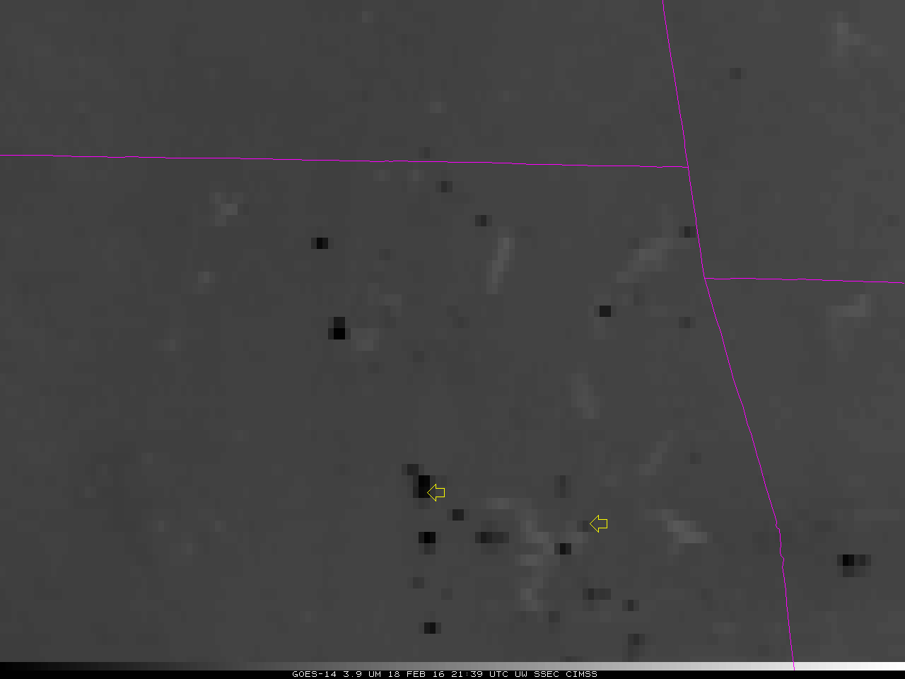
The animation above shows another view of 1-minute GOES-14 Shortwave Infrared (3.9 µm) imagery, centered over northeastern Oklahoma — in these images, the hottest fire pixels are darkest black. Time series of infrared brightness temperature values at two individual fire pixels (
shown here) are plotted below. The Blue lines show the 1-minute data; Red dots show how 5-minute monitoring would have adequately captured the events. Pixel Brightness Temperature changes that occur on the order of 1 or 2 minutes are common, and peak values can be missed with 5-minute granularity.
![GOES-14 Shortwave Infrared (3.9 µm) Brightness Temperatures at, 2138-2301 UTC on 18 February 2016 at 35:31:17 N, 96:05:55 W [click to enlarge]](https://cimss.ssec.wisc.edu/satellite-blog/wp-content/uploads/sites/5/2016/02/1MinuteTrace_2_5MinuteDots_toggle.gif)
GOES-14 Shortwave Infrared (3.9 µm) Brightness Temperatures from 2138-2301 UTC on 18 February 2016, at 35:31:17º N, 96:05:55º W [click to enlarge]
![GOES-14 Shortwave Infrared (3.9 µm) Brightness Temperatures at, 2138-2301 UTC on 18 February 2016 at 35:23:51 N, 95:20:52 W [click to enlarge]](https://cimss.ssec.wisc.edu/satellite-blog/wp-content/uploads/sites/5/2016/02/1MinuteTrace_5MinuteDots_toggle.gif)
GOES-14 Shortwave Infrared (3.9 µm) Brightness Temperatures from 2138-2301 UTC on 18 February 2016, at 35:23:51º N, 95:20:52º W [click to enlarge]
In the
GOES-R era, Fire Products will be produced every 5 minutes. Individual NWS Forecast Offices will be able to request Rapid-Scan Imagery (1-minute intervals) over a 1000 km x 1000 km mesoscale sector.
===== 19 February Update =====
Seen below are RealEarth comparisons of Aqua MODIS and Suomi NPP VIIRS true-color Red/Green/Blue (RGB) images from the early afternoon of 18 February (before the Buffalo OK fire) and 19 February (after the Buffalo OK fire), which revealed the long southwest-to-northeast oriented burn scar. As seen on the GOES-14 animation above, the fire crossed US Highway 183 just to the north of Buffalo (that portion of the highway was closed for several hours).
![Aqua MODIS true-color images on 18 February and 19 February [click to enlarge]](https://cimss.ssec.wisc.edu/satellite-blog/wp-content/uploads/sites/5/2016/02/160218-19_modis_truecolor_OK_fire_burn_scar_anim.gif)
Aqua MODIS true-color images on 18 February and 19 February [click to enlarge]
![Suomi NPP VIIRS true-color images on 18 February and 19 February [click to enlarge]](https://cimss.ssec.wisc.edu/satellite-blog/wp-content/uploads/sites/5/2016/02/160218-19_viirs_truecolor_OK_fire_burn_scar_anim.gif)
Suomi NPP VIIRS true-color images on 18 February and 19 February [click to enlarge]
In addition, a comparison of Suomi NPP VIIRS true-color and false-color images (below) helps to discriminate between the darker burn scar and the cloud shadows seen on the true-color image — the Buffalo fire burn scar appears as varying shades of brown in both the true-color and the false-color images.
![Suomi NPP VIIRS true-color and false-color images [click to enlarge]](https://cimss.ssec.wisc.edu/satellite-blog/wp-content/uploads/sites/5/2016/02/160219_viirs_truecolor_falsecolor_OK_fire_burn_scar_anim.gif)
Suomi NPP VIIRS true-color and false-color images [click to enlarge]
===== 27 February Update =====
![Landsat-8 false-color RGB images on 18 February (a few hours prior to the start of the fire) and 27 February (several says after the fire) [click to enlarge]](https://cimss.ssec.wisc.edu/satellite-blog/wp-content/uploads/sites/5/2016/02/160218_160227_landsat8_falsecolor_Buffalo_OK_burn_scar_before_after_anim.gif)
Landsat-8 false-color RGB images on 18 February (a few hours prior to the start of the fire) and 27 February (several says after the fire) [click to enlarge]
A comparison of 30-meter resolution Landsat-8 false-color (created using
OLI bands 6/5/4) RGB images from 18 February (about 3.5 hours prior to the start of the Buffalo OK fire) and 27 February (several days after the fire) provided a very detailed view of the burn scar. Note that a few green fields remained within the burn scar, and also appeared to prevent the spread of the fire along portions of its perimeter — this is a result of the vast difference between the very low moisture content of the
dry grassland (which burned quickly and easily) and the high moisture content of the well-irrigated fields of winter wheat, alfalfa, and canola crops.
View only this post
Read Less
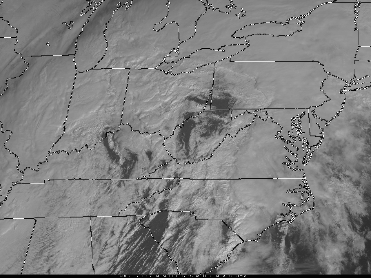
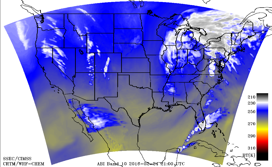
![GOES-14 Water Vapor Infrared (6.5 µm) images [click to play mp4 animation]](https://cimss.ssec.wisc.edu/satellite-blog/wp-content/uploads/sites/5/2016/02/1400x1210_GOES14_B3_Storm_24FEB_2016055_180000_0001PANEL.GIF)
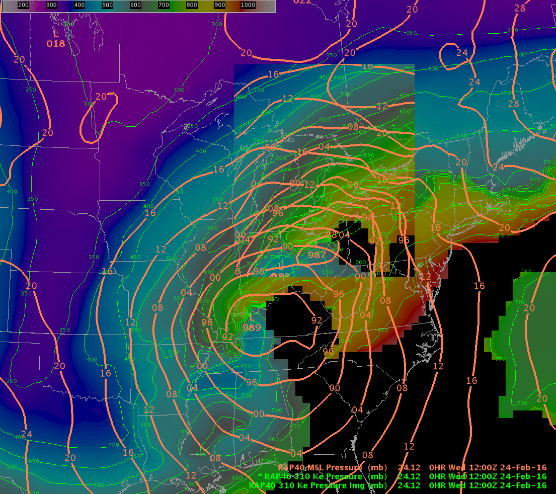
![Rapid Refresh Model Simulation of 310 K Equivalent Potential Temperature Surface [click to play animation]](https://cimss.ssec.wisc.edu/satellite-blog/wp-content/uploads/sites/5/2016/02/RAP40Thetae_310Kanim.gif)
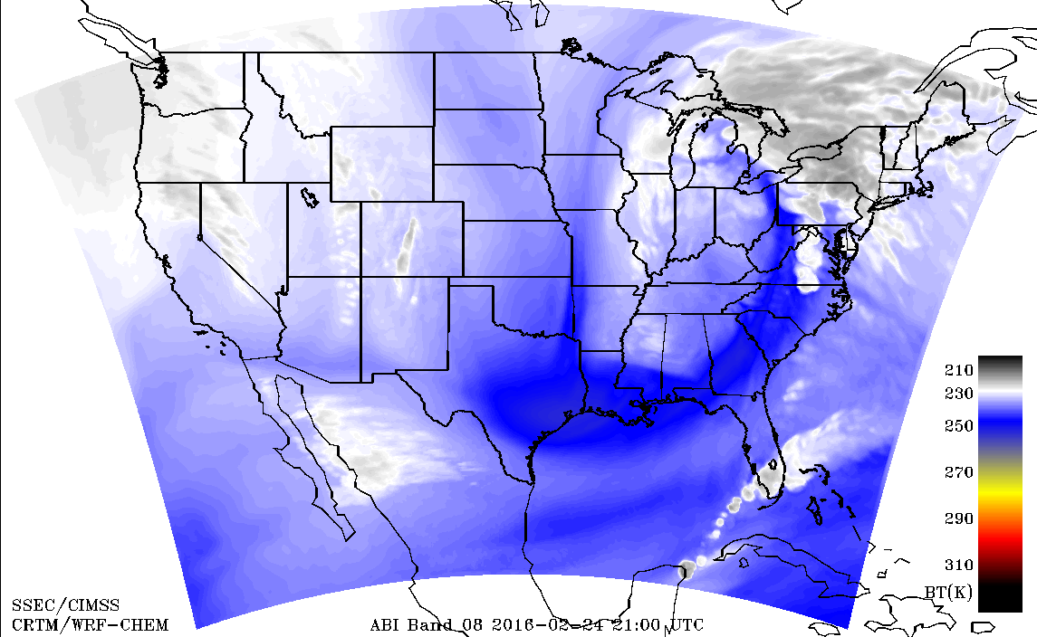
![Simulated ABI 7.3 µm Water Vapor Channel Imagery, hourly from 16-22 UTC on 24 February 2016 [click to play animation]](https://cimss.ssec.wisc.edu/satellite-blog/wp-content/uploads/sites/5/2016/02/SimuABI_10_16_22UTC_24Feb2016anim.gif)
![GOES-13 Visible (0.65 µm) images [click to play animation]](https://cimss.ssec.wisc.edu/satellite-blog/wp-content/uploads/sites/5/2016/02/GOES13VIS_24FEB2016_1415_2145anim.gif)
![GOES-14 Visible (0.65 µm) images [click to play animation]](https://cimss.ssec.wisc.edu/satellite-blog/wp-content/uploads/sites/5/2016/02/800x600_GOES14_ALL_B1_VISStorm_24FEB_animated_2016055_200100_182_2016055_225900_182_GRAY.gif)
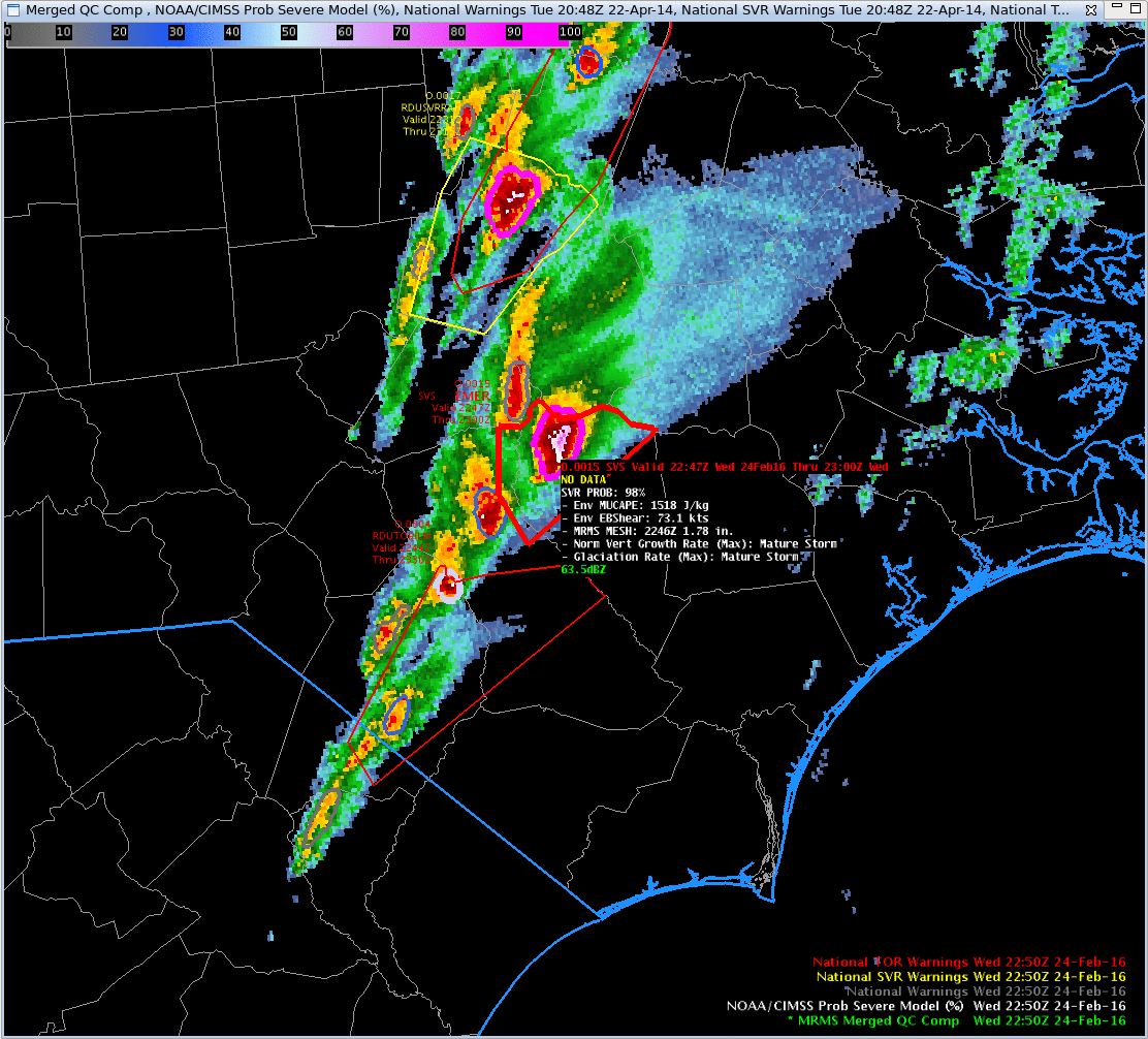
![NOAA/CIMSS ProbSevere output superimposed on MRMS Merged QC Composite Reflectivity, times as Indicated [click to play animation]](https://cimss.ssec.wisc.edu/satellite-blog/wp-content/uploads/sites/5/2016/02/ProbSevere_2134_2250_24Feb2016anim.gif)
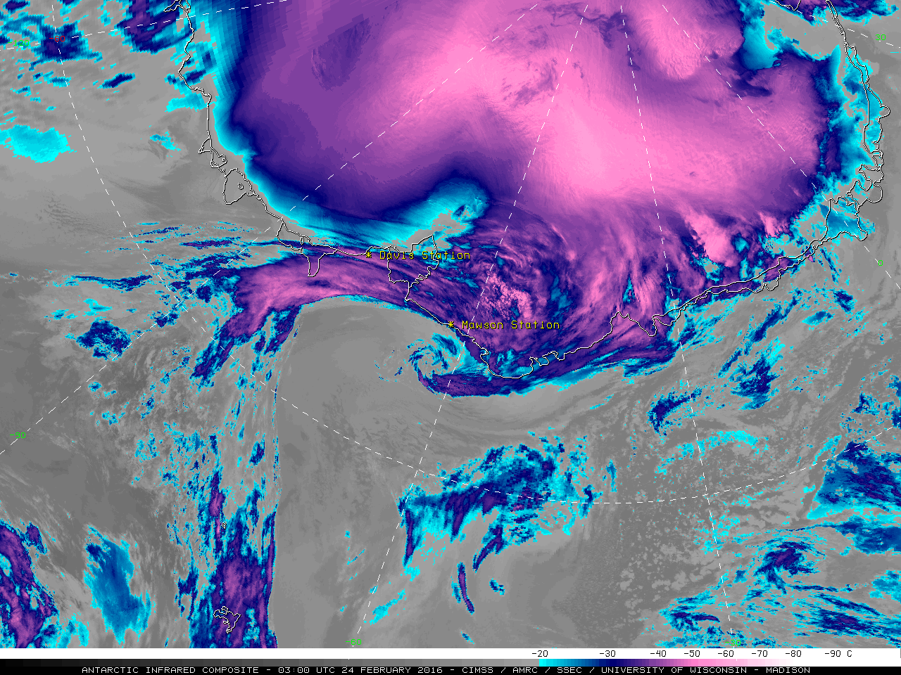
![Antarctic Infrared composite images [click to play animation]](https://cimss.ssec.wisc.edu/satellite-blog/wp-content/uploads/sites/5/2016/02/160223-24_Antarctic_infrared_composite_anim.gif)
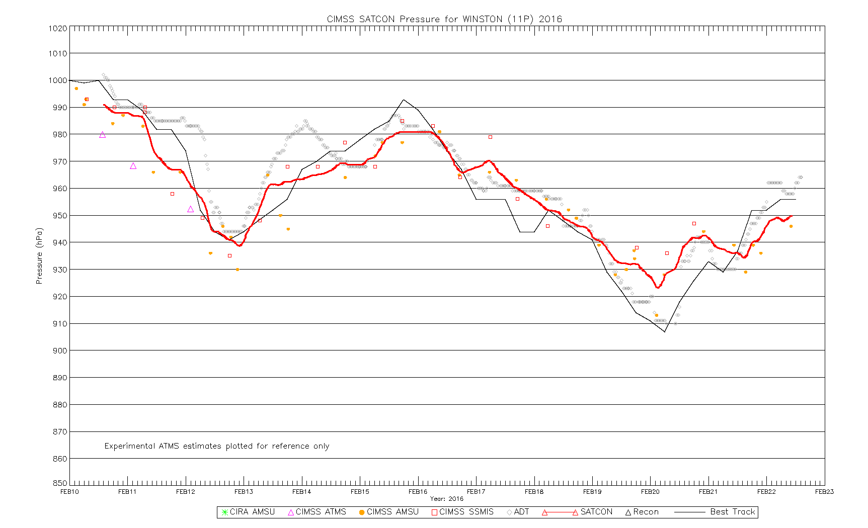
![Himawari-8 Visible (0.64 µm) images [click to play animation]](https://cimss.ssec.wisc.edu/satellite-blog/wp-content/uploads/sites/5/2016/02/160219-20_himawari8_visible_Cyclone_Winston_anim.gif)
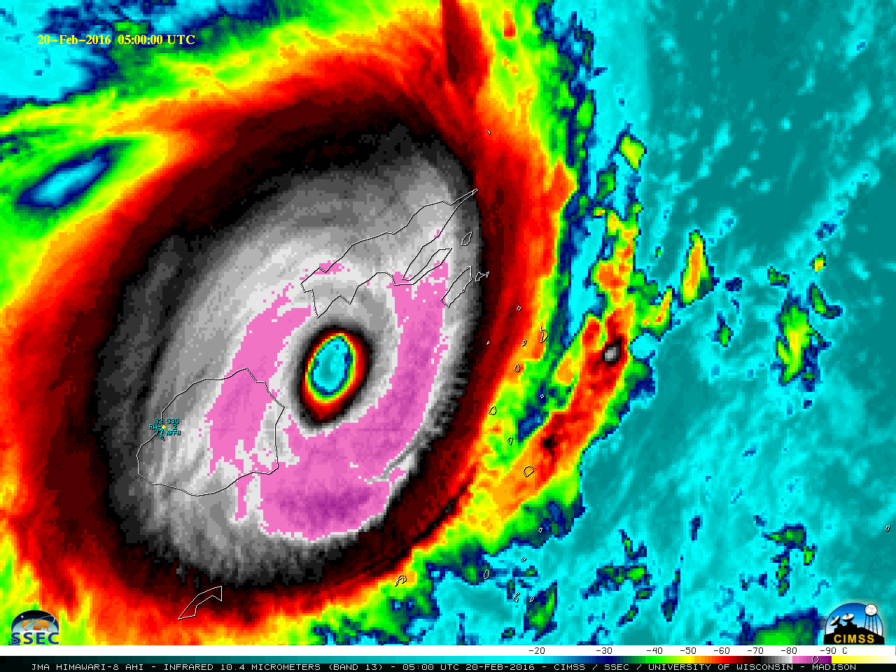
![Himawari-8 Infrared Window (10.4 µm) images [click to play animation]](https://cimss.ssec.wisc.edu/satellite-blog/wp-content/uploads/sites/5/2016/02/160219-20_himawari8_infrared_Cyclone_Winston_anim.gif)
![Suomi NPP VIIRS Day/Night Band (0.7 µm) and Infrared Window (11.45 µm) images [click to enlarge]](https://cimss.ssec.wisc.edu/satellite-blog/wp-content/uploads/sites/5/2016/02/160218_1241utc_suomi_npp_viirs_dnb_ir_Cyclone_Winston_anim.gif)
![Suomi NPP VIIRS Day/Night Band (0.7 µm) and Infrared Window (11.45 µm) images [click to enlarge]](https://cimss.ssec.wisc.edu/satellite-blog/wp-content/uploads/sites/5/2016/02/160220_1346utc_suomi_npp_viirs_dnb_ir_Cyclone_Winston_anim.gif)
![DMSP-16 SSMIS Microwave (85 GHz) and Himawari-8 Infrared Window (10.4 µm) images [click to enlarge]](https://cimss.ssec.wisc.edu/satellite-blog/wp-content/uploads/sites/5/2016/02/160221_1630utc_microwave_infrared_Cyclone_Winston_anim.gif)
![GOES-15 (left), GOES-14 (center), and GOES-13 (right) 3.9 µm Shortwave Infrared images covering the initial period 2030-2100 UTC [click to play animation]](https://cimss.ssec.wisc.edu/satellite-blog/wp-content/uploads/sites/5/2016/02/160218_goes15_goes14_goes13_shortwave_ir_Buffalo_OK_fire_initial_30_minutes_anim.gif)
![GOES-15 (left), GOES-14 (center), and GOES-13 (right) 3.9 µm Shortwave Infrared images covering the 2.5-hour period 2030-2300 UTC [click to play animation]](https://cimss.ssec.wisc.edu/satellite-blog/wp-content/uploads/sites/5/2016/02/160218_goes15_goes14_goes13_shortwave_ir_Buffalo_OK_fire_anim.gif)
![GOES-14 Shortwave Infrared (3.9 µm) images [click to play animation]](https://cimss.ssec.wisc.edu/satellite-blog/wp-content/uploads/sites/5/2016/02/GOES14_FIRE_18FEB_2016_2139_2301anim.gif)
