Suomi NPP and GOES Views of Hurricane Gonzalo

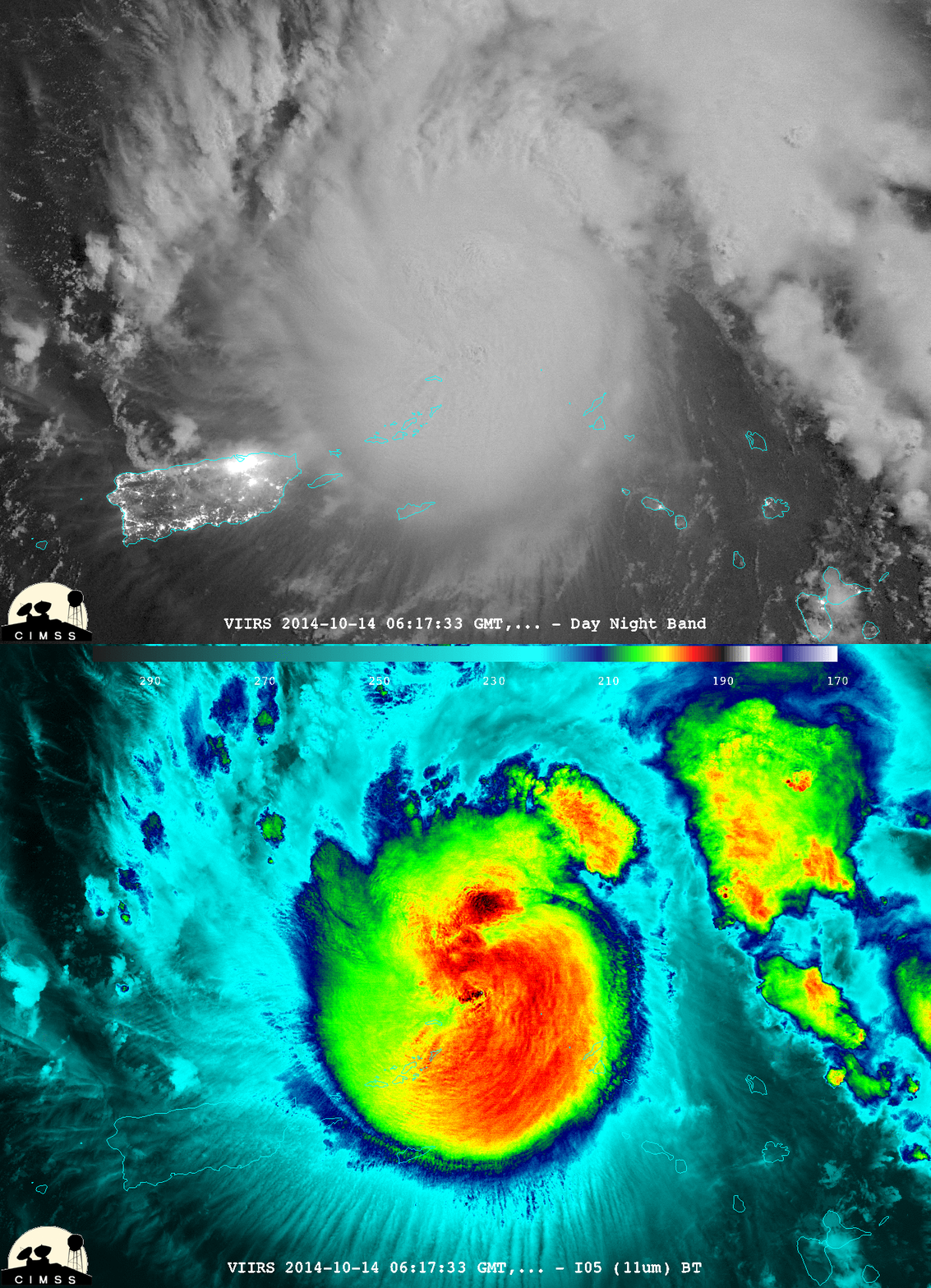
Suomi NPP 11.45 µm Infrared Imagery and Day Night Band Imagery, 0617 UTC 14 October 2014 (click to enlarge)
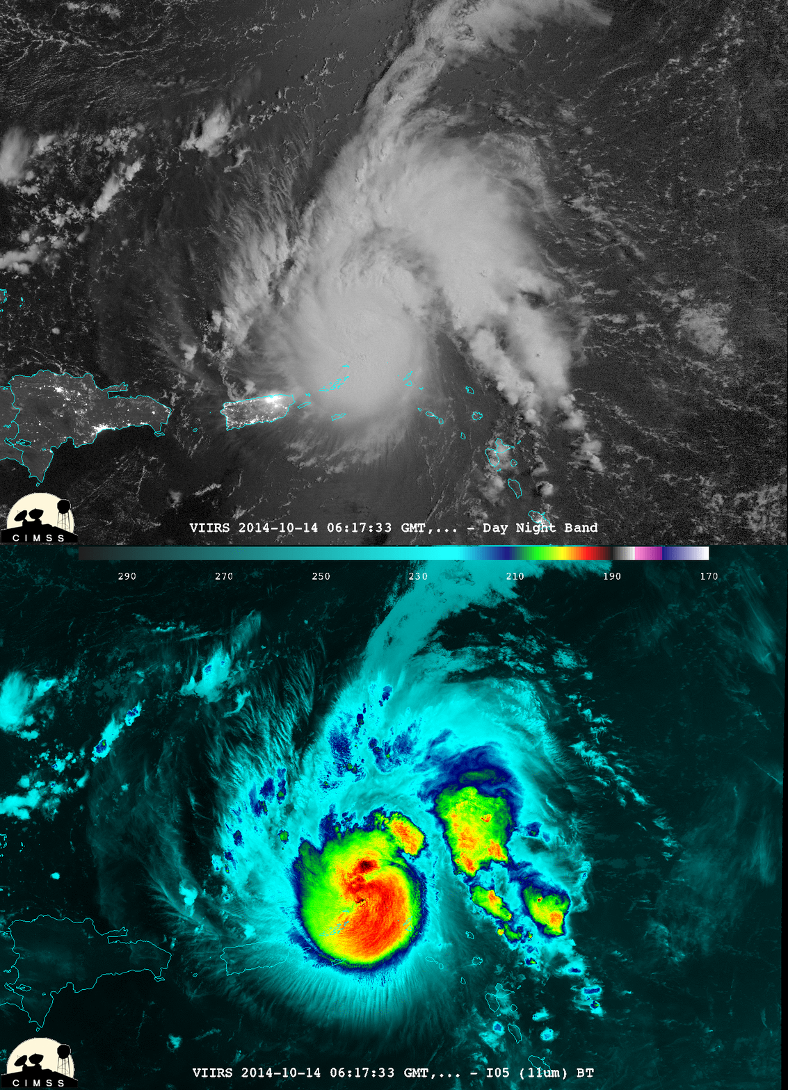
The VIIRS instrument on Suomi NPP yielded compelling nighttime imagery of Hurricane Gonzalo in the western Atlantic. The toggle above of the Day Night Band and the 11.45 µm Infrared imagery shows a circular central dense overcast over the storm (imagery courtesy of William Straka, CIMSS). No eye structure is immediately apparent, although very cold cloud tops are present at the storm center. A larger-scale view of the Day Night Band and 11.45 µm imagery, below, shows a storm in a low to moderate wind shear environment with a well-defined outflow channel to the northeast. Note the pronounced “transverse banding” signature along the southern periphery of the hurricane – such transverse banding is often seen in areas of high-altitude of turbulence. Gonzalo was forecast to strengthen (see the National Hurricane Center website for more details).

Suomi NPP 11.45 µm Infrared Imagery and Day Night Band Imagery, 0617 UTC 14 October 2014 (click to enlarge)
During the subsequent daytime hours on 14 October, Hurricane Gonzalo did indeed continue to intensify, becoming a Category 3 storm by the late afternoon (ADT plot). The GOES-13 satellite had been placed into Rapid Scan Operations (RSO) mode, providing images as frequently as every 5-7 minutes; 0.63 µm visible channel images (below; click image to play animation; also available as an MP4 movie file) showed periodic convective bursts around the eye of Gonzalo as the tropical cyclone moved northwestward.

