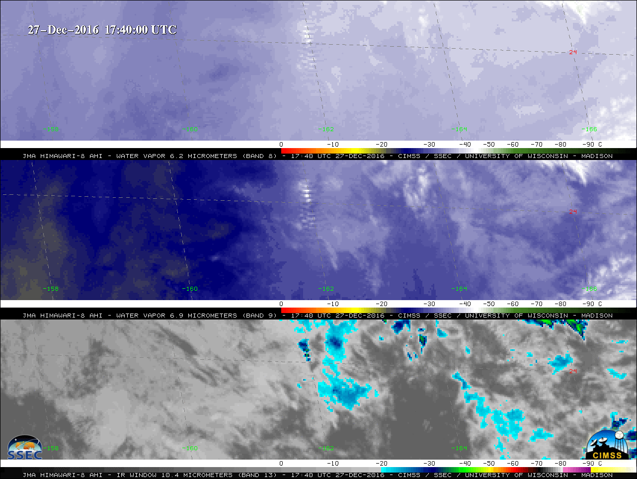
Turbulence over the Pacific Ocean affected at least one flight on Tuesday 27 December 2016 near 24º N, 162º E, as indicated by a pilot report issued at 1745 UTC:PGUA UUA /OV 24N 162E/TM 1745/FL340/TP B777/TB MOD-SEV/RM ZOAIn the animation above of the three Himawari-8 Water Vapor bands (sensing radiation... Read More
![Himawari-8 Water Vapor Imagery (6.2 µm, top; 6.9 µm, middle; 7.3 µm, bottom), 1700-1900 UTC on 27 December 2016 [click to enlarge]](https://cimss.ssec.wisc.edu/satellite-blog/wp-content/uploads/sites/5/2016/12/161227_himawari8_water_vapor_3panel_Central_Pacific_turbulence_anim.gif)
Himawari-8 Water Vapor Imagery (6.2 µm, top; 6.9 µm, middle; 7.3 µm, bottom), 1700-1900 UTC on 27 December 2016 [click to enlarge]
Turbulence over the Pacific Ocean affected at least one flight on Tuesday 27 December 2016 near 24º N, 162º E, as indicated by a pilot report issued at 1745 UTC:
PGUA UUA /OV 24N 162E/TM 1745/FL340/TP B777/TB MOD-SEV/RM ZOA
In the animation above of the three Himawari-8 Water Vapor bands (sensing radiation emitted at 6.2 µm, 6.9 µm and 7.3 µm), a characteristic banded gravity wave structure is evident which is associated with the pilot report of moderate to severe turbulence (Note: the ABI instrument on the GOES-R series of satellites will feature these same 3 upper level, mid-level and lower level water vapor bands). In contrast to a turbulence event earlier this month, documented here on this blog, the wave features responsible for this turbulence were more distinct in 8-bit McIDAS-X imagery, and were also apparent in all three water vapor bands.
The Himawari-8 satellite data were used in the subsequent issuance of a SIGMET (Significant Meteorological Information) advisory:
WSPA06 PHFO 271824
SIGPAS
KZAK SIGMET SIERRA 1 VALID 271825/272225 PHFO-
OAKLAND OCEANIC FIR MOD OCNL SEV TURB FCST BTN FL280 AND FL360.
WI N2640 E16810 – N2120 E16810 – N2120 E16240 – N2640 E16250
– N2640 E16810. MOV E 25KT. BASED ON ACFT AND SAT.
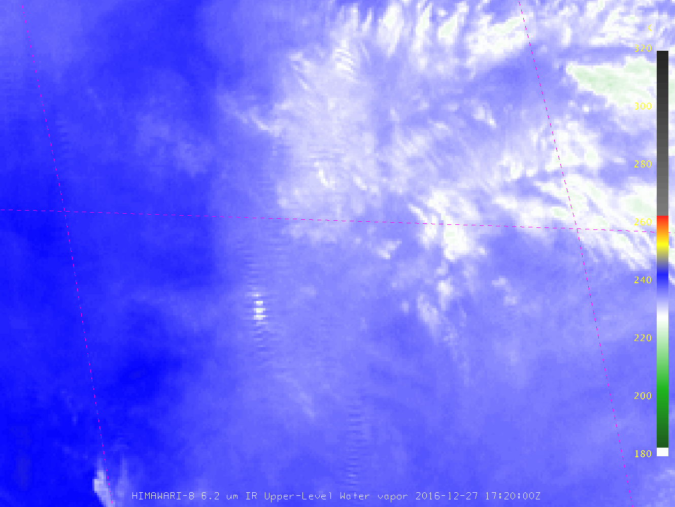
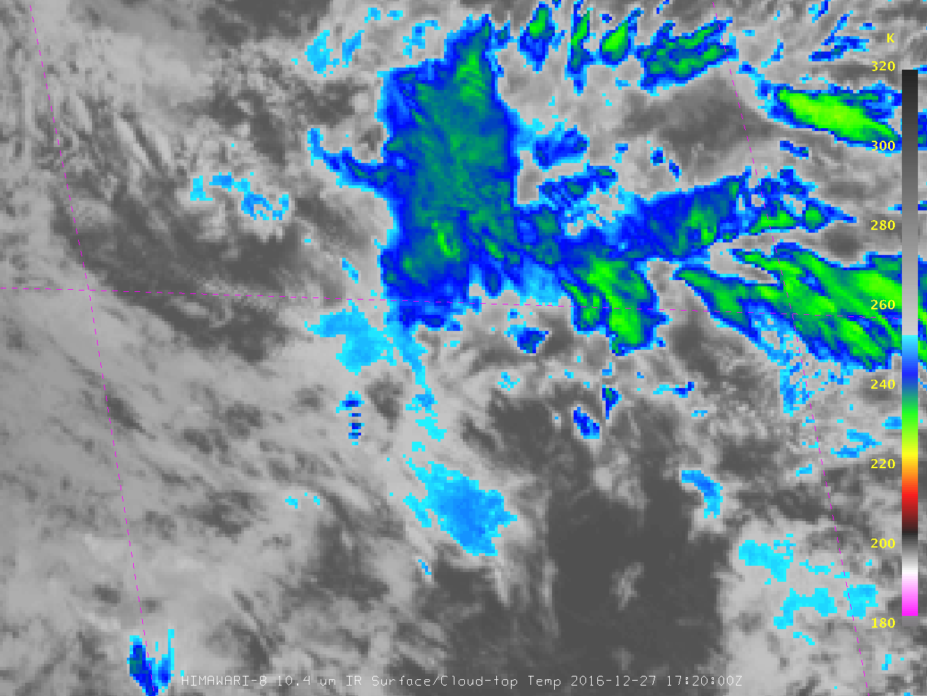
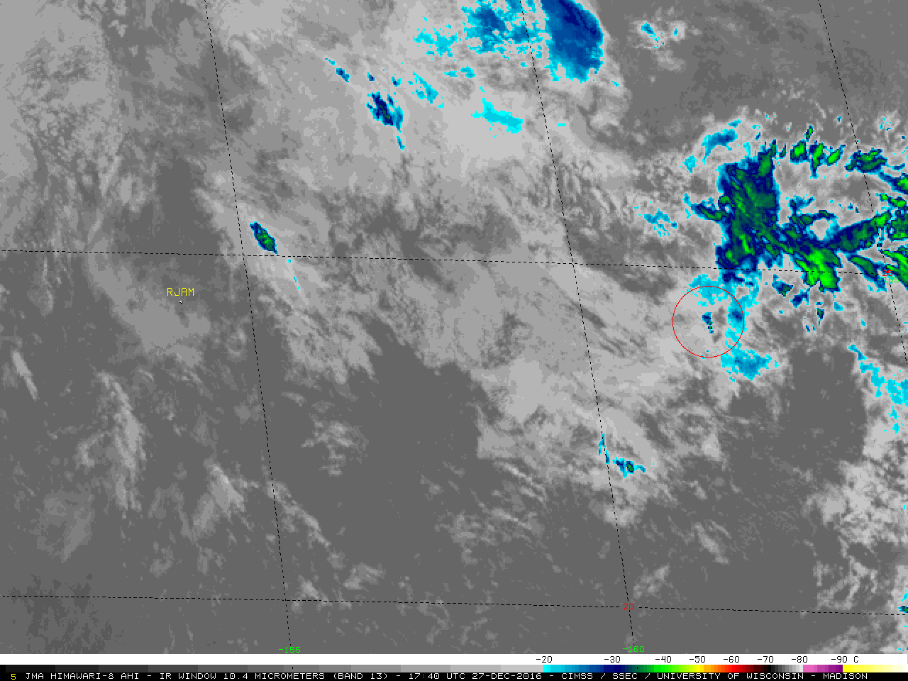
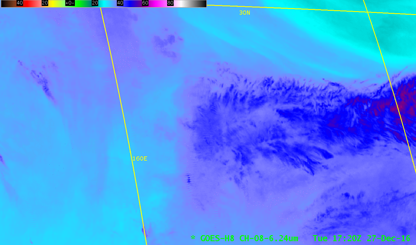
The full 11-bit McIDAS-V imagery from the 6.2 µm Water Vapor band on Himawari-8, below, shows multiple ephemeral signatures of potential turbulence. In contrast to the event on 14 December, the gravity waves in this event perturbed clouds enough that they were also apparent in the Infrared Window band, as shown in this toggle between the 10.4 µm and 6.2 µm images. Himawari-8 Infrared Window brightness temperatures exhibited by the gravity wave were in the -30º to -40ºC range at 1740 UTC, which roughly corresponded to altitudes of 30,000-34,000 feet according to data from the 12 UTC rawinsonde report from Minamitorishima RJAM (IR image | text) located about 890 km or 550 miles to the west of the wave feature. Additional Himawari-8 Water Vapor images created using AWIPS II are here for the 6.2 µm imagery (from 1720-1740 UTC); this is a toggle between 6.2 µm and 7.3 µm imagery at 1720 UTC.
![Himawari-8 Infrared Imagery (6.2 µm), 1600-1900 UTC on 27 December 2016 [click to animate]](https://cimss.ssec.wisc.edu/satellite-blog/wp-content/uploads/sites/5/2016/12/H8_6.2_MCV_27Dec2016_1720.gif)
Himawari-8 Water Vapor (6.2 µm) Imagery, 1600-1900 UTC on 27 December 2016 [click to animate]
The superior spatial resolution of Himawari-8 (2-km at the sub-satellite point) was vital in detecting the gravity wave features causing the turbulence. Water Vapor imagery from COMS-1, with a nominal resolution of 4 km, does not show the features associated with the turbulence report.
![COMS-1 Infrared Imagery (6.75 µm), 1630-1800 UTC on 27 December 2016 [click to animate]](https://cimss.ssec.wisc.edu/satellite-blog/wp-content/uploads/sites/5/2016/12/COMS_WV_6.75_27DEC2016_1630.GIF)
COMS-1 Water Vapor (6.75 µm) Imagery, 1630-1800 UTC on 27 December 2016 [click to animate]
Similarly, HimawariCast data that is broadcast at reduced resolution was insufficient to monitor this event. See the toggle below from 1740 UTC.
![Himawari-8 Infrared Imagery (6.2 µm) at 1740 UTC on 27 December 2016, native resolution and as distributed via Himawaricast [click to enlarge]](https://cimss.ssec.wisc.edu/satellite-blog/wp-content/uploads/sites/5/2016/12/HCAST_H8_6.2_27DEC2016_1740toggle.gif)
Himawari-8 Water Vapor (6.2 µm) Imagery at 1740 UTC on 27 December 2016, at native resolution and as distributed via Himawaricast [click to enlarge]
View only this post
Read Less
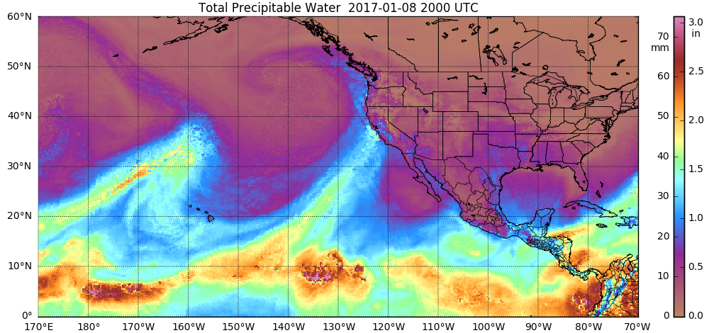
![MIMIC Total Precipatable Water product [click to play MP4 animation]](https://cimss.ssec.wisc.edu/satellite-blog/wp-content/uploads/sites/5/2017/01/comp20170108.200000_tpw.png)

![Terra MODIS true-color and false-color RGB images [click to enlarge]](https://cimss.ssec.wisc.edu/satellite-blog/wp-content/uploads/sites/5/2017/01/170113_modis_truecolor_falsecolor_Sacramento_Valley_CA_flooding_zoom_anim.gif)
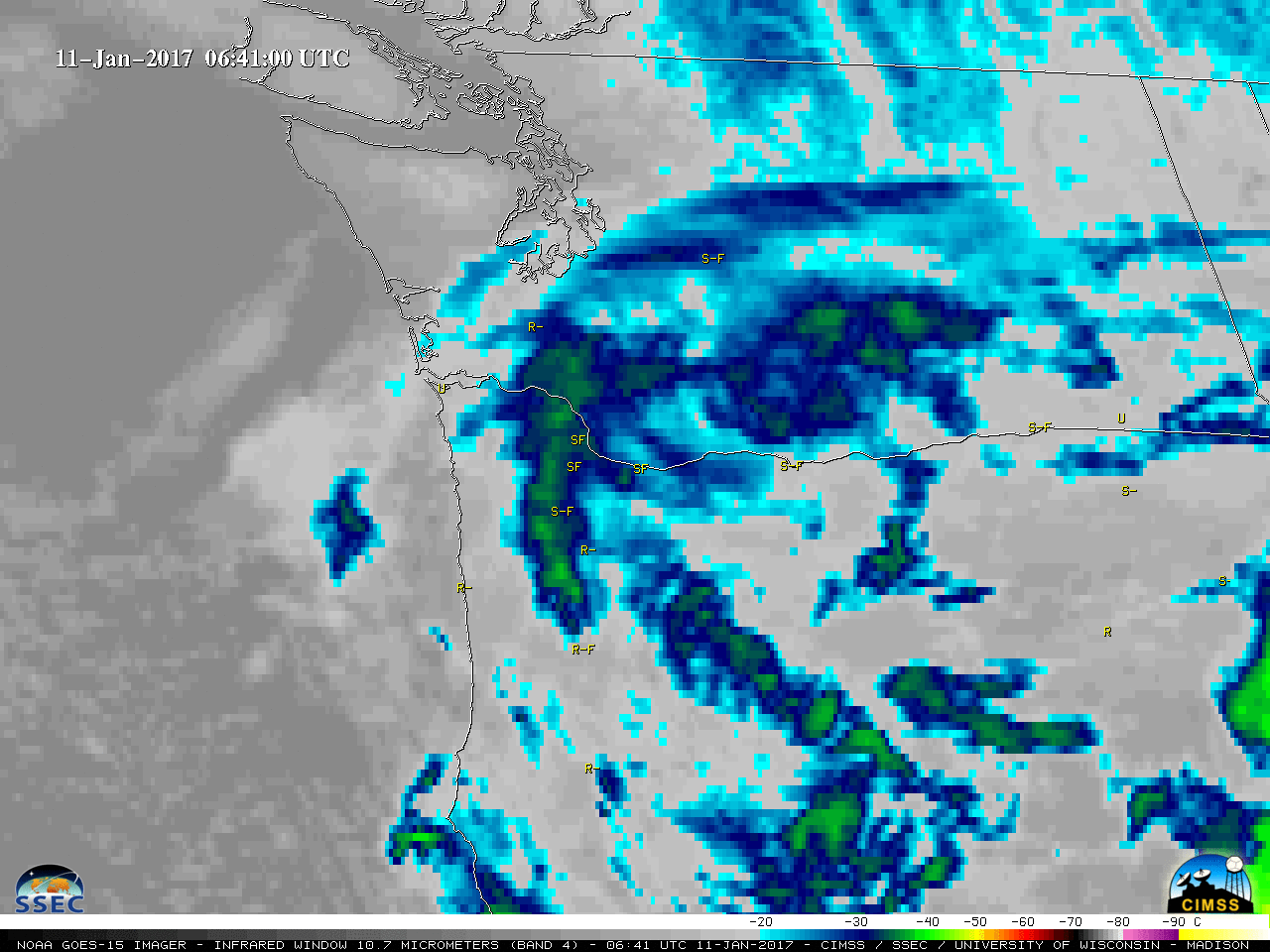
![GOES-15 Infrared Window (10.7 µm) images, with hourly reports of surface weather type [click to play animation]](https://cimss.ssec.wisc.edu/satellite-blog/wp-content/uploads/sites/5/2017/01/170110-11_goes15_infrared_PDX_snow_event_anim.gif)
![GOES-15 Water Vapor (6.5 µm) images, with hourly reports of surface weather type [click to play animation]](https://cimss.ssec.wisc.edu/satellite-blog/wp-content/uploads/sites/5/2017/01/170110-11_goes15_water_vapor_PDX_snow_event_anim.gif)
![GOES-15 Visible (0.63 µm) images, with hourly reports of surface weather type [click to play animation]](https://cimss.ssec.wisc.edu/satellite-blog/wp-content/uploads/sites/5/2017/01/170110-11_goes15_visible_PDX_snow_event_anim.gif)
![Suomi NPP VIIRS true-color and false-color RGB images [click to enlarge]](https://cimss.ssec.wisc.edu/satellite-blog/wp-content/uploads/sites/5/2017/01/170112_2053utc_suomi_npp_viirs_truecolor_falsecolor_Portland_OR_snow_cover_anim.gif)
![Landsat-8 false-color RGB image [click to play zoom-in animation]](https://cimss.ssec.wisc.edu/satellite-blog/wp-content/uploads/sites/5/2017/01/170112_1851utc_landsat8_falsecolor_Mt_Hood_OR_anim.gif)

![GOES-15 Visible (0.63 µm) images, with hourly surface reports [click to play animation]](https://cimss.ssec.wisc.edu/satellite-blog/wp-content/uploads/sites/5/2017/01/170106_goes15_visible_Utah_black_cloud_anim.gif)
![GOES-13 Visible (0.63 µm) images, with hourly surface reports [click to play animation]](https://cimss.ssec.wisc.edu/satellite-blog/wp-content/uploads/sites/5/2017/01/170106_goes13_visible_Utah_black_cloud_anim.gif)
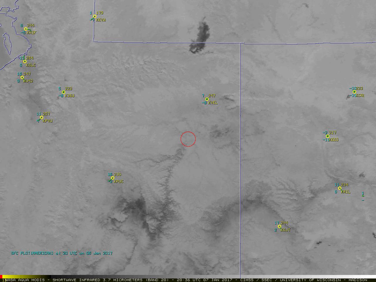
![Aqua MODIS Visible (0.645 µm) and Shortwave Infrared (3.7 µm) images at 2036 UTC [click to enlarge]](https://cimss.ssec.wisc.edu/satellite-blog/wp-content/uploads/sites/5/2017/01/170106_2036utc_aqua_modis_visible_shortwaveIR_IRwindow_UT_fire_anim_2.gif)
![Aqua MODIS true-color image at 2036 UTC [click to enlarge]](https://cimss.ssec.wisc.edu/satellite-blog/wp-content/uploads/sites/5/2017/01/170106_2036utc_aqua_modis_truecolor_Utah_well_fire_anim.gif)
![Himawari-8 Infrared Imagery (6.2 µm), 1600-1900 UTC on 27 December 2016 [click to animate]](https://cimss.ssec.wisc.edu/satellite-blog/wp-content/uploads/sites/5/2016/12/H8_6.2_MCV_27Dec2016_anim_1600_1900.gif)
![COMS-1 Infrared Imagery (6.75 µm), 1630-1800 UTC on 27 December 2016 [click to animate]](https://cimss.ssec.wisc.edu/satellite-blog/wp-content/uploads/sites/5/2016/12/COMS_WV_6.75_27DEC2016_1630_1800anim.gif)

/na2017_01_06_006_aqua.gif)