Search results for MIMIC

Andres and Blanca in the eastern Pacific
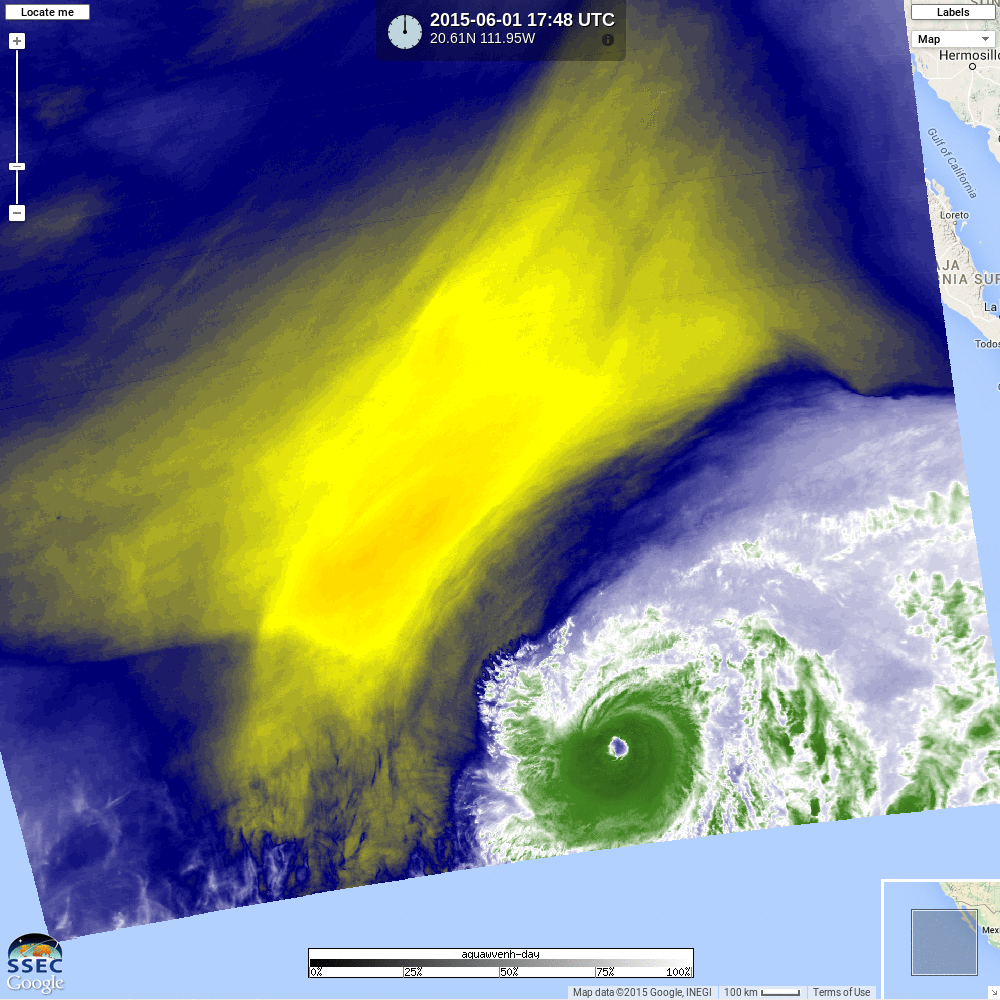
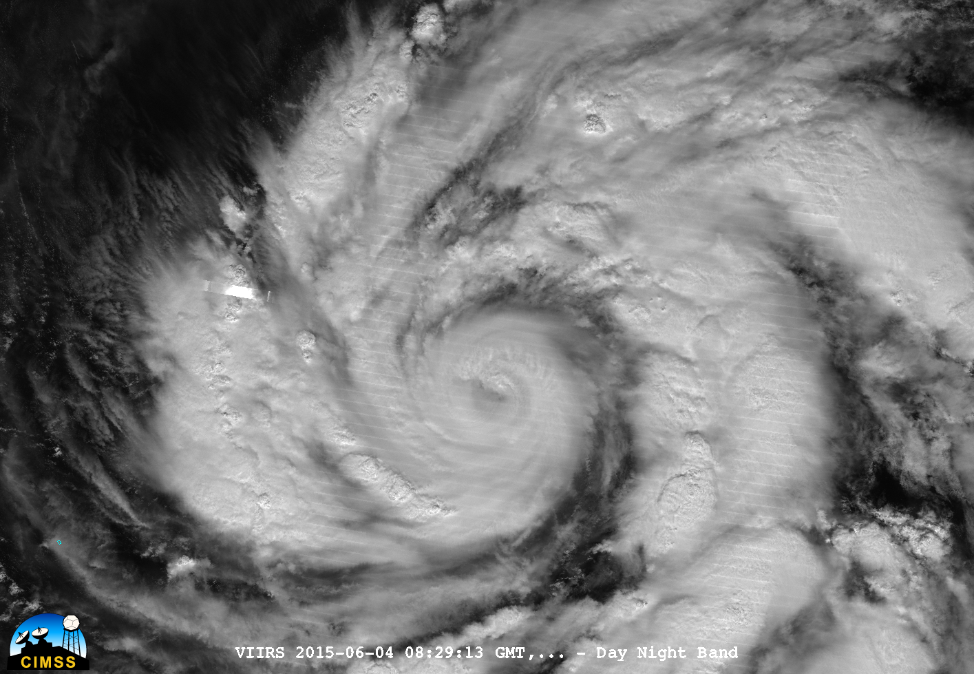
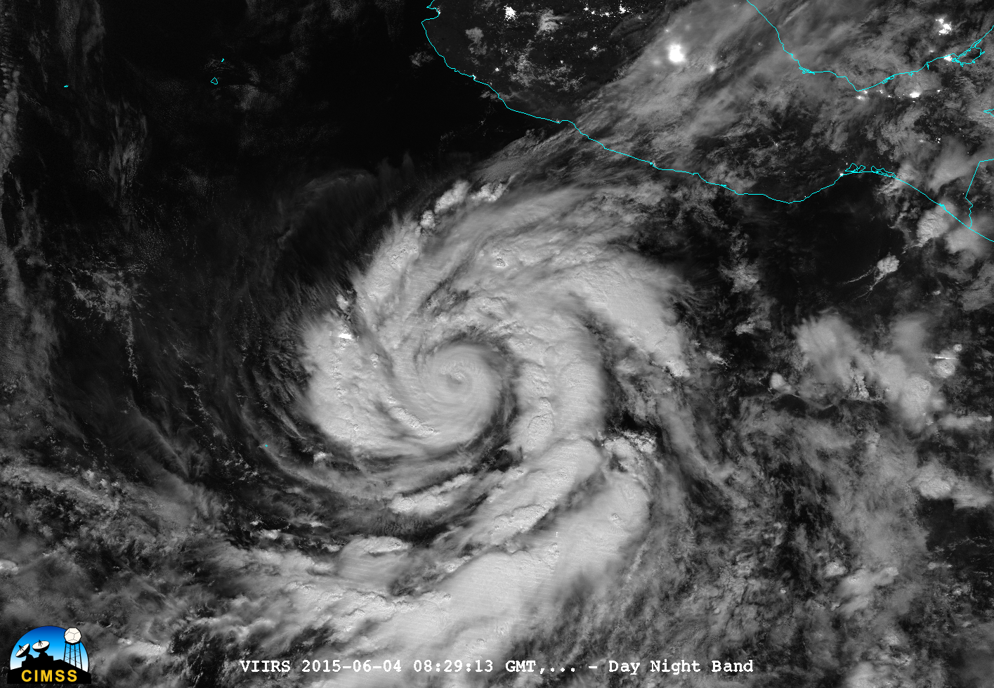
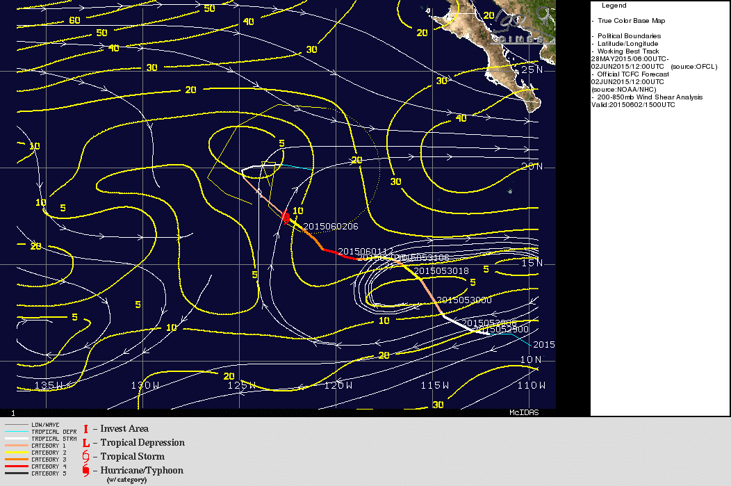
Hurricane Andres (above) in the eastern tropical Pacific was on 2 June 2015 joined by Tropical Storm Blanca (below). Blanca was forecast to become a Hurricane later on 2 June as Andres weakens. The circulation of Andres, above, is well-established, with good anti-cyclonic outflow and curved inflow bands. Shear values are... Read More
Dolphin acquires an eye
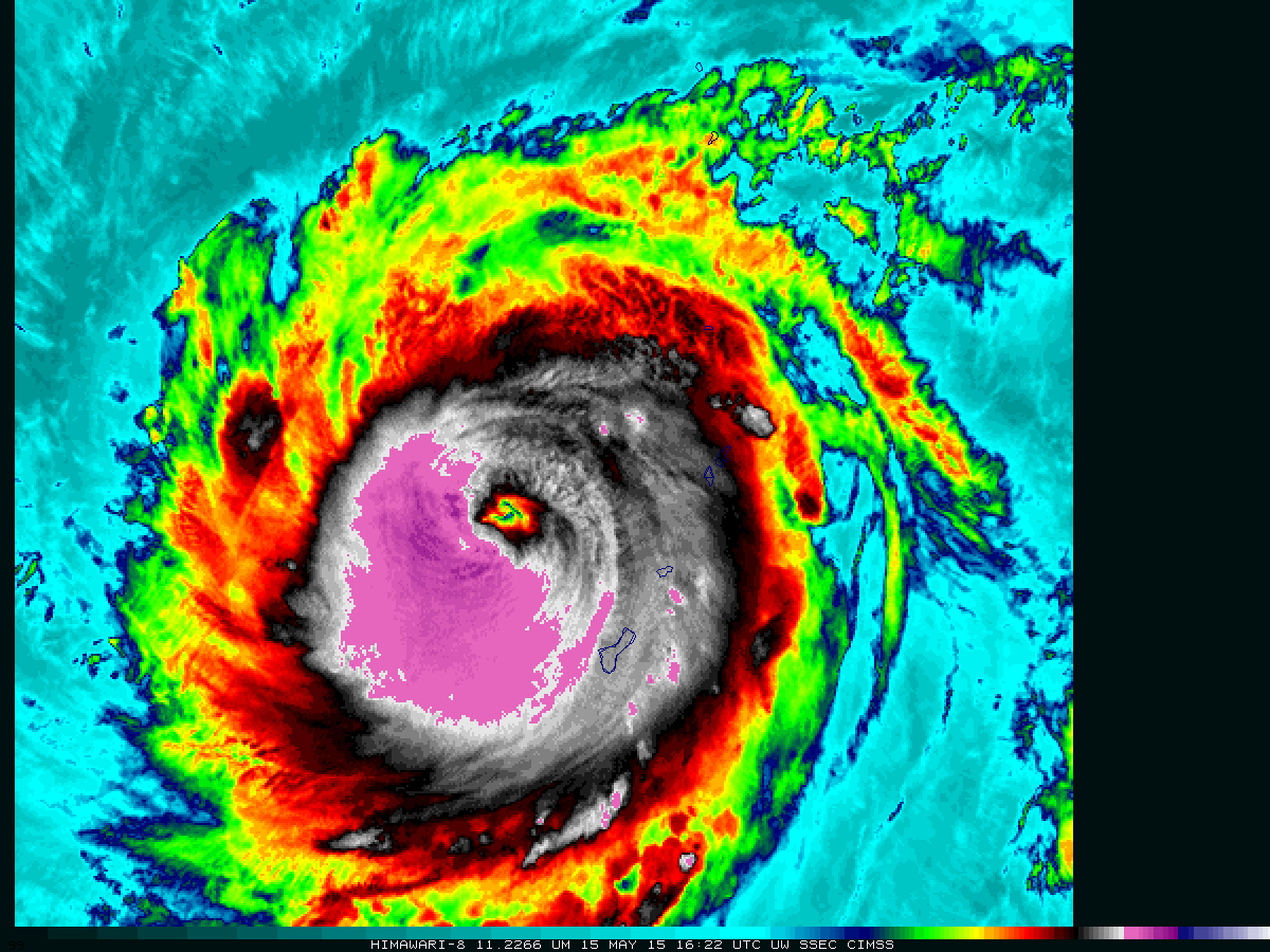
Himawari-8 infrared imagery (above, at 2.5-minute time steps and available here as an mp4) shows the development of an eye in Typhoon Dolphin shortly after 1400 UTC when the storm was northwest of Guam. With the subsequent arrival of daylight, mesovortices were clearly seen within the eye on 2.5-minute interval rapid scan visible images... Read More
Typhoon Dolphin approaches Guam
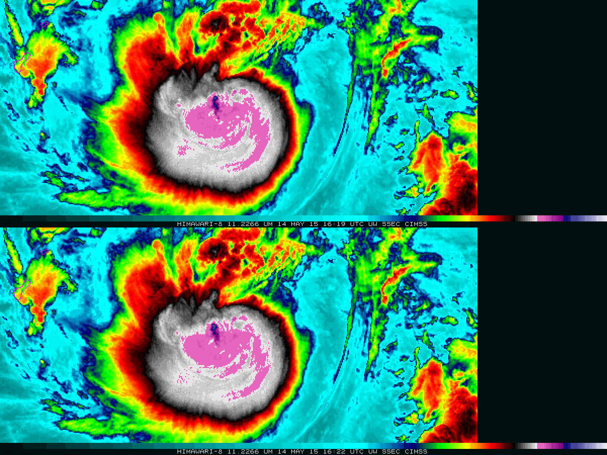
The animation above (available here as an mp4, and here on YouTube) shows 11.22 µm infrared imagery at 2.5-minute time steps (bottom) and 10-minute time steps (top) from Himawari-8 on 14 May 2015. Category 2 intensity Typhoon Dolphin is approaching Guam, seen at the left edge of both panels in... Read More
