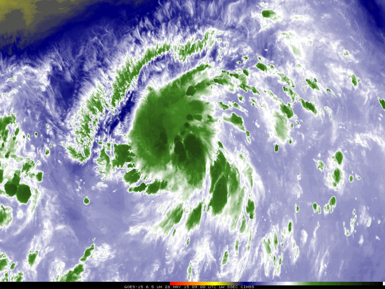
Andres and Blanca in the eastern Pacific
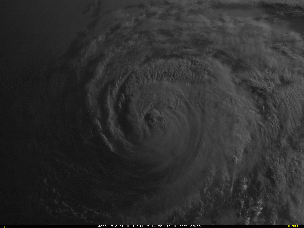
GOES-15 Imager 0.64 µm visible channel images (click to play animation)
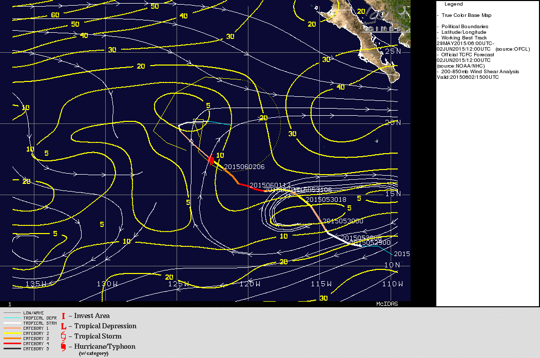
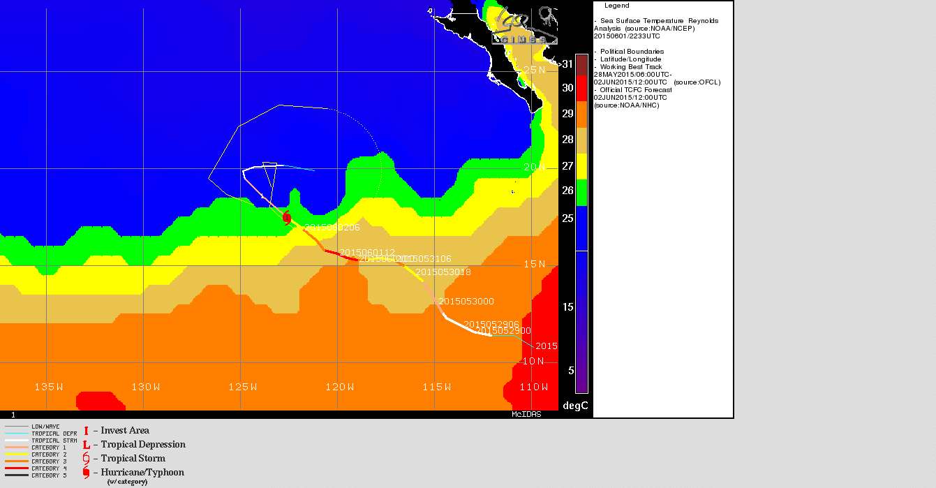
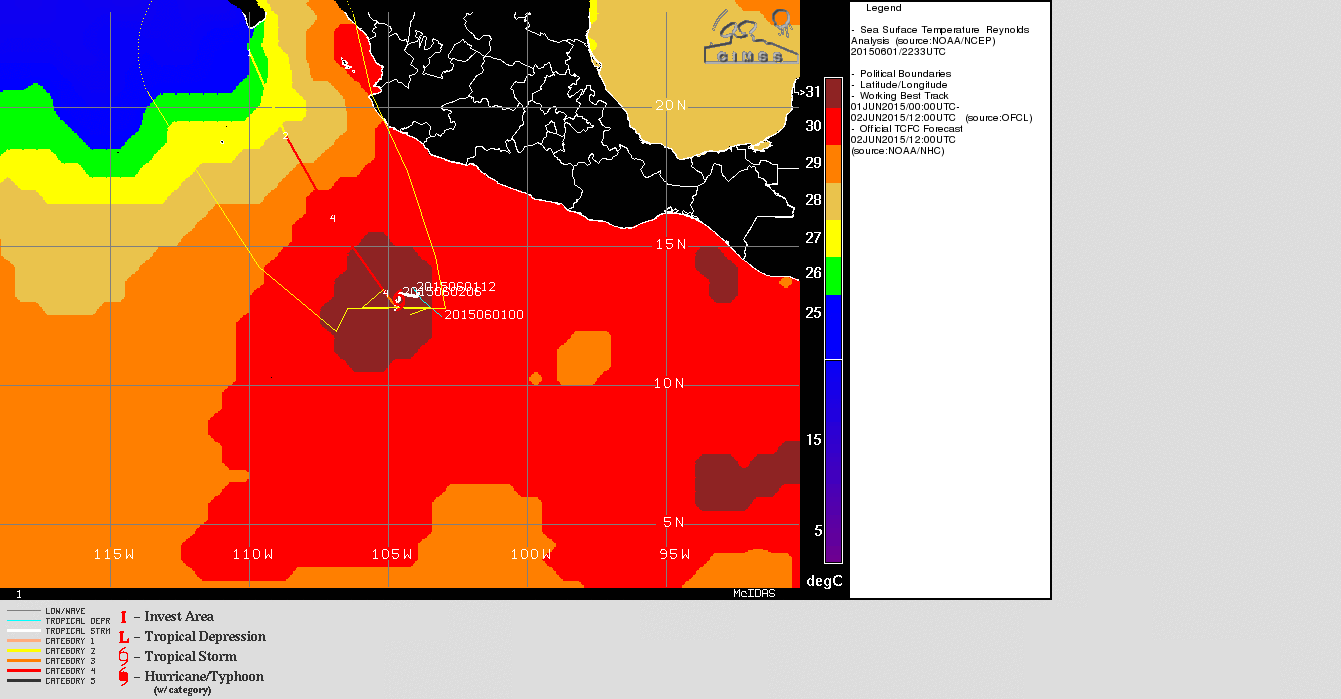
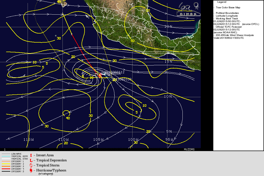
Hurricane Andres (above) in the eastern tropical Pacific was on 2 June 2015 joined by Tropical Storm Blanca (below). Blanca was forecast to become a Hurricane later on 2 June as Andres weakens. The circulation of Andres, above, is well-established, with good anti-cyclonic outflow and curved inflow bands. Shear values are low. (Graphics come from this site). However, Andres has moved over relatively cool Sea Surface Temperatures that spell weakening.
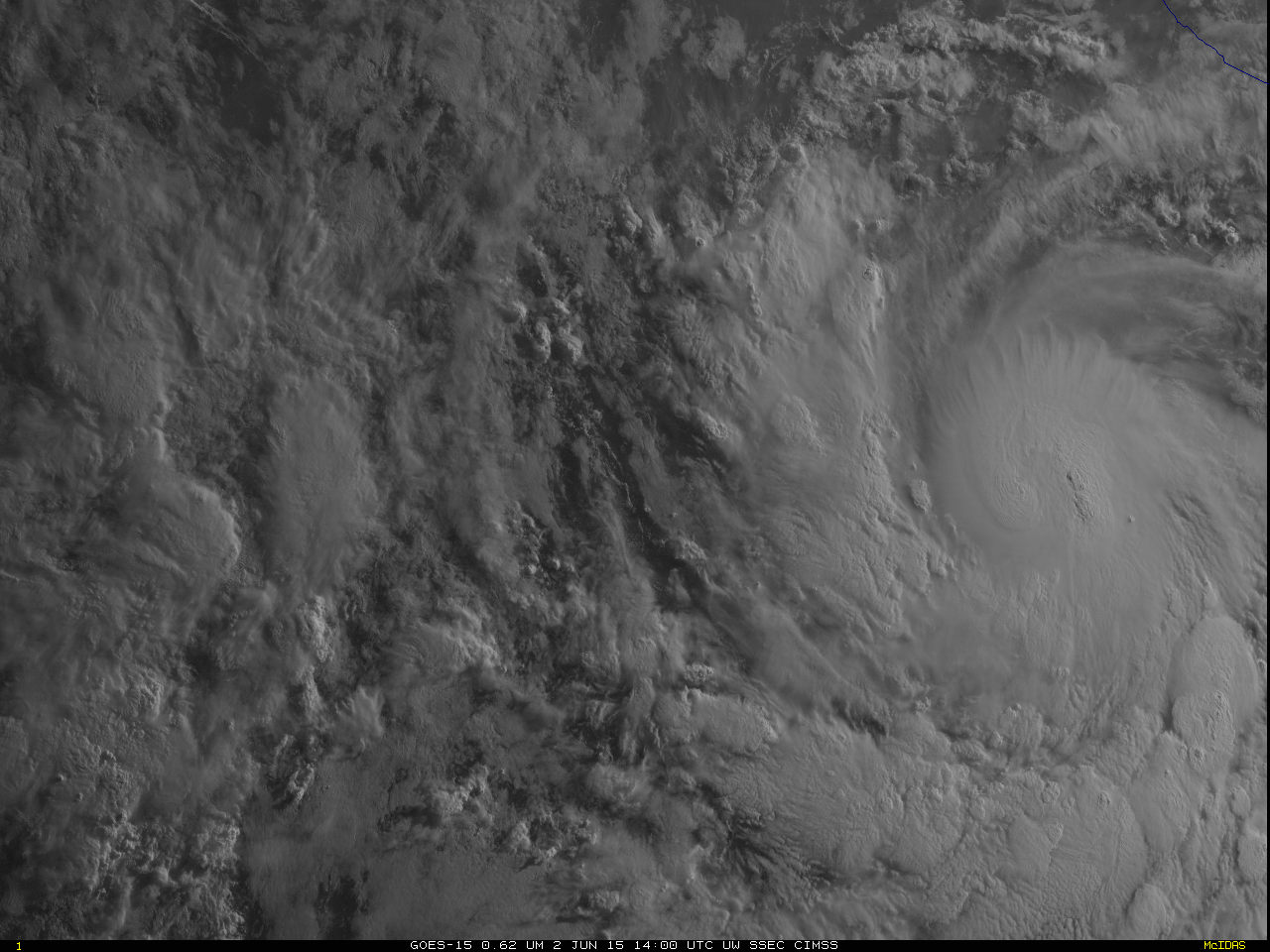
GOES-15 Imager 0.64 µm visible channel images (click to play animation)
Blanca, in contrast, has a circulation that is not so well-defined. However, the storm is over very warm water, and also in a region of relatively low shear. Strengthening is forecast.
The animation of Andres at top shows a ragged appearance as dry air intrudes upon the circulation from the south and west. This dry air is apparent in the MIMIC Total Precipitable Water animation below. The circulation of Blanca appears at the end of the animation, embedded within a rich source of tropical moisture.
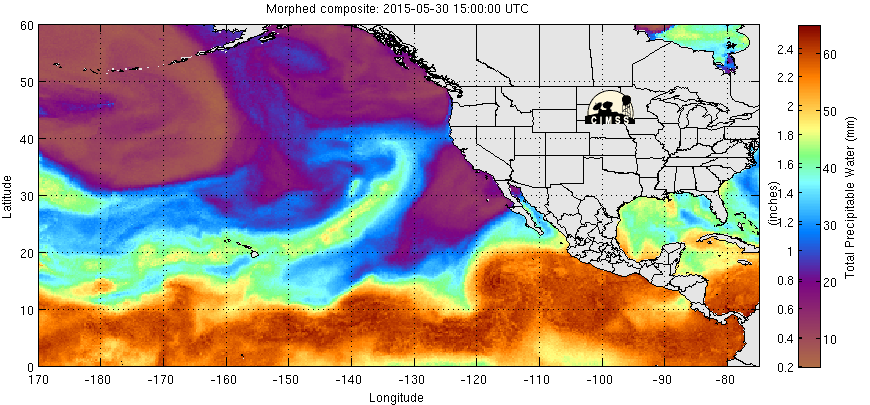
3-day animation of MIMIC Total Precipitable Water over the eastern Pacific (click to enlarge)
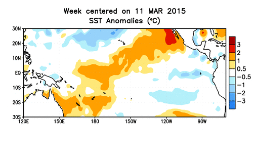
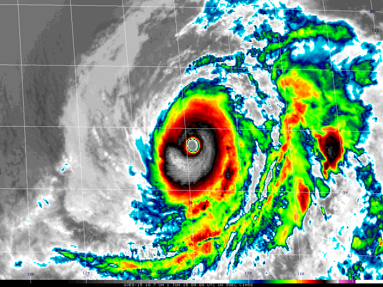
Sea-surface temperatures off the Pacific Coast of Mexico have been warmer than normal for much of this year (Map, data from here). Warmer-than-normal sea-surface temperatures argue for stronger hurricanes, and Andres was a Category 4 storm on 1 June with a well-developed eye. Andres is one of only 5 May storms in the eastern Pacific since 1970 to achieve Major Hurricane status (Link).
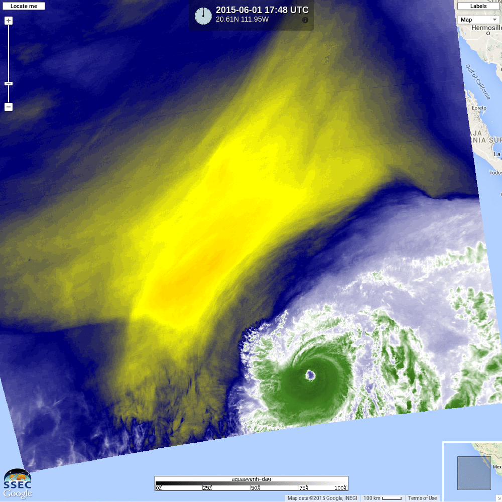
Aqua overflew Andres shortly before 1800 UTC on 1 June, and the water vapor imagery of the storm at that time is here. The True-Color imagery is shown below.
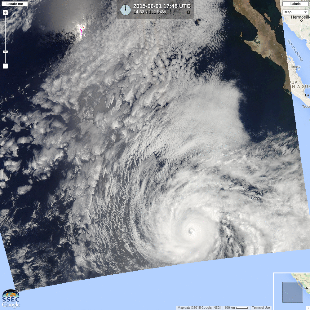
Aqua True-Color Imagery, 1748 UTC on 1 June 2015 (click to enlarge)
A storm-centered animation over Andres’ lifecycle is shown below. The storm starts in the moisture-rich ITCZ and ends as an isolated region of moisture surrounded by dryness.
GOES-15 Water Vapor Infrared Imagery (6.5µm) centered on Andres’ center (click to enlarge)
For further information on these storms, consult the National Hurricane Center website.