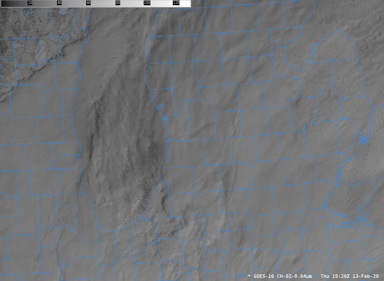
TJ Turnage, the Science and Operations Officer (SOO) at the National Weather Service forecast office in Grand Rapids, noted today the presence of smooth, curving bands over Lake Michigan. The animation above shows their development — and the smooth appearance of the bands (just offshore of Ottawa Co, and curving into... Read More

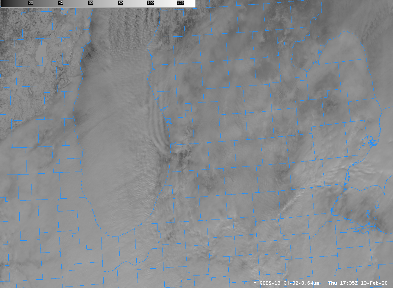
GOES-16 Advanced Baseline Imager (ABI) “red” visible imagery (0.64 µm), 1435 – 1840 UTC on 13 February 2020 (Click to enlarge)
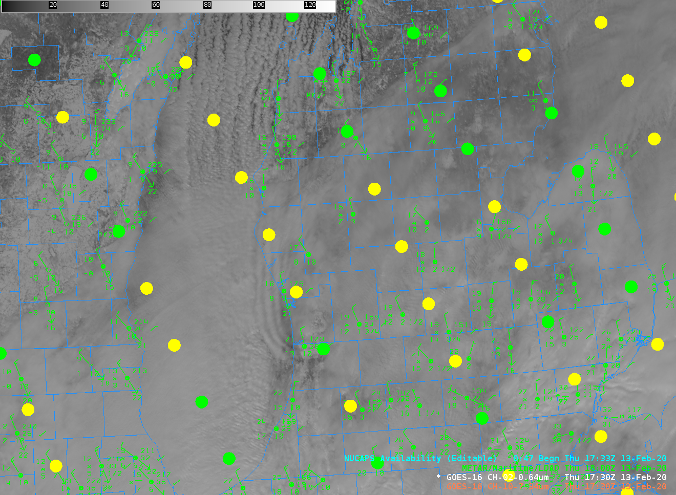
TJ Turnage, the Science and Operations Officer (SOO) at the National Weather Service forecast office in Grand Rapids, noted today the presence of smooth, curving bands over Lake Michigan. The animation above shows their development — and the smooth appearance of the bands (just offshore of Ottawa Co, and curving into Allegan Co) is in marked contrast to the north-south oriented lake-effect bands over central Lake Michigan. This falls into the “What the Heck is this?” Blog Category.
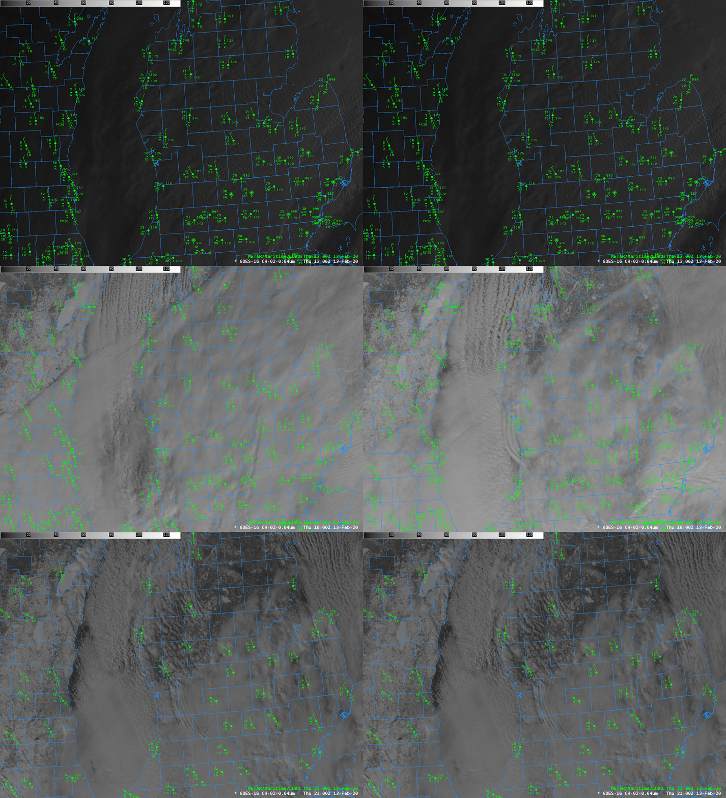
An hourly animation that includes surface conditions sheds little light. The bore-like feature seems to arise out of an interaction of the atmospheric flow with Big and Little Sable Points, and surface winds at Muskegon (just north of Ottawa Co) and Holland (in Allegan Co) change as the feature moves over — but no snow is observed at those stations during the bore passage.

GOES-16 Advanced Baseline Imager (ABI) “red” visible imagery (0.64 µm) and surface METARS hourly from 1300 – 2100 UTC on 13 February 2020 (Click to enlarge)
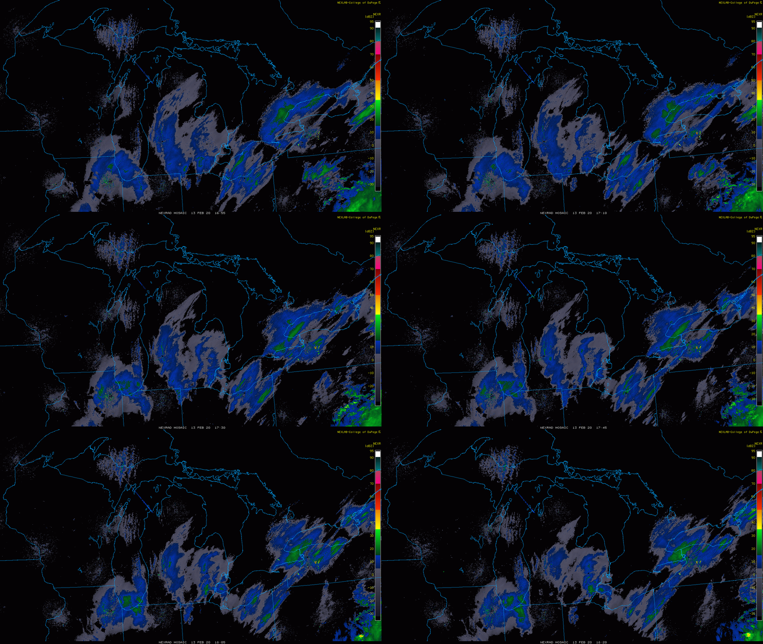
Radar imagery (from the College of Dupage) also shows little return associated with the bore-like features. (Click to see images from 1720 and 1800 UTC, when the bands were on shore).

NEXRAD Composite Radar Imagery (Composite Reflectivity) centered on MI, 1655-1820 UTC on 13 february 2020 (Click to enlarge)
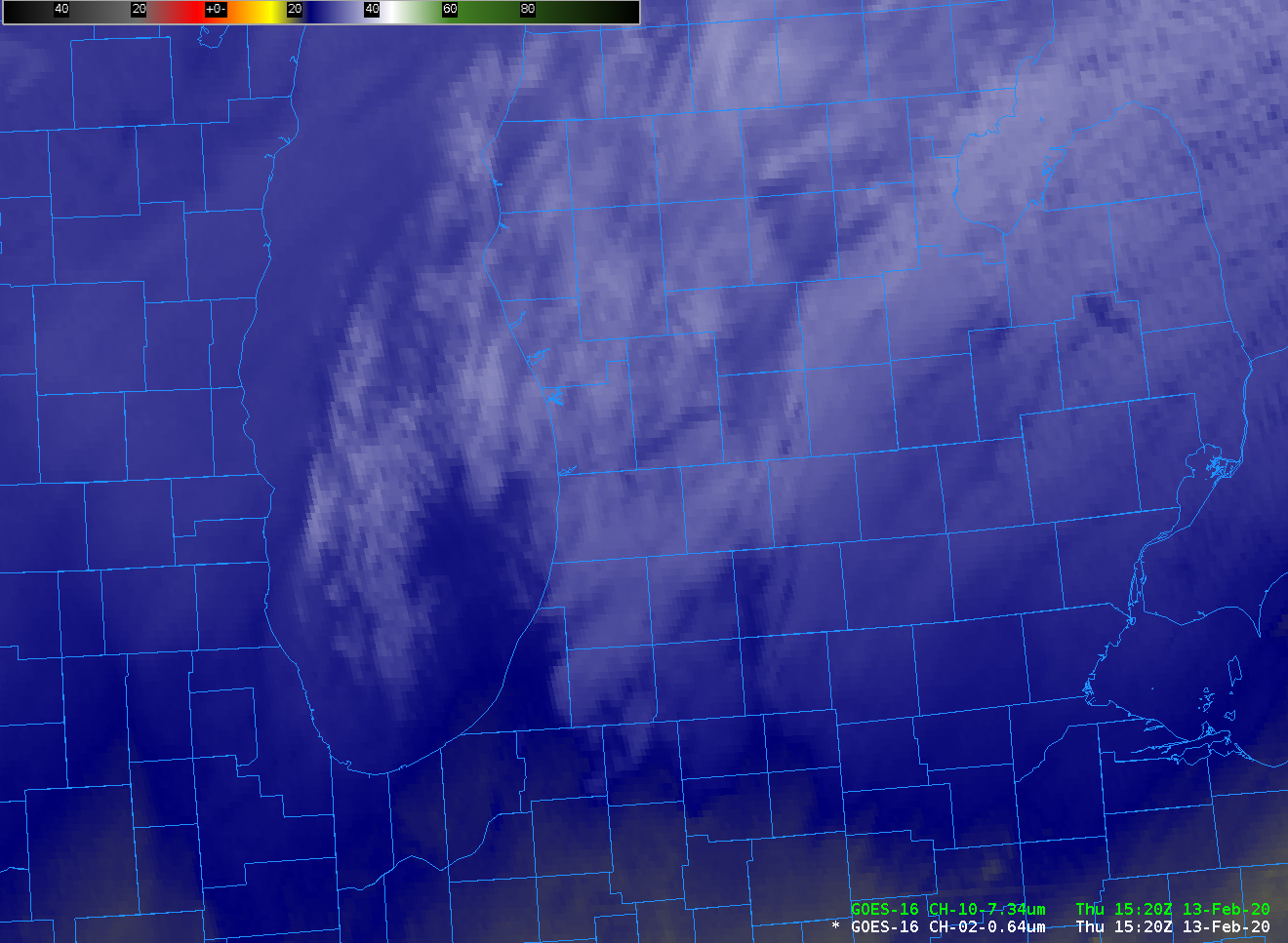
Water vapor imagery, below, suggests that the stable layer that is trapping the energy and causing the bore-like feature originated near Big and Little Sable Points, around 1600 UTC. The enhancement also suggests the bore-like feature is higher than the tops of lake-effect bands in the middle of Lake Michigan. (Click here for a rocking animation of the water vapor imagery; the rocking allows for better tracking of the impulse back to the source near the Sables, its earliest hint is at 1610 UTC — vs. about 1635 UTC in visible imagery).

GOES-16 ABI Band 10 (7.34 µm, low-level water vapor) infrared imagery, 1520 to 2015 UTC, 13 February 2020 (Click to play animated gif)

GOES-16 ABI Band 2 (0.64 µm) visible imagery, 1520 to 2015 UTC, 13 February 2020 (Click to play animated gif)
Bore-like features require stable layers. The Gaylord Michigan sounding at 1200 UTC — upstream from the region out of which the bore emerged — shows several inversion layers. The weighting function for the sounding (from this site) shows peak contributions for 7.34 µm (indeed, from all water vapor channels) from above 500 mb. The coldest brightness temperature in the bands is -28 º C; based on the Gaylord sounding, that’s a pressure level near 560 mb. These Bore-like features are not Lake-Effect snow bands, despite having the correct aspect ratio — their width and length both suggest Lake-effect bands, but their height suggests otherwise.
NOAA-20 overflew this region shortly after 1700 UTC, and a NUCAPS sounding is close to the Michigan shoreline, just east of Holland, where the cloud band is coming onshore. The sounding from NUCAPS at that point/time is below. The very smooth sounding does bear a passing resemblance to the Gaylord Sounding, but the smoothness of the NUCAPS profile — sampling a volume of air that in this case is about as wide as a county, makes identification of sharp inversions difficult.

NOAA-20 NUCAPS Profile points over Lake Michigan and lower Michigan, ca. 1730 UTC on 13 February 2020 (Click to enlarge)

NUCAPS Profile of temperature and moisture, 17 UTC on 13 February 2020 (Click to enlarge)
View only this post
Read Less
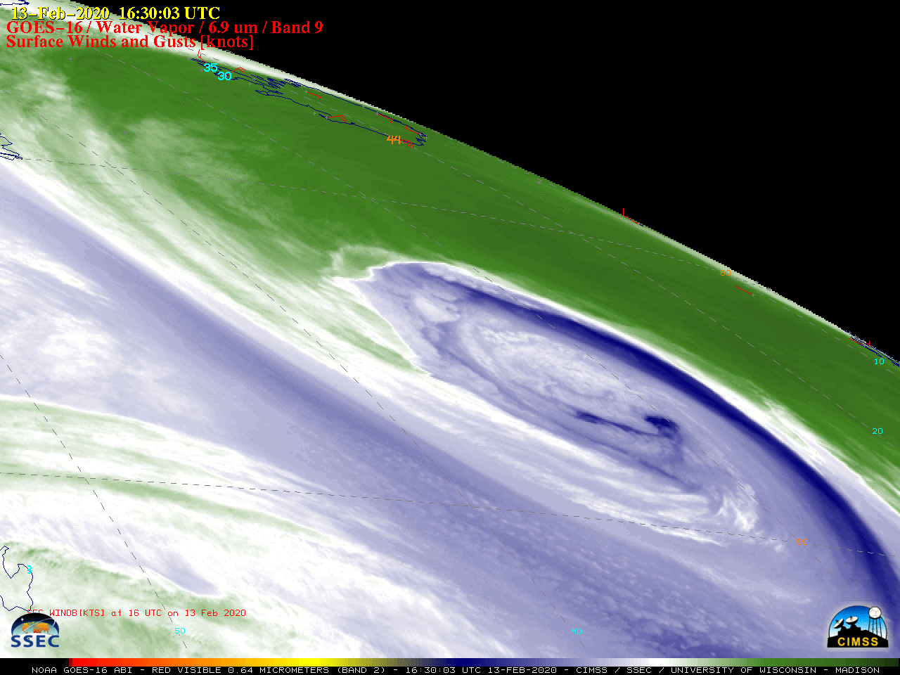
![GOES-16 Mid-level Water Vapor (6.9 µm) images, with plots of hourly surface wind barbs and gusts (in knots) [click to play animation | MP4]](https://cimss.ssec.wisc.edu/satellite-blog/images/2020/02/G16_WV_WINDS_NATL_13_15FEB2020_B9_2020044_163003_GOES-16_0001PANEL_FRAME00100.GIF)
![Sequences of VIIRS Infrared Window (11.45 µm) images from NOAA-20 and Suomi NPP [click to play animation]](https://cimss.ssec.wisc.edu/satellite-blog/images/2020/02/200215_13z_snpp_ir_natl.png)
![Meteosat-11 Water Vapor (6.25 µm) images, with hourly wind barbs and gusts (in knots) [click to play animation | MP4]](https://cimss.ssec.wisc.edu/satellite-blog/images/2020/02/MET12_WV_WINDS_STORM_DENNIS_14_16FEB2020_B5_2020046_120000_0001PANEL_FRAME00145.GIF)


![Sequence of VIIRS True Color RGB images from NOAA-20 and Suomi NPP [click to play animation]](https://cimss.ssec.wisc.edu/satellite-blog/images/2020/02/200215_13z_snpp_tc_natl.png)

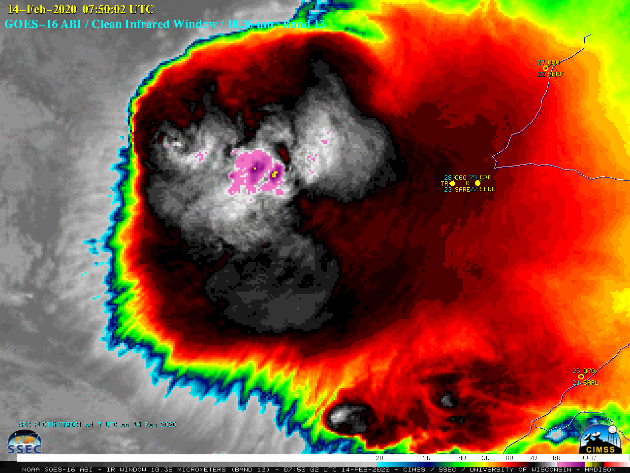
![VIIRS Infrared Window (11.45 µm) images from NOAA-20 (at 0452 UTC) and Suomi NPP (at 0541 UTC) [click to enlarge]](https://cimss.ssec.wisc.edu/satellite-blog/images/2020/02/200214_noaa20_suomiNPP_viirs_infrared_Argentina_mcs_anim.gif)
![Plots of available NUCAPS sounding points at 0341 UTC [click to enlarge]](https://cimss.ssec.wisc.edu/satellite-blog/images/2020/02/nucaps_arg-20200214_034135_sounding_points.png)
![NUCAPS profile north of the MCS [click to enlarge]](https://cimss.ssec.wisc.edu/satellite-blog/images/2020/02/200214_04utc_nucaps_profile_north.png)
![NUCAPS profile south of the MCS [click to enlarge]](https://cimss.ssec.wisc.edu/satellite-blog/images/2020/02/200214_0341utc_nucaps_profile_south.png)
![Plots of rawinsonde data from Córdoba, Argentina [click to enlarge]](https://cimss.ssec.wisc.edu/satellite-blog/images/2020/02/200213_200214_SACO_RAOBS.GIF)
