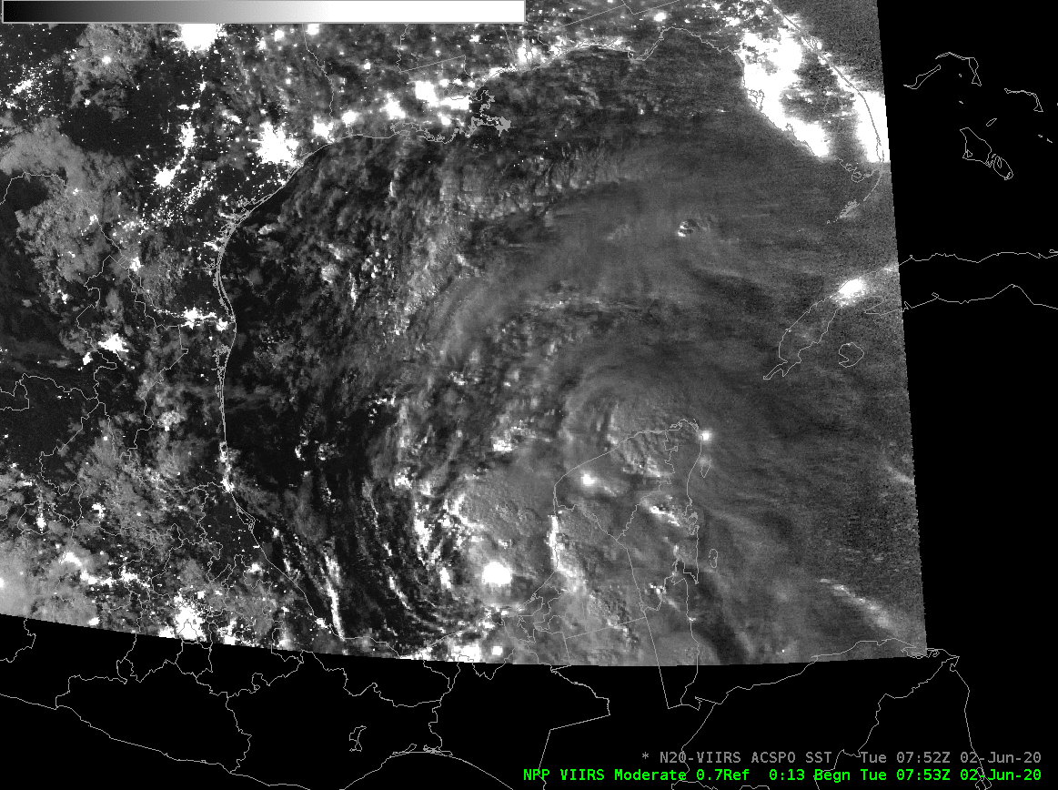
Suomi-NPP Day Night Band visible imagery (0.7 µm) overlain with ACSPO SSTs, 0752 UTC 2 June 2020 (Click to enlarge)
The tropical system in the southern Gulf of Mexico that owes part of its genesis to Eastern Pacific Tropical Cyclone Amanda has been named tropical storm Cristobal, the third named storm of the Atlantic Season. Day Night band imagery from Suomi NPP, shown above from 0753 UTC on 2 June 2020 (when the system was still an un-named depression), shows abundant strong convection over and adjacent to the Yucatan Peninsula and in the Bay of Campeche. The western edges of clouds were very well-illuminated because the >80% Full Moon was setting and approaching the western horizon; moonset at New Orleans’ longitude on 2 June was shortly after 3:30 AM (i.e., 0830 UTC). Lights from cities surrounding the Gulf and from Oil platforms within the Bay of Campeche are also apparent.
The Advanced Clear-Sky Processor for Oceans (ACSPO) Sea-Surface Temperature field (this VIIRS-based field is available in AWIPS via an LDM feed from CIMSS) shows few pixels of information because of the extensive cloud shield. However, the pixels that do show through the clouds reveal SSTs between 82 and 84º F.
The storm is just south of a region of strong shear, as shown below (source) and over very warm waters (albeit close to land) and slow strengthening is forecast as it drifts northward in the next days (interests along the Gulf Coast should pay special attention to this system; refer to the National Hurricane Center for more information).
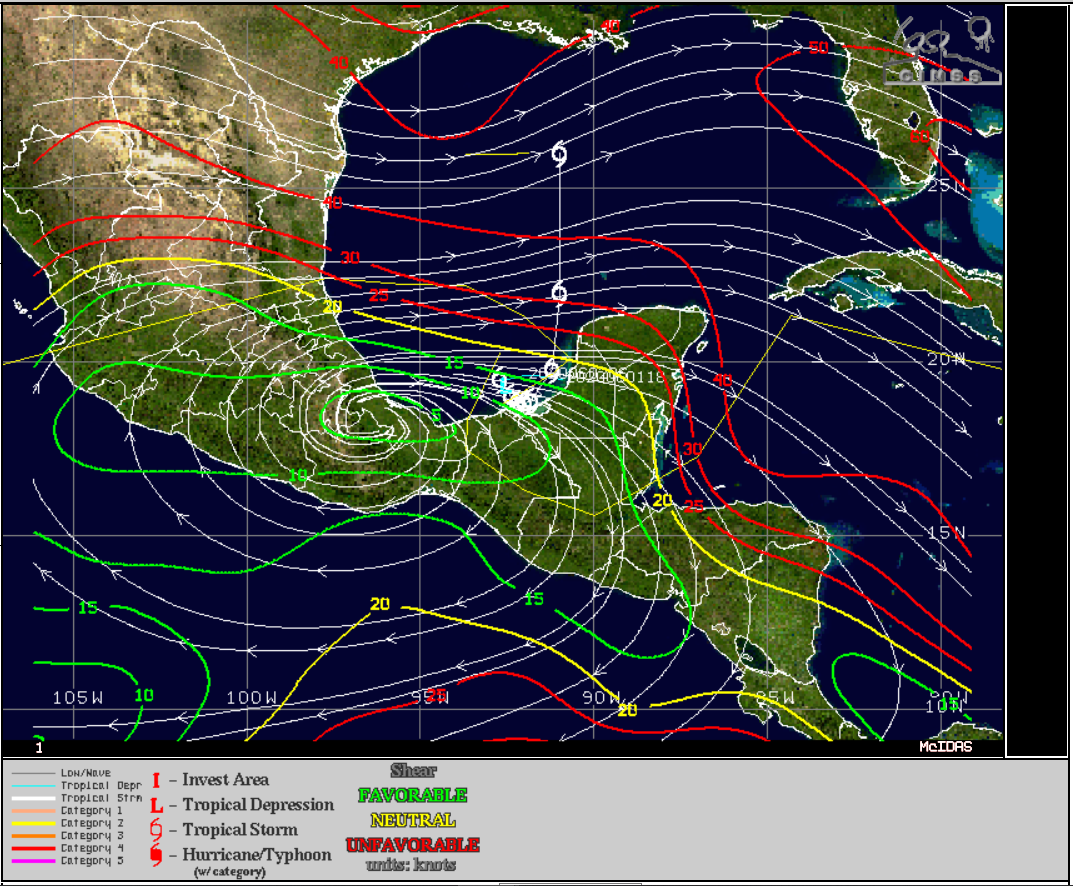
Wind Shear analysis at 1500 UTC on 2 June 2020 (Click to enlarge)
GOES-16 Atmospheric Motion Vectors (below, from 350-450 mb in red, and from 775-900 mb in lavender) also suggest shear over the central Gulf of Mexico.
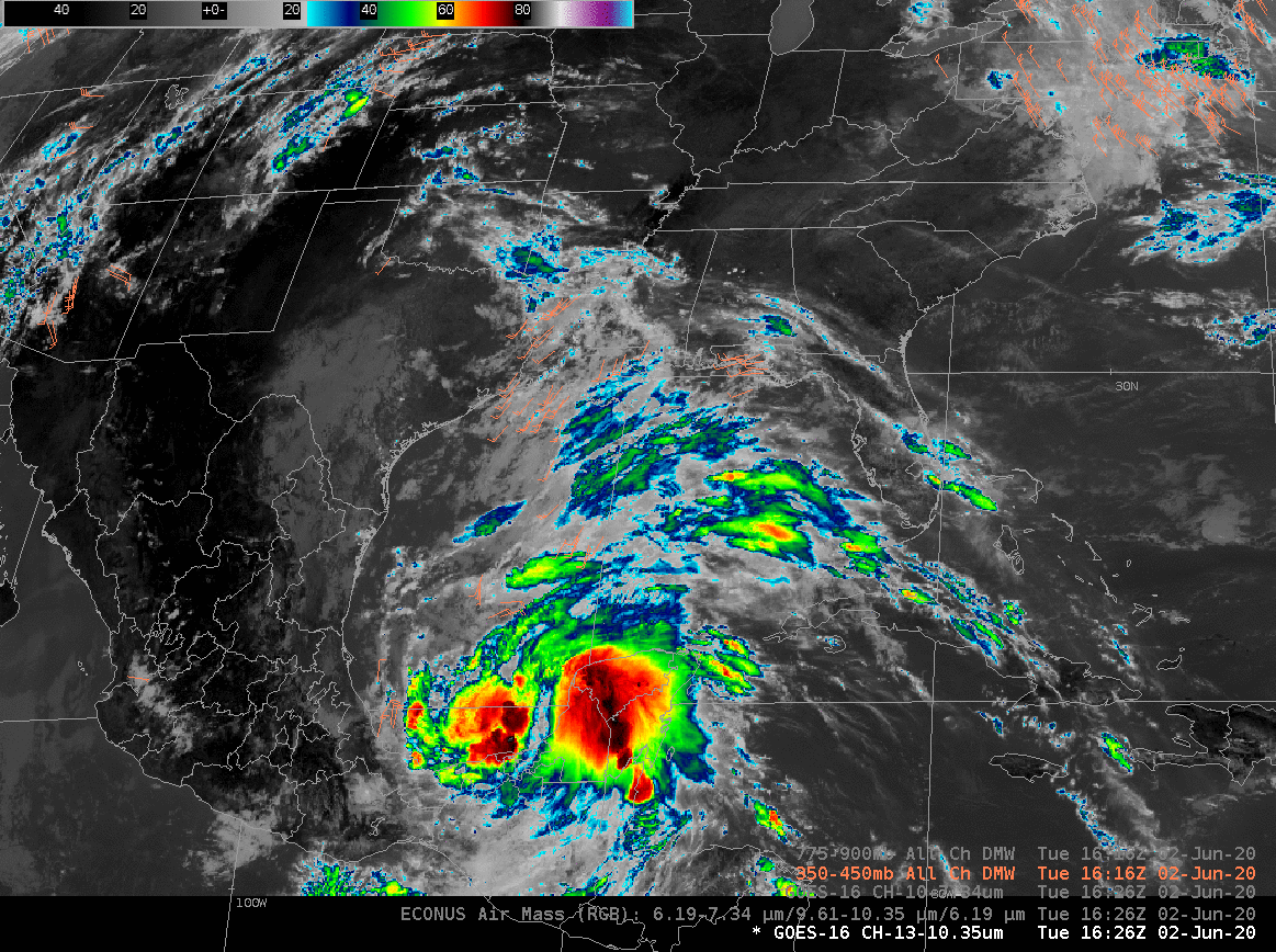
GOES-16 ABI Band 13 (10.3 µm) at 1626 UTC on 2 June, along with upper-level (350-450 mb) atmospheric motion vectors (in red) and low-level (775-900 mb) atmospheric motion vectors (in lavender) (Click to enlarge)
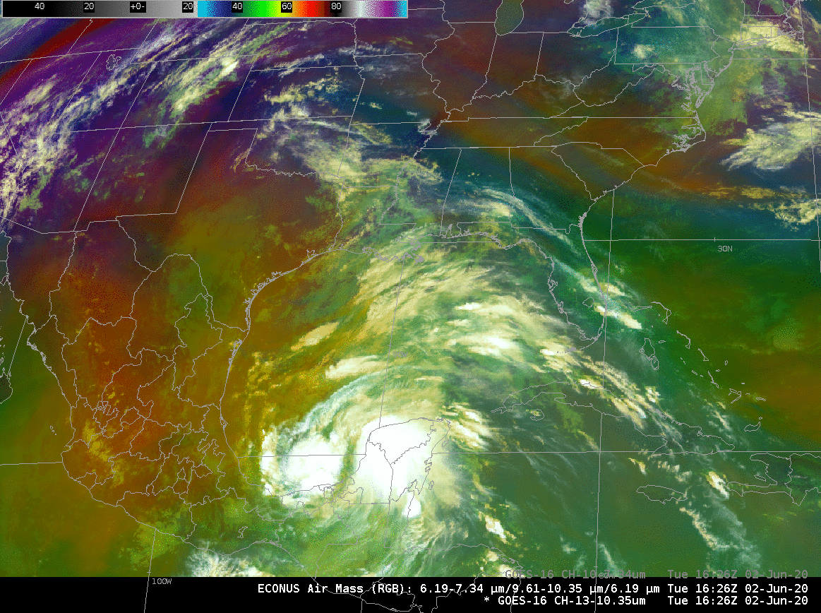
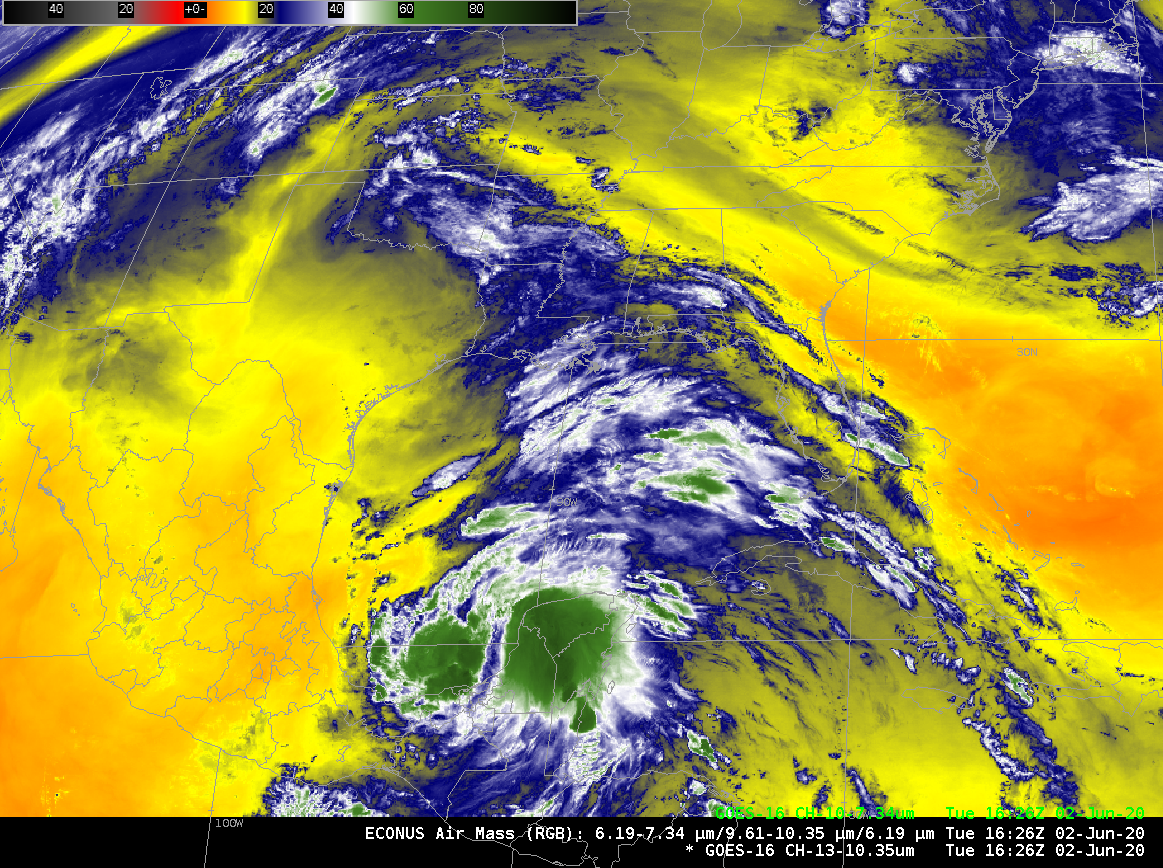
The Air Mass RGB animation, below, shows Cristobal’s convection developing within a moisture-rich tropical airmass characterized by green shading in the RGB. Dry air — orange and red in the RGB — is present just west of the storm.
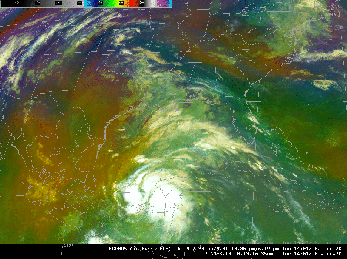
GOES-16 Air Mass RGB, 1401-1626 UTC on 2 June 2020 (Click to animate)
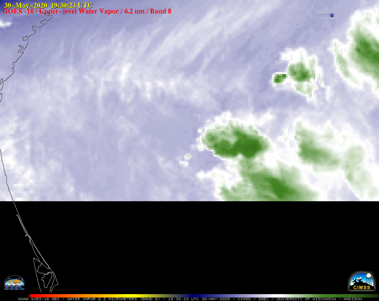
The dry air is even more obvious in the toggle below of the Air Mass RGB and the Low-Level water vapor imagery (Band 10, 7.34 ) at 1626 UTC on 2 June. Color enhancements of yellow and orange over Texas and Mexico suggest dry air in the mid-troposphere.
GOES-16 Air Mass RGB and low-level water vapor (Band 10, 7.34 µm) at 1626 UTC on 2 June 2020 (Click to enlarge)
For more information on this storm, refer to the National Hurricane Center, the CIMSS Tropical Weather Page, or your favorite Tropical Weather site.
The (mp4) video below, generated by CSPP-Geo and from an experimental CIMSS website, shows Cristobal in True Color from GOES-16.
View only this post Read Less

![GOES-17 "Red" Visible (0.64 µm) images [click to play animation | MP4]](https://cimss.ssec.wisc.edu/satellite-blog/images/2020/06/200601_goes17_infrared_AK_anim.gif)
![Suomi NPP VIIRS Visible (0.64 µm) and Infrared Window (11.45 µm) images at 2123 UTC [click to enlarge]](https://cimss.ssec.wisc.edu/satellite-blog/images/2020/06/200601_2123utc_suomiNPP_viirs_visible_infrared_AK_anim.gif)
![Suomi NPP VIIRS Visible (0.64 µm) and Infrared Window (11.45 µm) images at 2306 UTC [click to enlarge]](https://cimss.ssec.wisc.edu/satellite-blog/images/2020/06/200601_2306utc_suomiNPP_viirs_visible_infrared_AK_anim.gif)
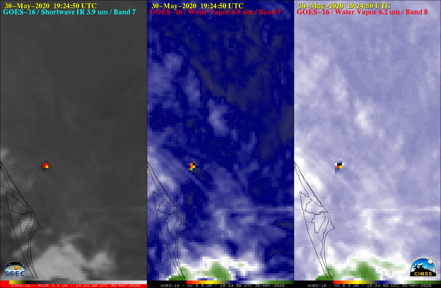
![GOES-16 Low-level (7.3 µm, left), Mid-level (6.9 µm, center) and Upper-level (6.2 µm, left) Water Vapor images [click to play animation | MP4]](https://cimss.ssec.wisc.edu/satellite-blog/images/2020/05/200530_goes16_waterVapor_SpaceX_launch_anim.gif)
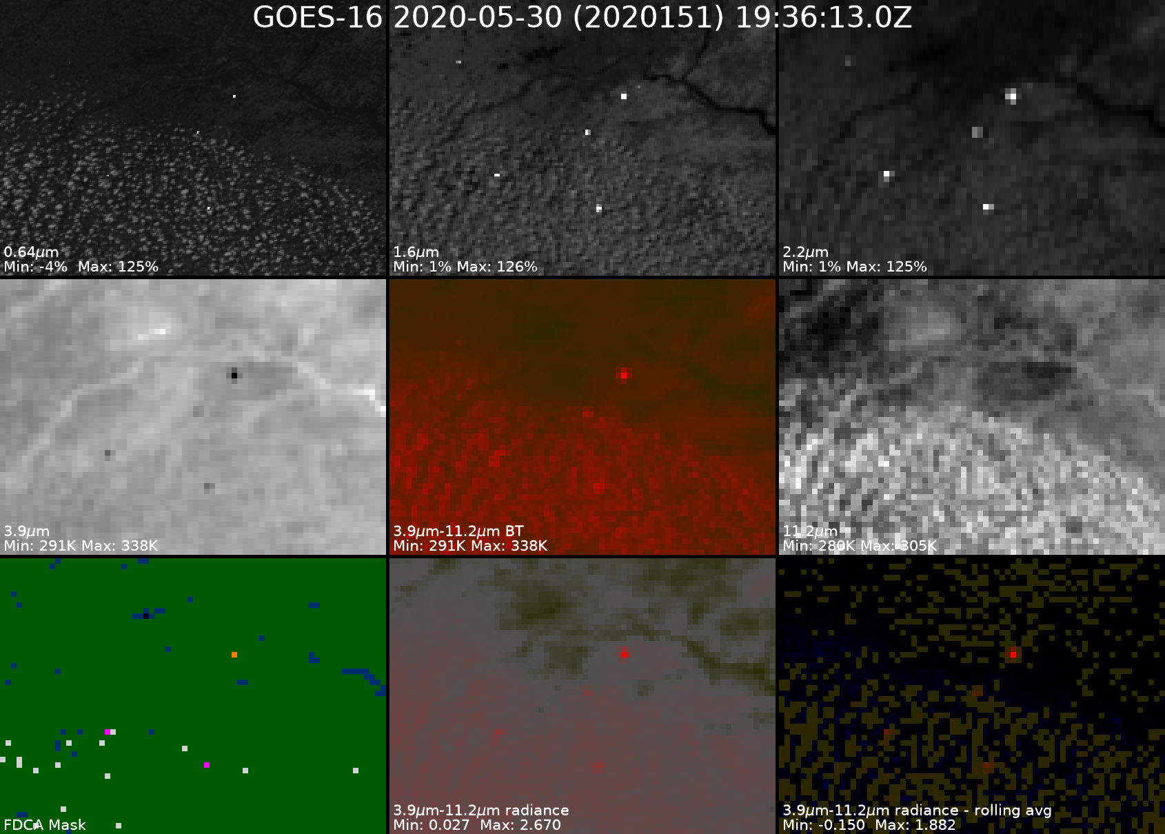
![GOES-16 Upper-level (6.2 µm) Water Vapor images [click to play animation | MP4]](https://cimss.ssec.wisc.edu/satellite-blog/images/2020/05/200530_goes16_waterVapor_SpaceX_rocket_thermal_signature_anim.gif)
![GOES-16 Shortwave Infrared (3.9 µm, left), Mid-level Water Vapor (6.9 µm, center) and Upper-level Water Vapor (6.2 µm, left) images [click to play animation | MP4]](https://cimss.ssec.wisc.edu/satellite-blog/images/2020/05/200530_goes16_shortwaveInfrared_waterVapor_SpaceX_launch_v2_anim.gif)
![GOES-16 Shortwave Infrared (3.9 µm) images [click to play animation | MP4]](https://cimss.ssec.wisc.edu/satellite-blog/images/2020/05/FALCON_loop_2020151_192150_2020151_192550.GIF)
![GOES-16 True Color RGGB images [click to play animation | MP4]](https://cimss.ssec.wisc.edu/satellite-blog/images/2020/05/200530_goes16_trueColorRGB_SpaceX_rocket_condensation_plume_anim.gif)
