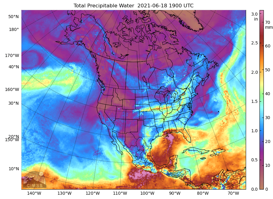
MIMIC Total Precipitable Water (TPW) estimates, 1900 UTC 18 June 2021 – 1800 UTC 19 June 2021 (Click to enlarge)
The Potential Tropical Cyclone that has been moving northward through the Gulf of Mexico made landfall southwest of New Orleans, LA on Saturday 19 June as a minimal Tropical Cyclone. The animation of total precipitable water, above, from the MIMIC TPW website, shows that most of the storm’s moisture is east of the center. (The circulation of Pacific Tropical Storm Dolores is also apparent, making landfall near Punta San Telmo in Mexico) A percent-of-Normal plots from NOAA/NESDIS/OSPO, below, shows values about 150% of normal over much of the southeast USA. Consequently, Flash Flood Watches are in effect over much of southern Alabama northeastward into western North Carolina, as shown below.
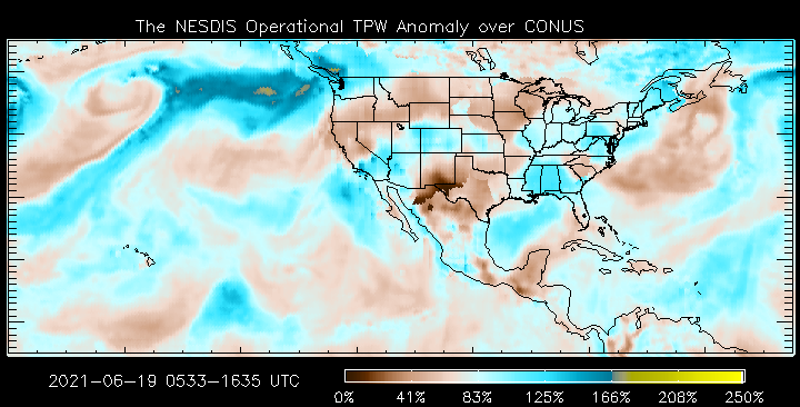
Percent-of-normal Blended Total Precipitable Water, 1800 UTC on 19 June 2021 (Click to enlarge)
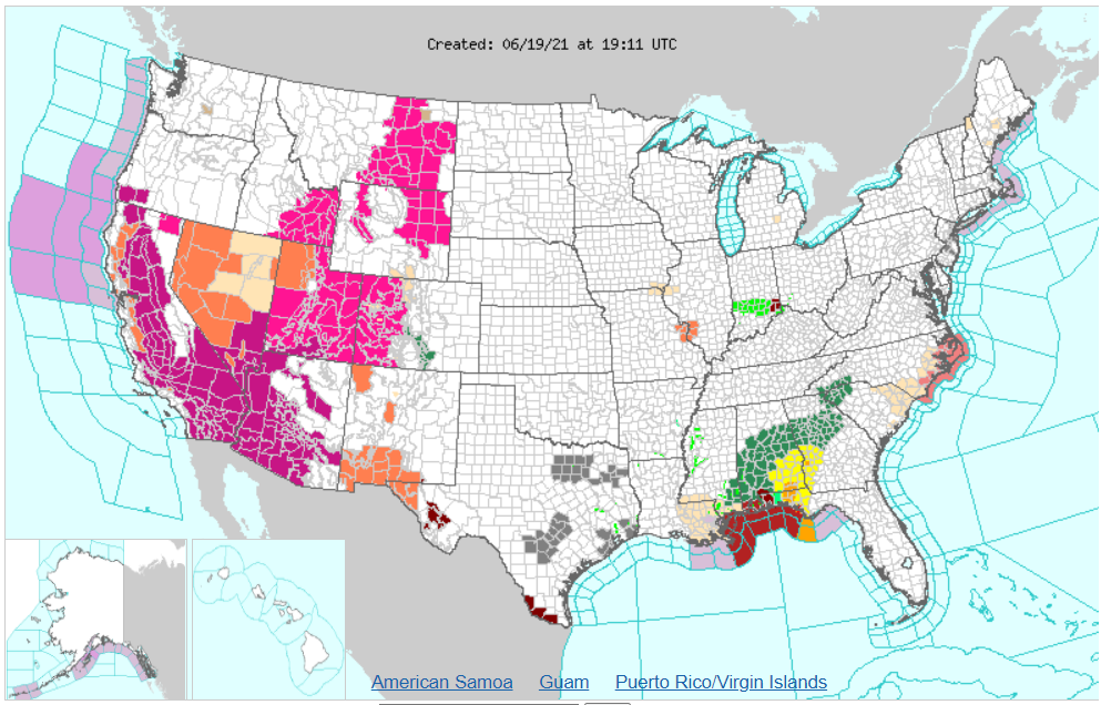
Weather hazards at 1911 UTC on 19 June 2021 (Click to enlarge)
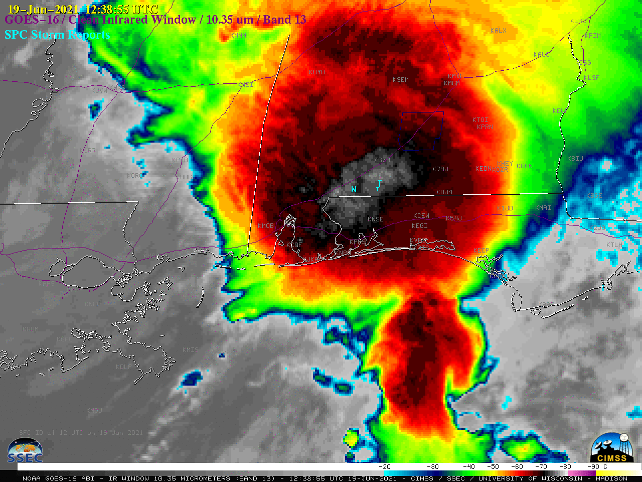
A True-Color image from CSPP Geosphere, below, taken from this link, shows the storm inland over southwestern Alabama; much of the rain and deep moisture with the storm remains to the east of the center.
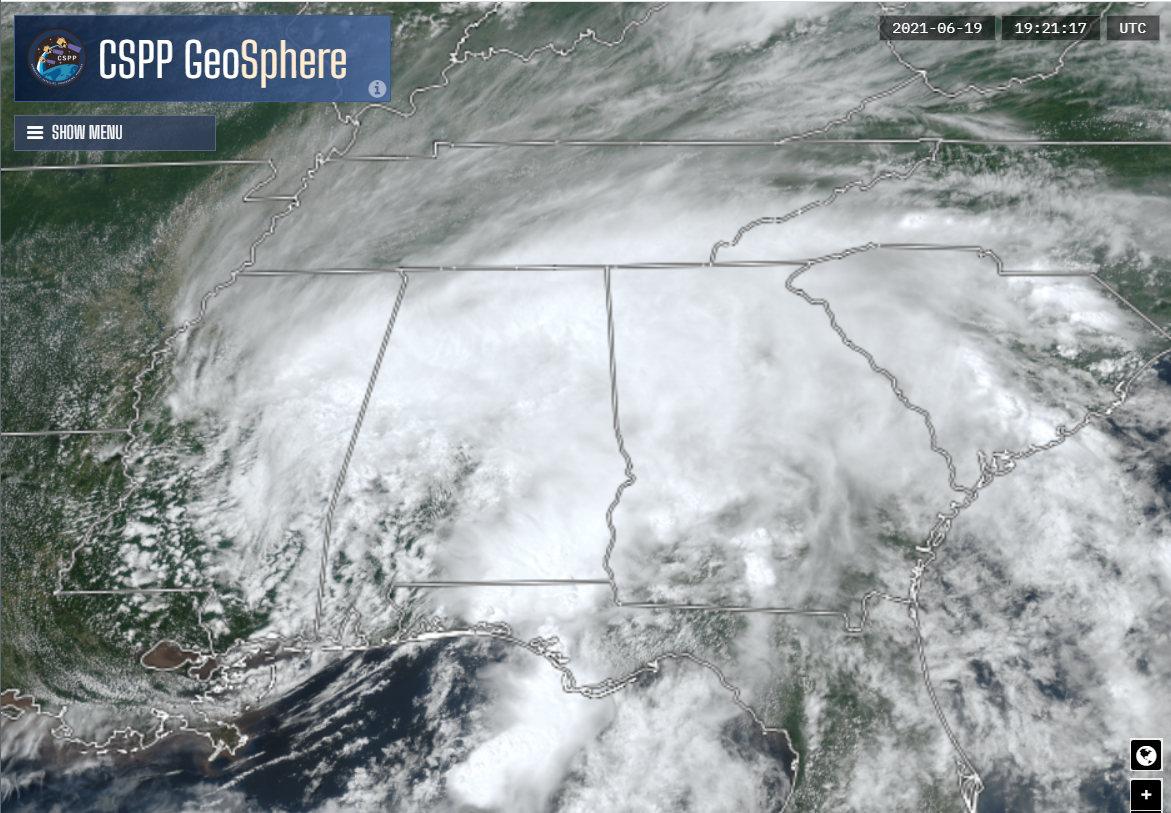
True-Color imagery, 1921 UTC on 19 June 2021, from CSPP Geosphere (Click to enlarge)
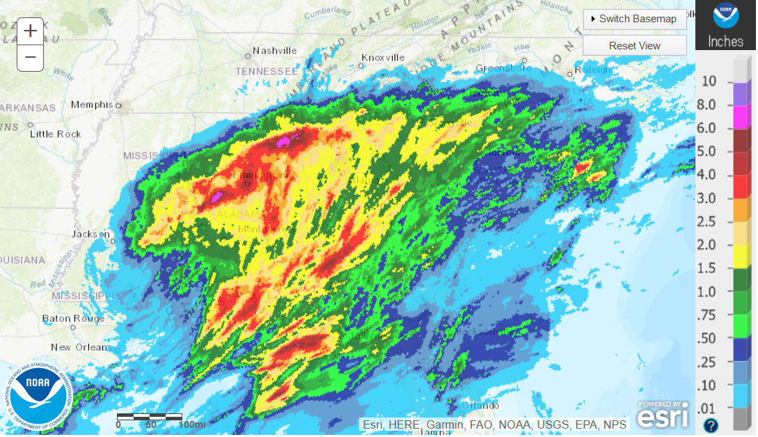
24-hour precipitation ending 1200 UTC on 20 June 2021 (Click to enlarge)
24-hour precipitation totals (from this site) are shown above. The analysis shows a few spots in northern Alabama received 6-8″ of rain.
CMORPH2 estimates for the 24-hours of precipitation ending at 0000 UTC on 20 June (that is, 12 hours before the estimate above), from RealEarth, are shown below.

24-hour CMORPH2 precipitation total estimates for the time ending 0000 UTC on 20 June 2021 (Click to enlarge)
GSMaP (link) also shows satellite-derived precipitation estimates. The 24-hour estimate ending at 0000 UTC on 20 June is shown below.

GSMaP precipitation estimate for the 24 hours ending 0000 UTC on 20 June 2021 (Click to enlarge)
View only this post Read Less
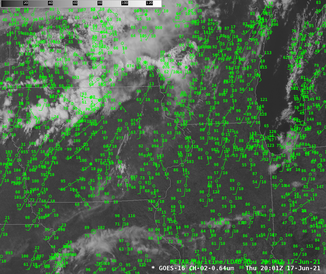
![GOES-16 “Red” Visible (0.64 µm) images, with SPC Storm Reports plotted in red [click to play animation | MP4]](https://cimss.ssec.wisc.edu/satellite-blog/images/2021/06/210619_goes16_visible_spcStormReports_Claudette_anim.gif)
![GOES-16 “Clean” Infrared Window (10.35 µm) images, with SPC Storm Reports plotted in cyan [click to play animation | MP4]](https://cimss.ssec.wisc.edu/satellite-blog/images/2021/06/210619_goes16_infrared_spcStormReports_Claudette_anim.gif)

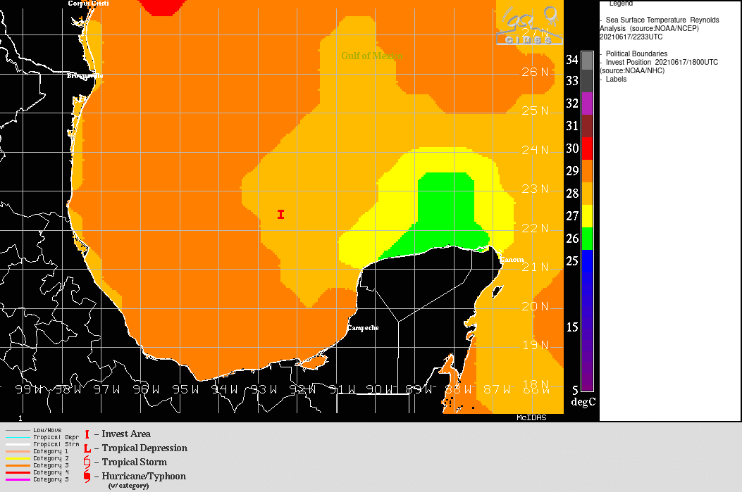
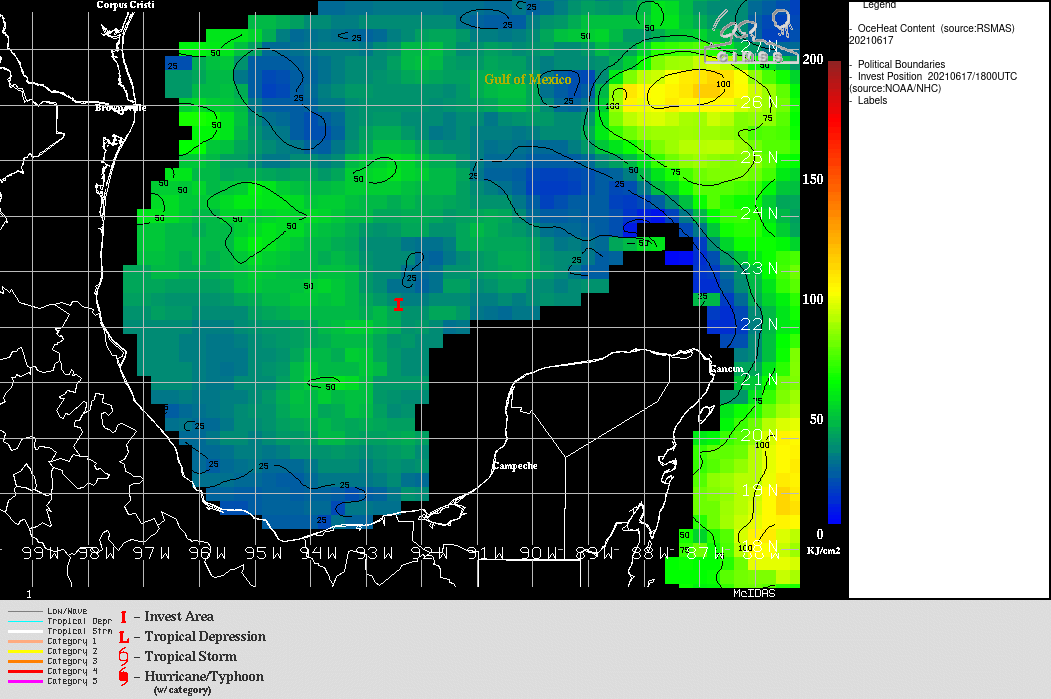
![GOES-16 Infrared Window images, with contours of deep-layer wind shear [click to enlarge]](https://cimss.ssec.wisc.edu/satellite-blog/images/2021/06/210617_goes16_infrared_shear_PTC3_anim.gif)


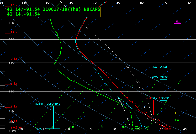