Using satellite data to describe a fire-prone environment
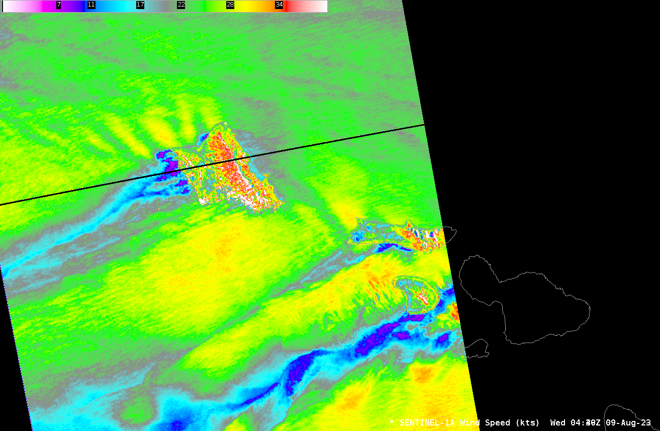
Deadly fires on the island of Maui occurred in an environment favorable to fire development: dry and windy. What kind of satellite data could be used to assess those conditions? Sentinel-1A overflew the western Hawai’ian islands near sunset on 8 August 2023 (that is, at 0440 UTC on 9 August), as shown above. Widespread 30-knot winds... Read More
