Satellite estimates of instability on a moderate risk day

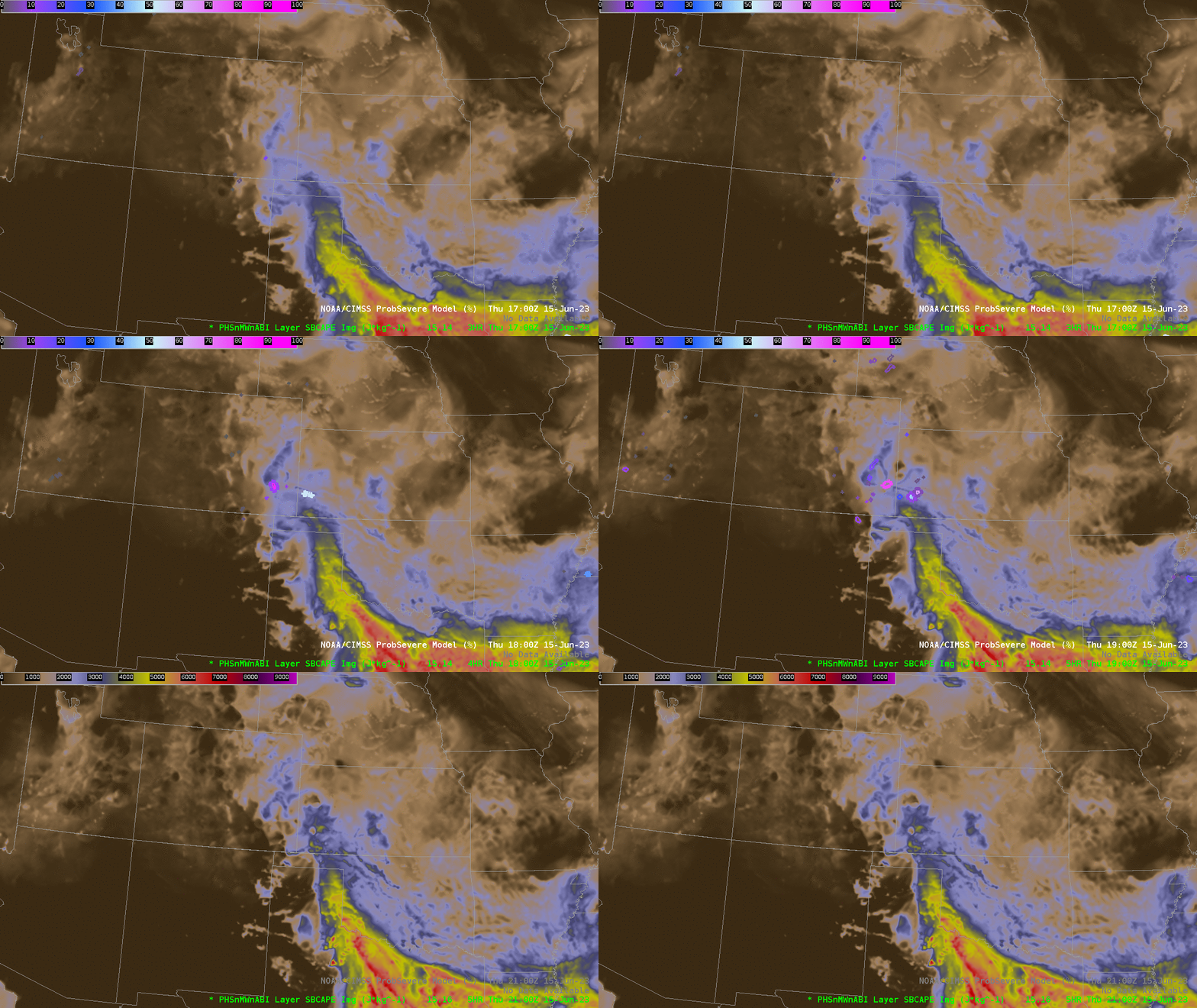
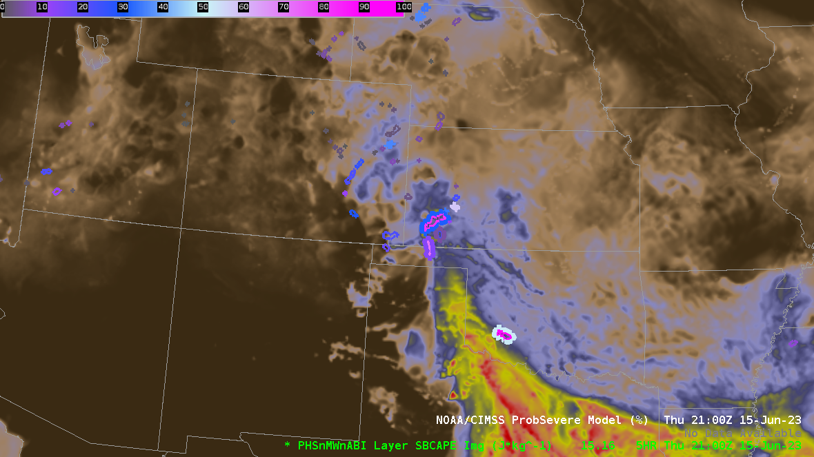
The Storm Prediction Center predicted a moderate risk of severe weather (link) over the southern Plains of the US on 15 June 2023. The animation above shows surface-based CAPE derived from 4-km WRF model output. This model incorporates information from Polar Hyperspectral Soundings via the Fusion process. Model CAPE fields are overlain by NOAA/CIMSS ProbSevere (version 3) polygons from 1700-2000 UTC. There is good agreement for those times between the gradient of the CAPE fields and the location of the ProbSevere polygons that show were severe weather is most likely. The 2100 UTC image of surface-based CAPE is also shown. Where do you think the polygons will be at 2100 UTC? That is shown below. These model fields can help with situational awareness in the near-term. (Model output is available at this link).

A particular benefit of the PHS model output fields shown above is that they are high-resolution, that information is available in cloudy and clear regions and that the forecast provides short-term (that is, 0-9 hour) guidance. Other satellite-based stability products are available of course. The two-panel below shows PHS output and GOES-16 Derived Stability Index estimates of CAPE. The character and gradients of the fields are very similar — but the Level-2 GOES estimate is created only in regions of clear skies. A direct (toggled) comparison of the fields at 1900 UTC is here. The comparison between the real-time GOES estimates and the 5-h model field suggests that the model evolution is just a bit slow.

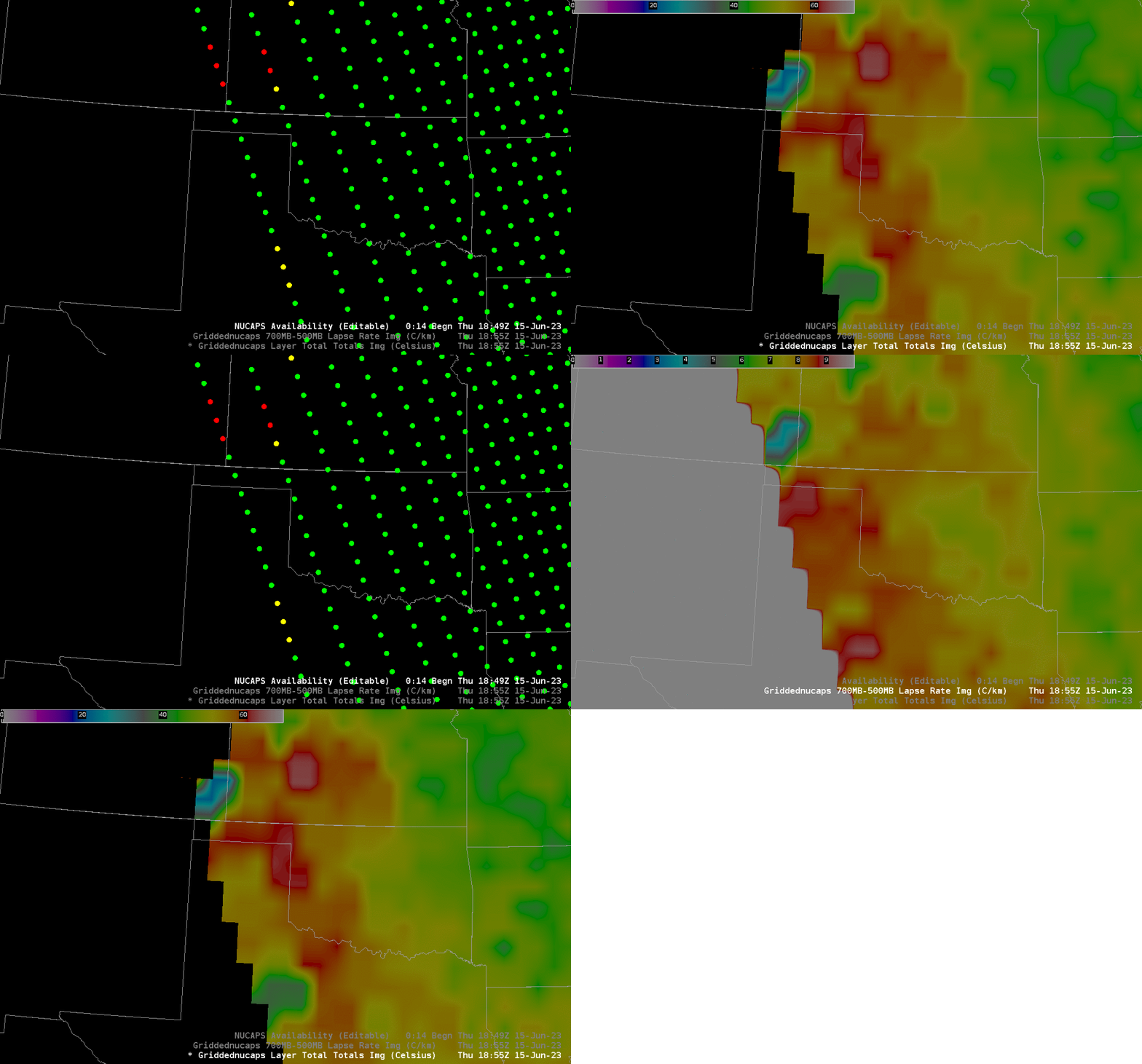
NOAA-20 overflew the eastern part of this domain at around 1900 UTC, and gridded NUCAPS fields of temperature and moisture were used to diagnose the stability. That is shown below. As with the PHS-enhanced WRF model output, NUCAPS fields give information in clear and cloudy regions. The horizontal resolution of NUCAPS data, however, is around 50 km; the display of tight gradients is a challenge.
The toggle below shows Sounding Availability points (Green Points: infrared retrieval converged to a solution; Yellow Points: microwave retrieval converged to a solution; Red Points: neither infrared nor microwave retrieval converged), the Total Totals index, and the lapse rate from 700-500 mb. The Total Totals index suggests the strongest instability over western Oklahoma, a region with steep 700-500 mb lapse rates.

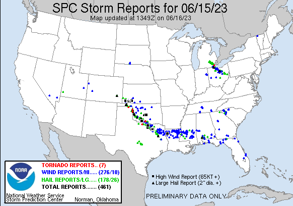
The PHSnMWnABI model output (and Probsevere Version 3) were both evaluated at SPC’s Hazardous Weather Testbed within the past month. Blog Posts from the forecasters that describe how these products can be used are here. SPC storm reports for this day are shown below. They do align with satellite estimates of CAPE.


