
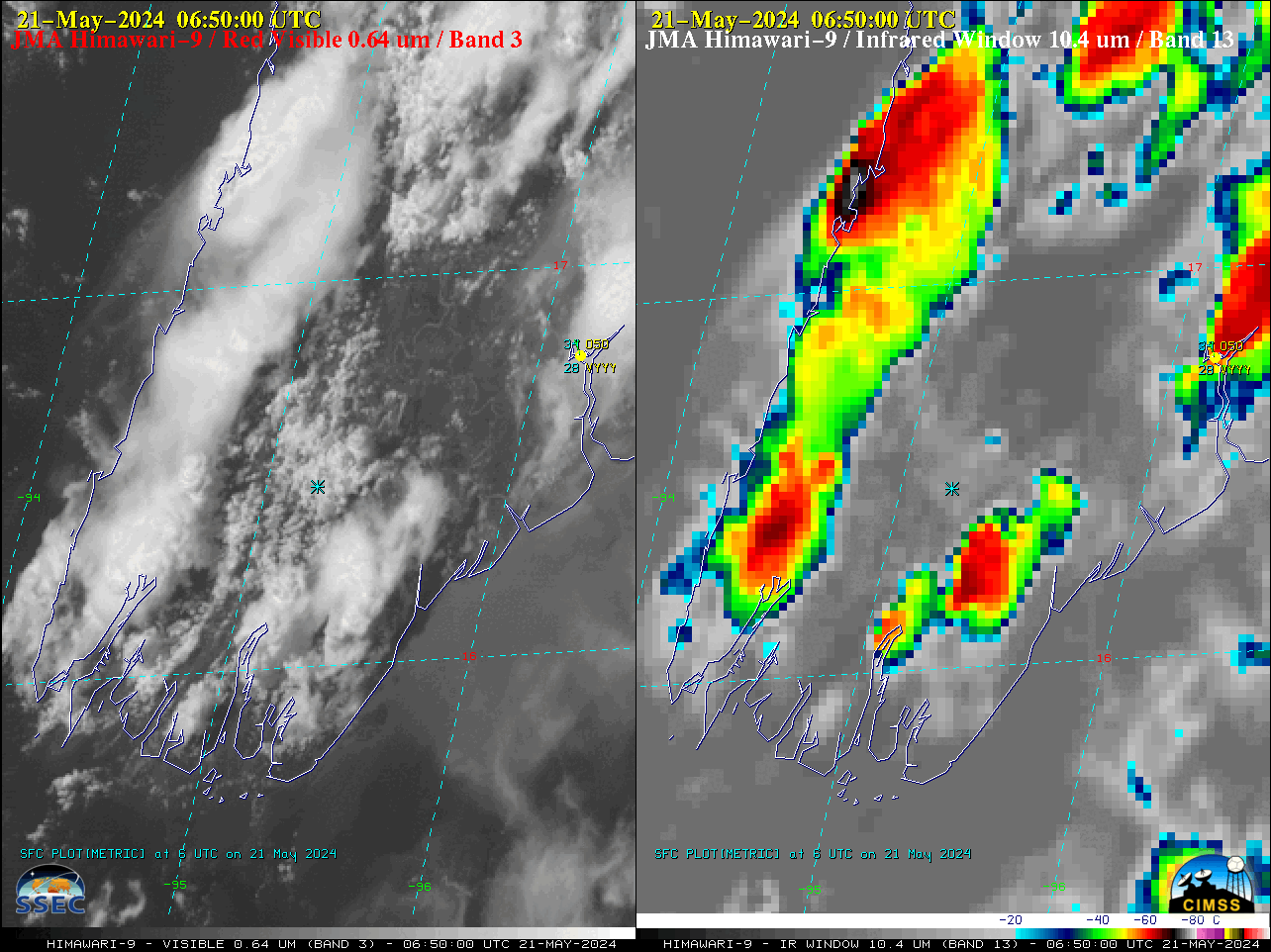
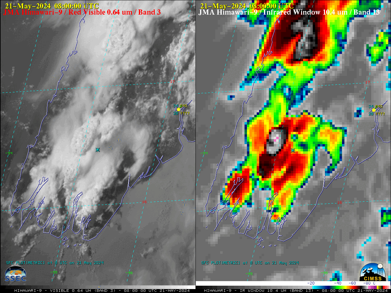
JMA Himawari-9 “Red” Visible (0.64 µm, left) and “Clean” Infrared Window (10.4 µm, right) images, with a cyan * marking the approximate location of the turbulence encounter at 0749 UTC on 21 May [click to play animated GIF | MP4]
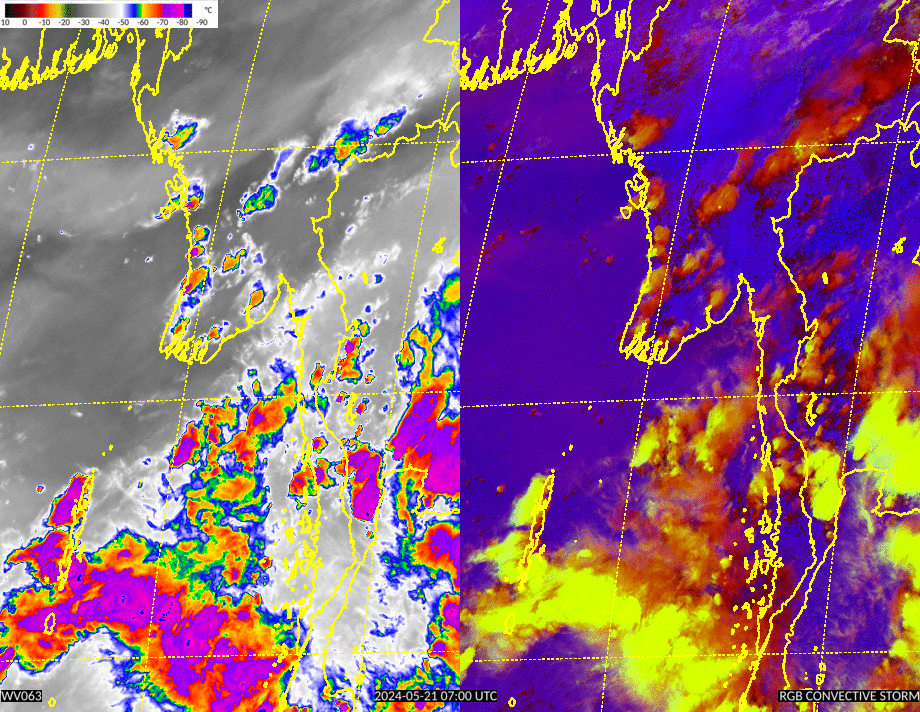
Singapore Airlines Flight SQ321 encountered severe turbulence over Myanmar (flightradar24 blog) while en route from London to Singapore on 20-21 May 2024 — which resulted in dozens of injuries and 1 fatality. 10-minute interval JMA Himawari-9 AHI Visible and Infrared images (above) showed areas of deep convection developing over Myanmar, near the estimated location of the turbulence encounter at 0749 UTC on 21 May (southwest of Yangon International Airport, identifier VYYY). The main cluster of rapidly-developing convection in the vicinity of the turbulence event exhibited cloud-top infrared brightness temperatures as cold as -81.6ºC by 0800 UTC (violet-enhanced pixels); VYYY later reported a thunderstorm from 1030-1100 UTC.
A rocking animation of Himawari-9 Visible and Infrared images at 0740/0750/0800 UTC (below) helped to emphasize how rapidly the area of convection (that the aircraft likely flew over) was developing — from no apparent infrared signature at 0740 UTC to exhibiting minimum cloud-top infrared brightness temperatures of -72.3ºC at 0750 UTC and -81.6ºC at 0800 UTC. However, it is important to note that the Himawari-9 AHI instrument was actually scanning the Myanmar area about 3 minutes after the time stamp of each image — so on the 0740 UTC and 0750 UTC images, a cyan * symbol marked the approximate aircraft position at 0743 UTC and 0753 UTC (when the satellite was scanning that region; Flight SQ321 had exited the image scene by 0803 UTC).
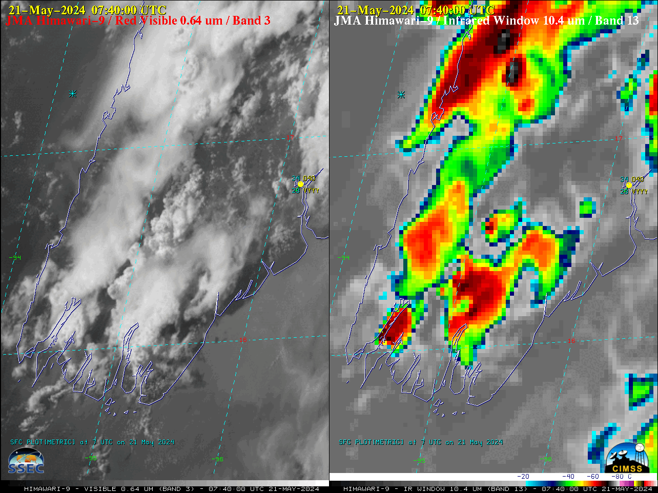
Rocking animation of JMA Himawari-9 “Red” Visible (0.64 µm, left) and “Clean” Infrared Window (10.4 µm, right) images at 0740/0750/0800 UTC on 21 May; a cyan * symbol marked the approximate aircraft position at 0743 UTC and 0753 UTC [click to enlarge]
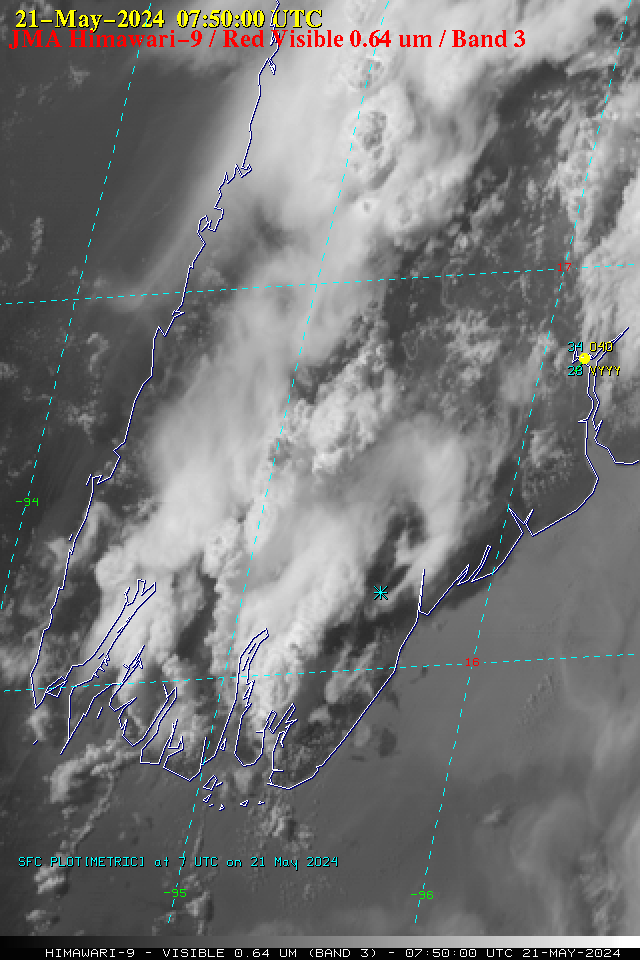
The 0750 UTC Himawari-9 Visible and Infrared images are shown below (a toggle between the individual Visible and Infrared images is available here). While the cyan * symbol making the approximate aircraft location at the 0753 UTC satellite scan time appeared to be well southeast of the rapidly-developing convection, another important consideration is parallax — for cloud tops of 30 kft and 50 kft over Myanmar, the parallax adjustments for those cloud tops would be toward the southeast at distances of 10 km (6.2 mi) and 17 km (10.6 mi), respectively.
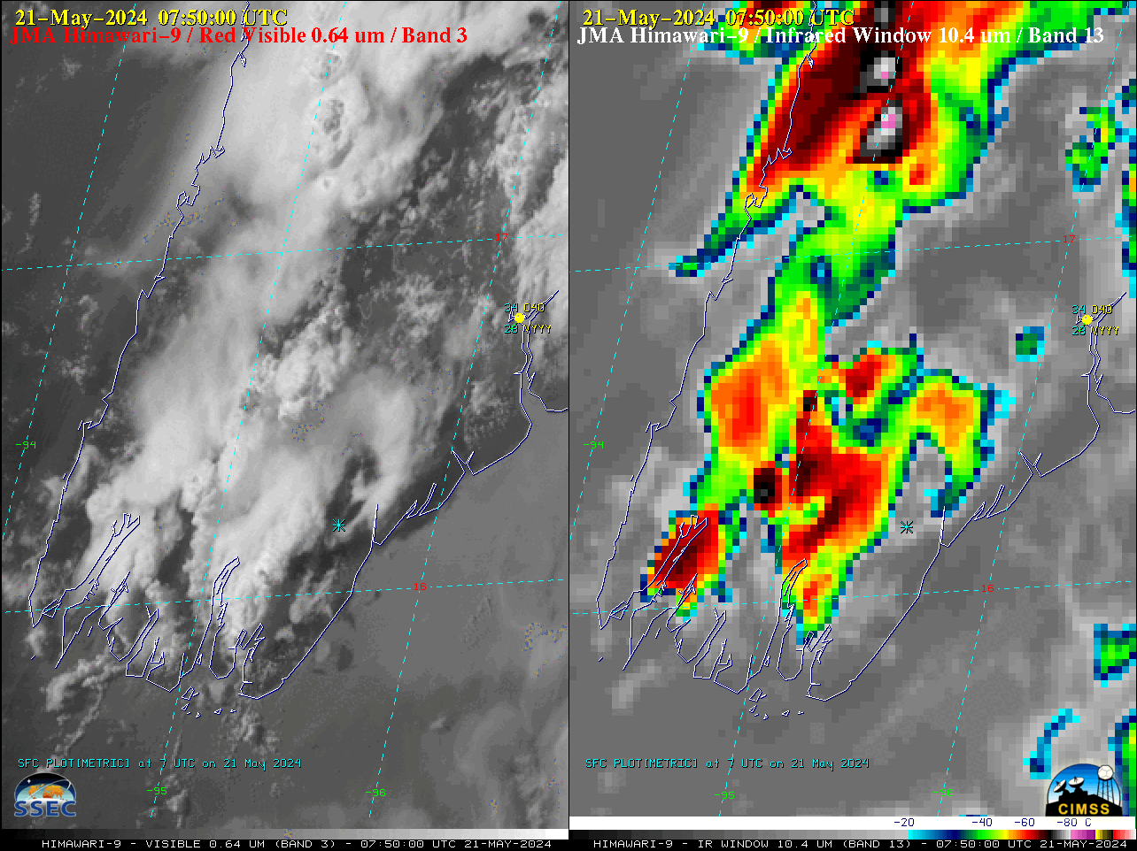
JMA Himawari-9 “Red” Visible (0.64 µm, left) and “Clean” Infrared Window (10.4 µm, right) images at 0750 UTC on 21 May, with a cyan * marking the approximate location of the aircraft at 0753 UTC (when the satellite was scanning that region) [click to enlarge]
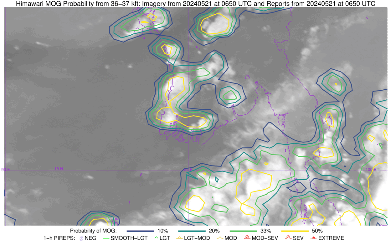
Himawari-9 Water Vapor images with contours of Moderate Or Greater (MOG) Turbulence Probability (source) began to display pockets of 50% or higher MOG probability over that area of Myanmar (yellow contours, just west of the top center portion of the images) at least an hour before the Flight SQ321 severe turbulence event.
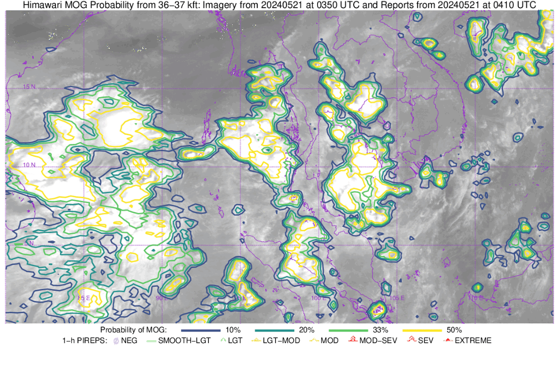
JMA Himawari-9 Upper-level Water Vapor (6.2 µm) images, with contours of Moderate Or Greater (MOG) Turbulence Probability [click to play animated GIF | MP4]
A more zoomed-in view is shown below, with a plot of the flight path of SQ321 (here’s the loop as an animated gif).
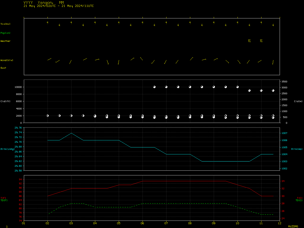
Cloud Heights
An animation of the Himawari-9 Cloud Top Height (CTH) derived product is shown below — CTH values of several convective clouds reached 40-50 kft as Flight SQ321 was flying over that portion of Myanmar.
Stereoscopic visible imagery over the region of turbulence from Himawari-9 (left in the animation below) and GEOKOMPSAT-2A or GK-2A (on the right in the image below) shows the rapid vertical growth around the time of turbulence. To view the imagery in 3-dimensions, cross your eyes so that 3 images are present, and focus on the image in the center, as described here, where this technique is called ‘cross-viewing’.
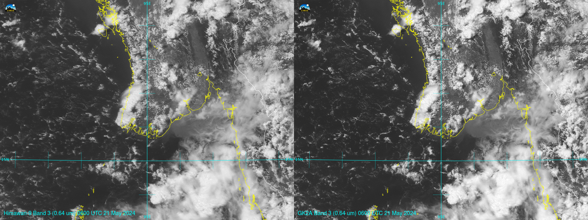
GK2A imagery cropped from Full Disk imagery from this site, shown below from 0700 to 0800 UTC on 21 May, similarly show the development of strong convection over Myanmar.
View only this post Read Less


