Assessing the future of a tropical invest

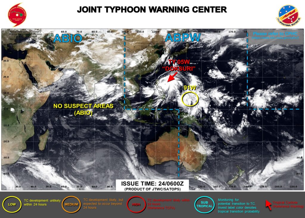
The Joint Typhoon Warning Center (JTWC) website has for more than a day been tracking invest number 91W, shown above. The feature is circled in yellow, meaning development is unlikely in the next 24 hours. What satellite data might be used to make that determination?
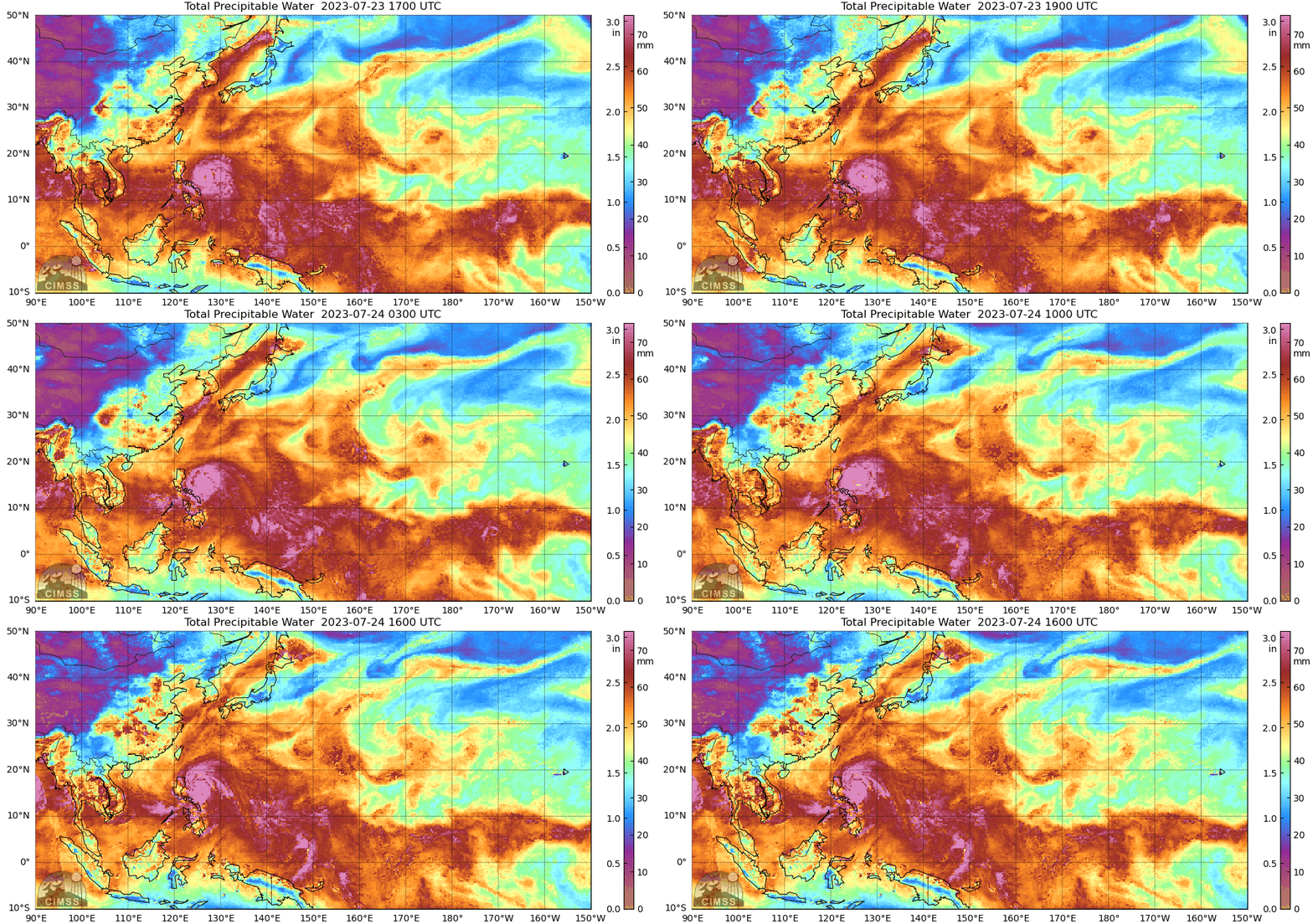
MIMIC Total Precipitable water fields, for the 24 hours ending at 1600 UTC on 24 July 2023, below, show an area rich in tropical moisture, and a broad, diffuse, cyclonic circulation is present between 140 and 150o E, an between the Equator and 10oN. In other words, there is plenty of moisture here and one can therefore infer a lack of dry air to impede convection. Are there observations to support the presence of a cyclonic circulation? Motion in the MIMIC fields is a by-product of advection of MIRS Total Precipitable Water fields (computed from individual data swaths from low-earth-orbit — LEO — satellites) by the GFS model (see this training on MIMIC).

Advanced Scatterometer (ASCAT) data from Metop-C and Metop-B (from this NOAA/NESDIS/STAR website), below, shows a cyclonic circulation with southwest winds between 2o and 6o N, and southeast winds from 6oN to 10oN, around near 147o E at around 0000 UTC on 24 July 2023. The 1200 UTC imagery, below, doesn’t quite show a circulation in the same region, but it’s hard to tell how well it might have been sampled.


Tropical Cyclones typically form in regions of low shear. Estimates of shear are available at the SSEC/CIMSS Tropical Website (direct link), as are convergence/vorticity analyses, shown in a toggle below. For the region between 0 and 10oN, 140 to 150 oE, there is low-level vorticity (not as concentrated as in the region of Typoon Doksuri, of course) near a narrow ribbon of low shear values (larger shear values are Equatorward of the vorticity center). Low-level convergence and upper-level divergence in the region are weak and do not appear to be linked however.

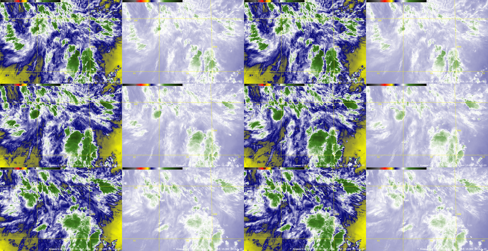
Himawari-9 Upper-level and lower-level Water Vapor imagery, below (Band 10, 7.34 µm, on the left and Band 8, 6.24 µm, on the right) from 1000 to 1500 UTC shows widespread convection in the square bordered by 140 and 150 oE and 0 and 10oN. No widespread dry air is present. Much of the convection is south and east of the vorticity center.

Future information on this invest (and on Typhoon Doksuri) can be viewed at the webpages of the Joint Typhoon Warning Center. The RSMC at Tokyo also has information on Western Pacific tropical cyclones. Forecasts are for 91W to move between Yap and Guam in the next days. The information presented here might help the reader decide for themselves whether or not the Invest will develop further.

