Search results for snow RGB

Snow cover and ice accrual across the Upper Midwest
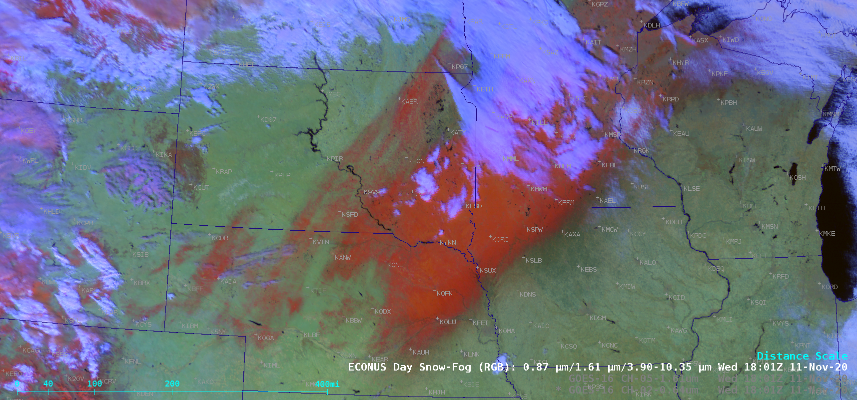
GOES-16 (GOES-East) “Red” Visible (0.64 µm), Near-Infrared “Snow/Ice” (1.61 µm) and Day Snow-Fog Red-Green-Blue (RGB) images (above) showed a broad swath of fresh snow cover across parts of Nebraska, South Dakota, Iowa, Minnesota, Wisconsin and Upper Michigan on 11 November 2020. The band of heavy snow developed northwest of an intensifying midlatitude cyclone on the... Read More
Melting of lake effect snow cover in Pennsylvania
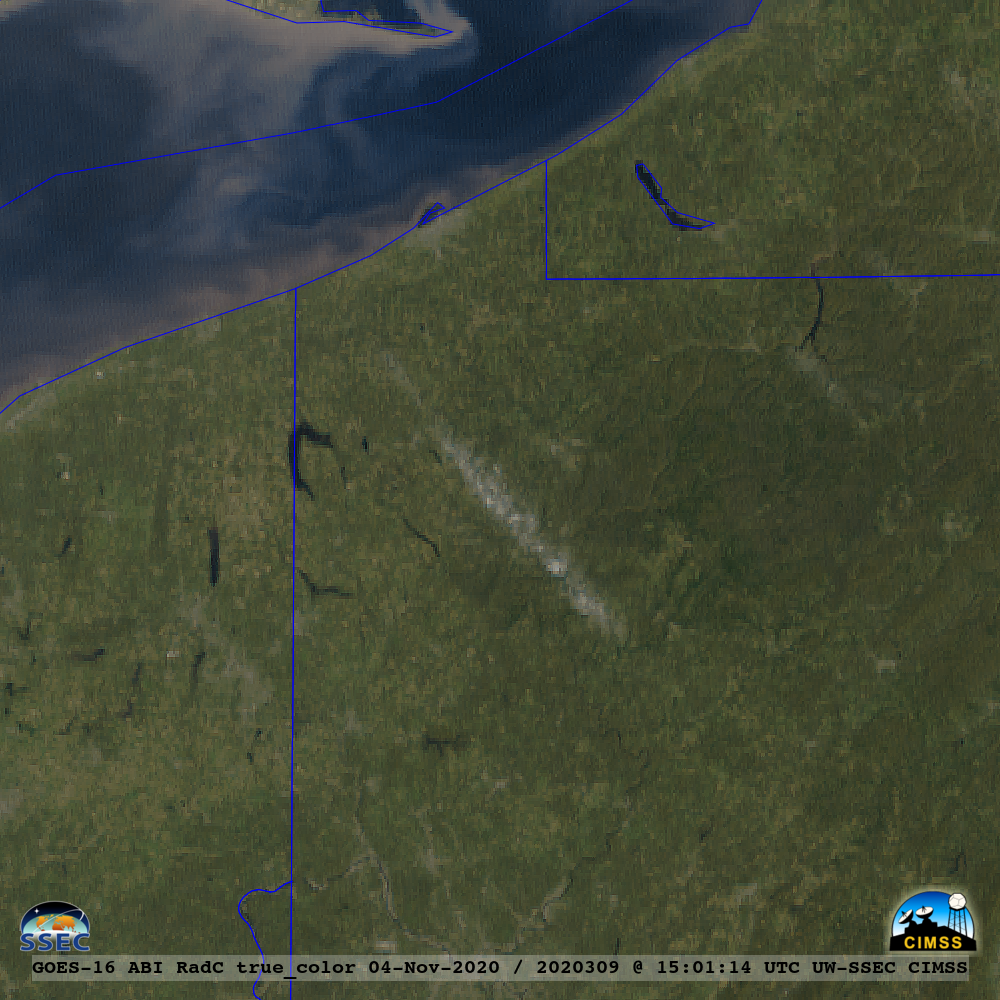
GOES-16 (GOES-East) “Red” Visible (0.64 µm) images (above) showed a narrow northwest-to-southeast oriented swath of snow cover across far northwestern Pennsylvania on 04 November 2020. With full sunshine and strong southerly winds helping air temperatures warm into the 60s F, this narrow band of snow cover melted by the end of the day.... Read More
Thundersnow in South Dakota and Minnesota
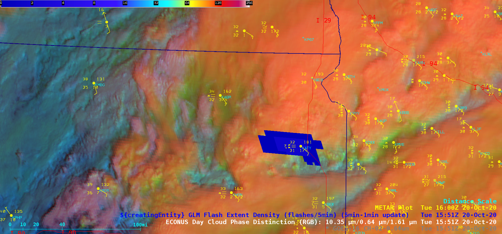
GOES-16 (GOES-East) Day Cloud Phase Distinction Red-Green-Blue (RGB) images with a overlay of GLM Flash Extent Density (above) displayed clusters of convection — some with brief bursts of lightning activity — which were moving eastward and enhancing snowfall rates from Watertown, South Dakota (station identifier KATY) into far western Minnesota on 20 October 2020. The resulting snowfall amounts... Read More
