This website works best with a newer web browser such as Chrome, Firefox, Safari or Microsoft Edge. Internet Explorer is not supported by this website.

Archive: Feb 2025

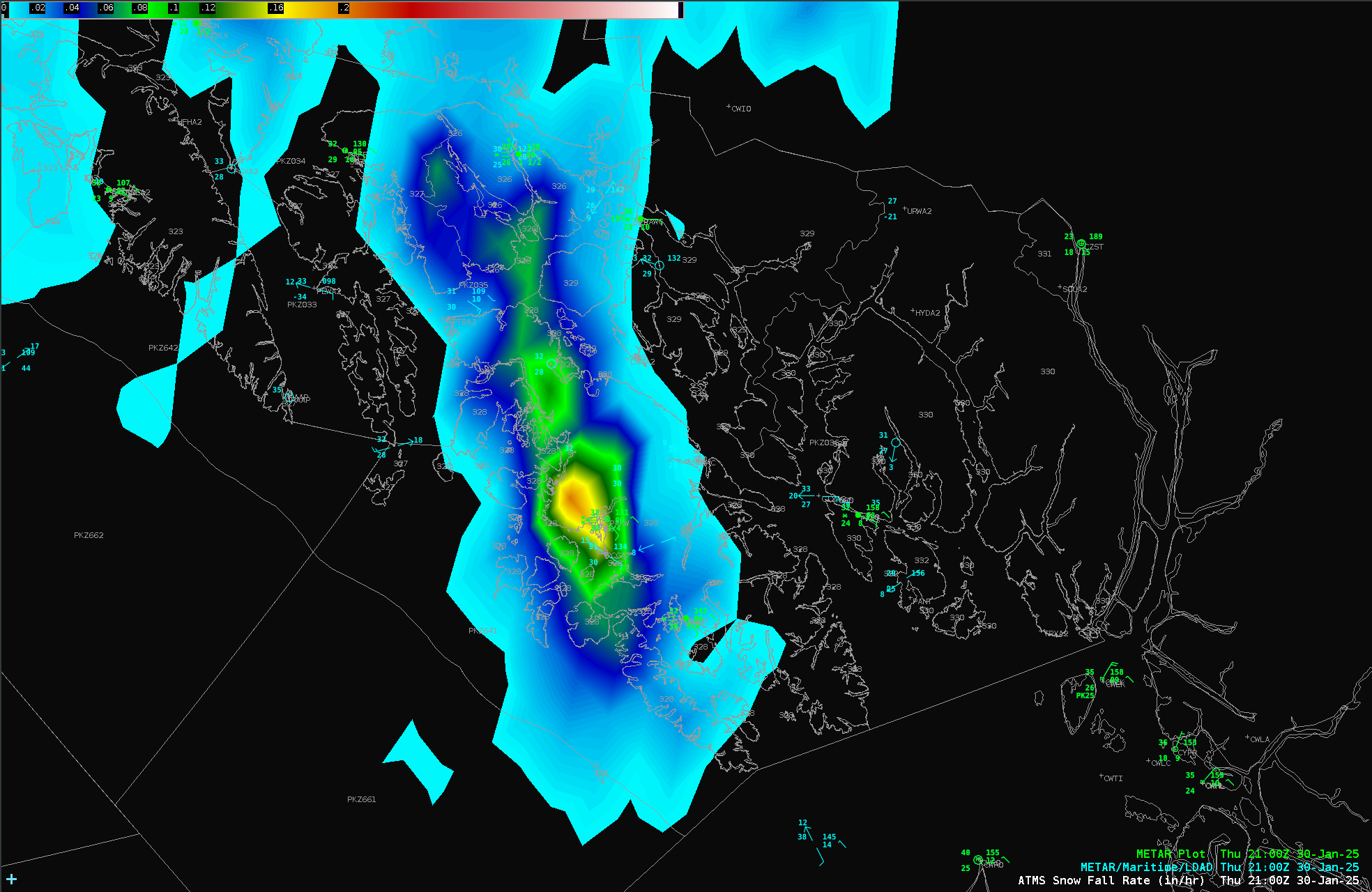
Microwave Snowfall Rate over southeast Alaska

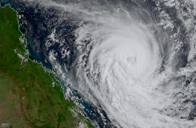
GOES-18 infrared imagery, above, shows a cyclonic circulation over the northeastern Gulf of Alaska. Shower development is suggested by the evolution of brightness temperatures changing from cyan to blue to green (showing cooling); showers then dissipate as the brightness temperatures warm. Do you think these are showers of rain or... Read More

Alfred and a Parade of Tropical Cyclones

It has been an active period of impactful weather in and near Australia, and today is no exception. Severe Tropical Cyclone Alfred continues to spin northeast of Queensland. The latest update from the Australian Bureau of Meteorology indicates a central pressure of 956 mb. Over the last day, it was downgraded from... Read More

South Dakota’s first February tornado on record

5-minute CONUS Sector GOES-16 (GOES-East) Visible and Infrared images (above) displayed a thunderstorm that was moving southeast from Aberdeen (KABR) to Watertown (KATY) in northeastern South Dakota on 24 February 2025. While overall GLM-detected lightning activity was relatively modest, periodic increases in Flash Extent Density (orange to red pixels) were evident.A Special... Read More