Clear skies and NOAA-20 sea-surface temperatures
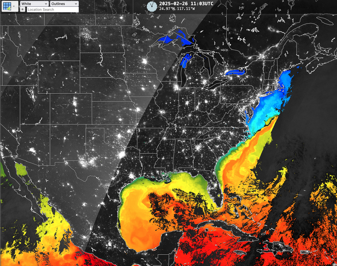
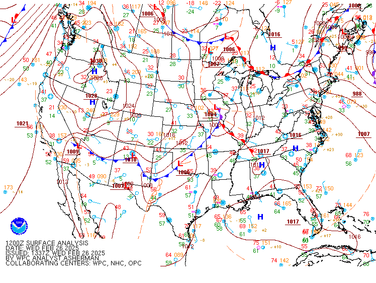
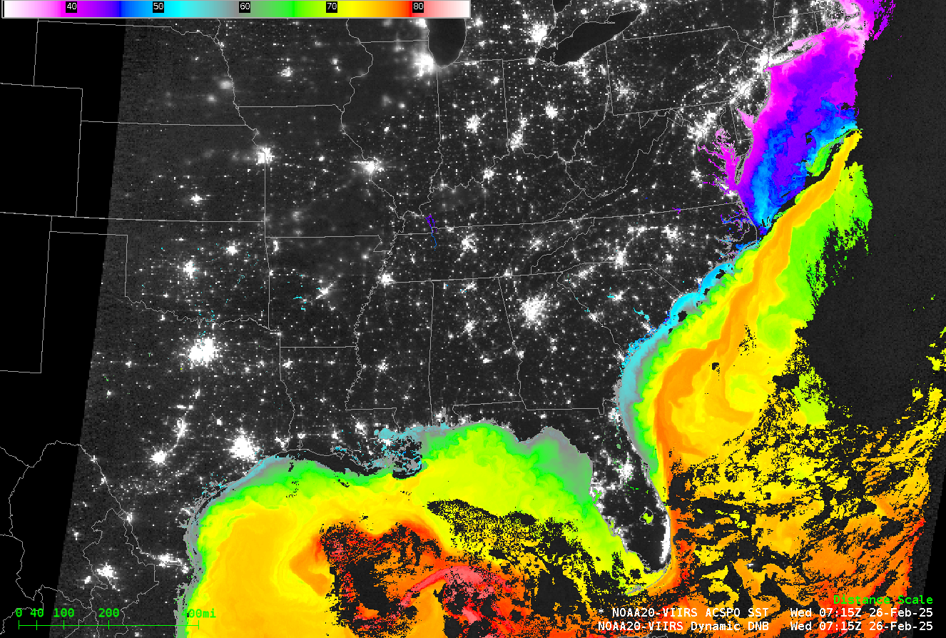
High pressure and mild temperatures over the western Atlantic and adjacent Gulf waters early on 26 February 2025 (here is the 1200 UTC surface analysis) meant NOAA-20 VIIRS data could provide near-complete views of sea- (and lake-) surface temperatures. The above image was captured from the RealEarth website. The warm waters (mid-70s oF) of the Gulf Stream off the North Carolina coast are in very close proximity to cold (mid-40s oF). Direct Broadcast data processed into AWIPS-ready VIIRS tiles are available from CIMSS and an example swath is shown below.
A zoomed-in view over the Outer Banks of North Carolina, below, shows the strength of the SST gradient, from very warm to much colder in less than 40 miles.

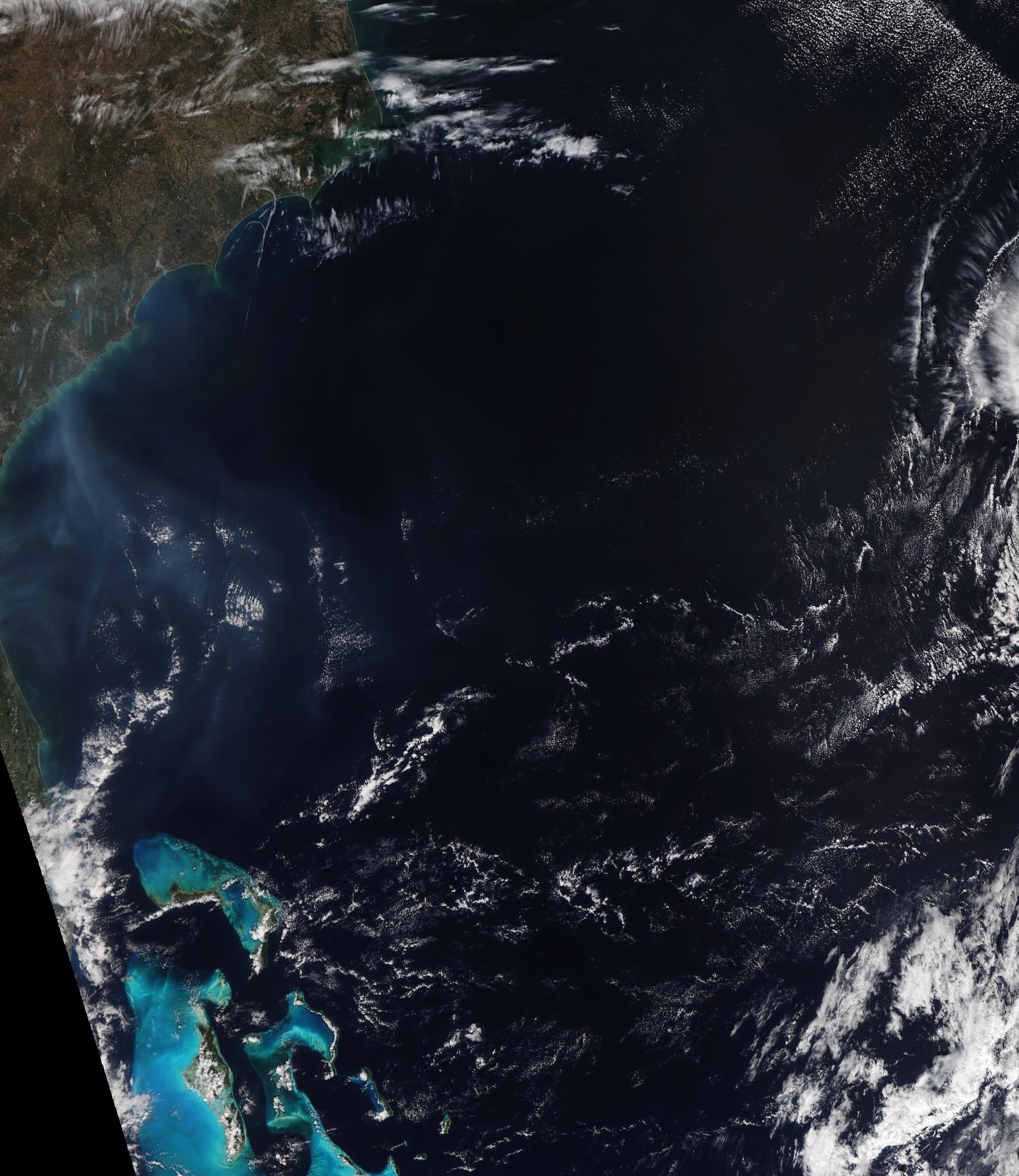
The SSTs over the northern part of the South Atlantic bight, shown below, include filaments of colder water extending from the shelf waters out into the open ocean.

NOAA-20 True-Color imagery, below, from the VIIRS Today website, shows filaments of turbid water that suggest a link between the observed cold filaments above and cold fresher water from the Continent. (Note also the smoke plumes over the southeastern US!)