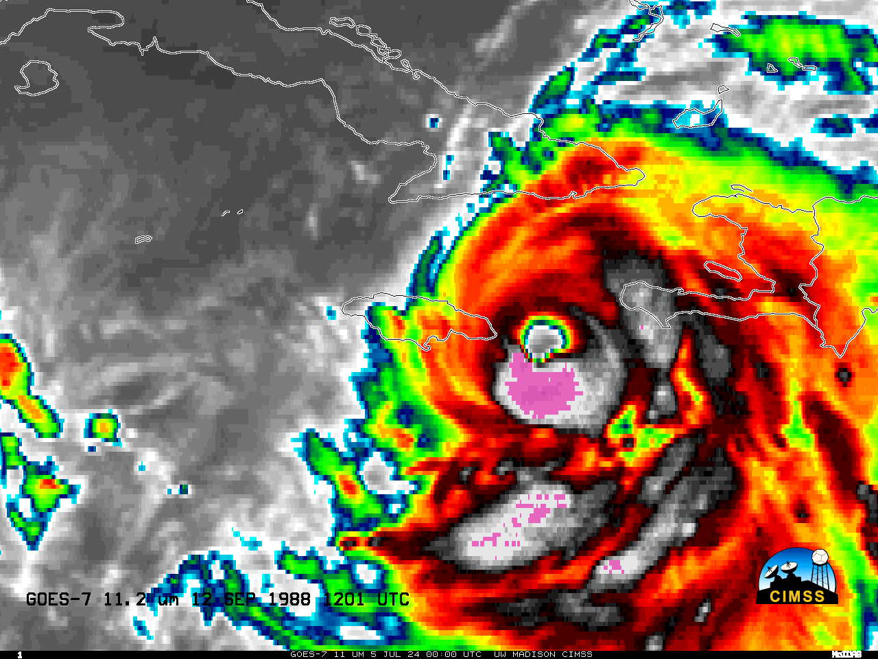
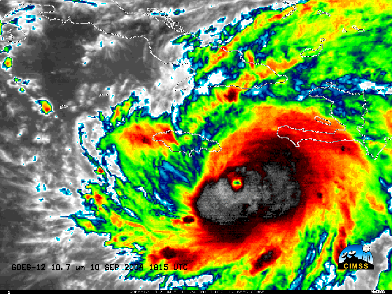
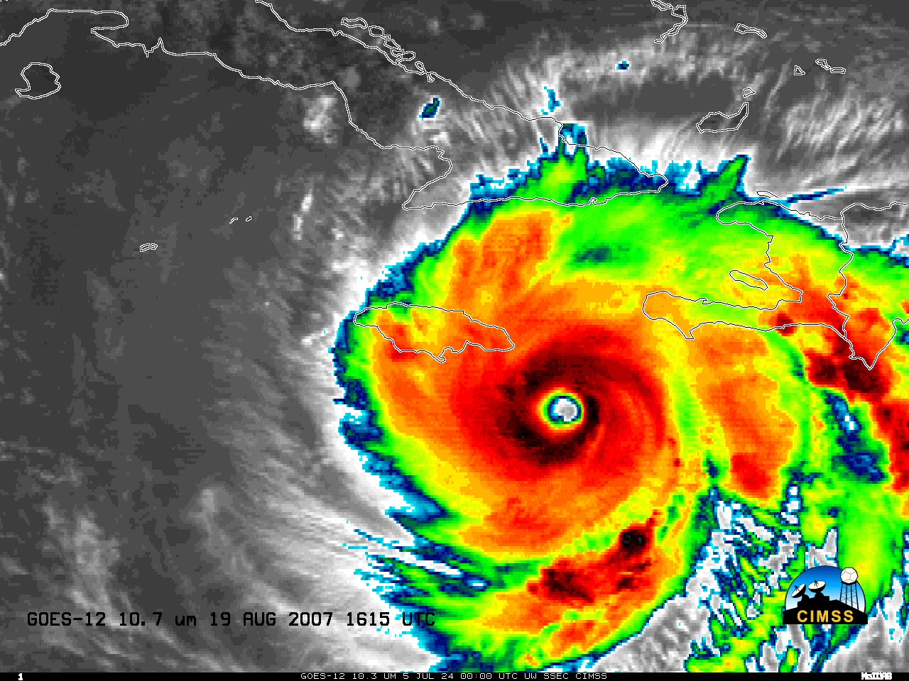
Satellite comparisons of Beryl near Jamaica to Gilbert, Ivan, and Dean near (or over!) Jamaica
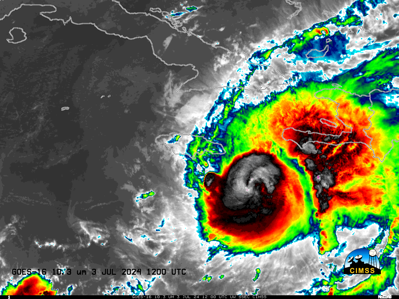
GOES-16 clean window infrared imagery, above, shows the evolution (at half-hourly intervals; in reality, 1-minute data was available of its passage, along with lightning) of Hurricane Beryl‘s cloud field as it moved just south of the island of Jamaica. The time-step above was degraded to allow a comparison to Hurricanes Gilbert, see this too, (with GOES-7 — a spinner! — imagery), Ivan and Dean (both with GOES-12 — 3-axis stabilized — imagery).
Gilbert moved east-to-west across Jamaica, and its eye re-intensified very quickly once back over the ocean. It would subsequently deepen to 888 hPa — then a record for the lowest sea-level pressure in the Atlantic/Caribbean basins. Ivan remained south of Jamaica and its eye changed perhaps as a result of the landmass of Jamaica. Ivan’s passage partially corresponded with GOES-12 in eclipse between the 0345 and 0645 UTC images; the batteries on GOES-12 were not sufficiently large to power scanning when GOES-12 was in Earth’s shadow. Dean passed south of Jamaica, and its eye seems to have been mostly unaffected by the close passages, although the cold cloud pattern did change.