Update on the Smokehouse Creek Fire and Windy Deuce Fire burn scars in Texas
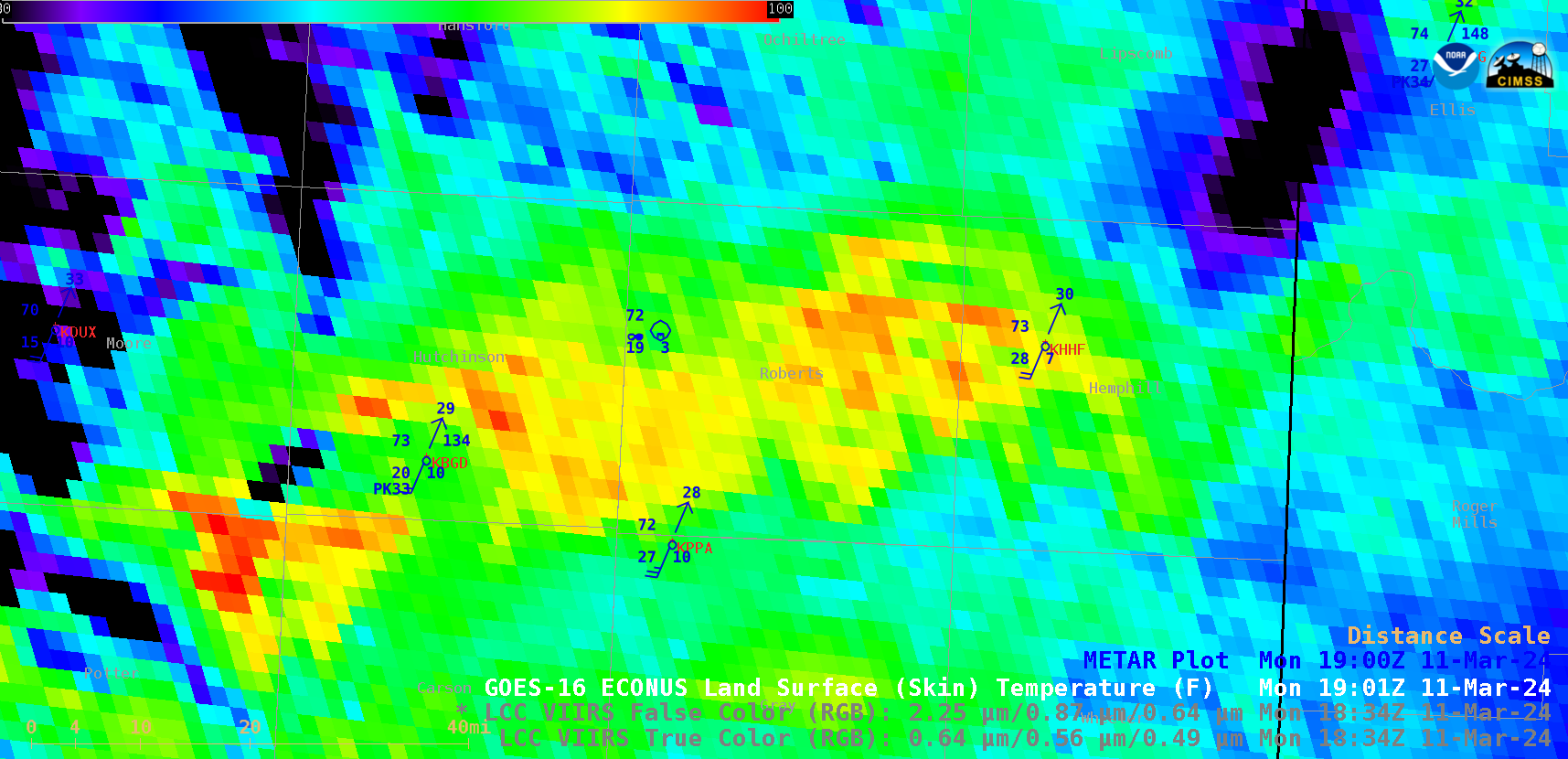
Two weeks after the Smokehouse Creek Fire and Windy Deuce Fire started in the Texas Panhandle — as discussed in this blog post — a comparison of Suomi-NPP VIIRS True Color RGB and False Color RGB images along with the GOES-16 (GOES-East) Land Surface Temperature (LST) derived product (above) showed the extent of the burn scars from those... Read More