Microwave estimates of rainfall from direct broadcast data on Guam
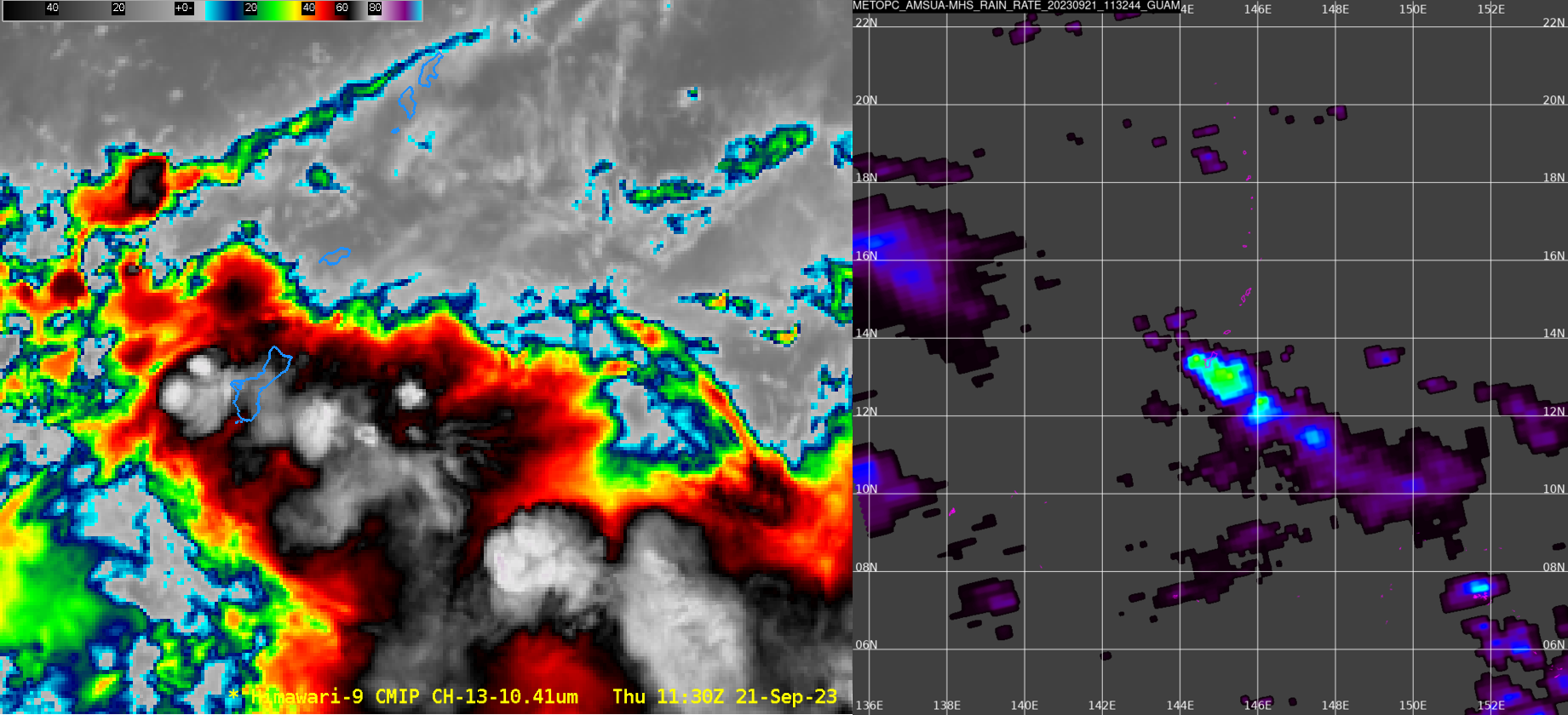
The National Weather Service forecast office on Guam (at 13.4oN, 144.7oW) is paired with an L/X band satellite receiver that can download data from Polar Orbiting satellites, which data can subsequently be processed by Polar2Grid software to produce useful products. The animation above shows 4 different Himawari-9 Band 13 images... Read More
