Microwave estimates of rainfall from direct broadcast data on Guam
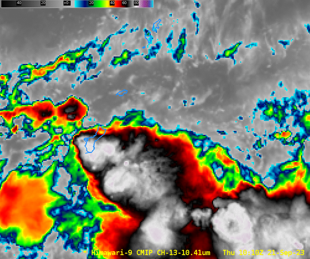
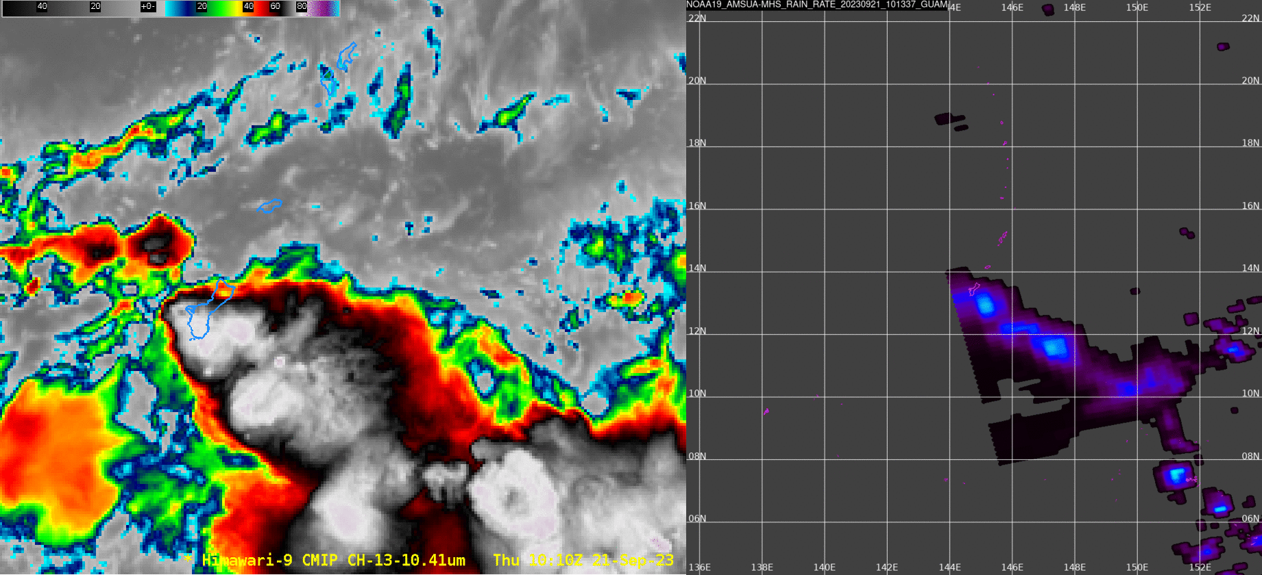
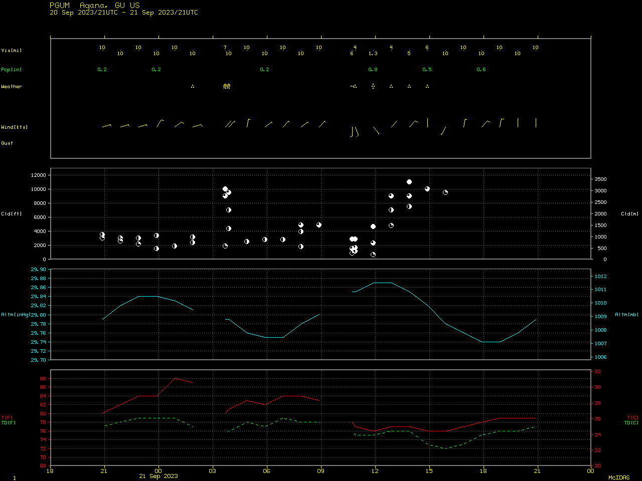
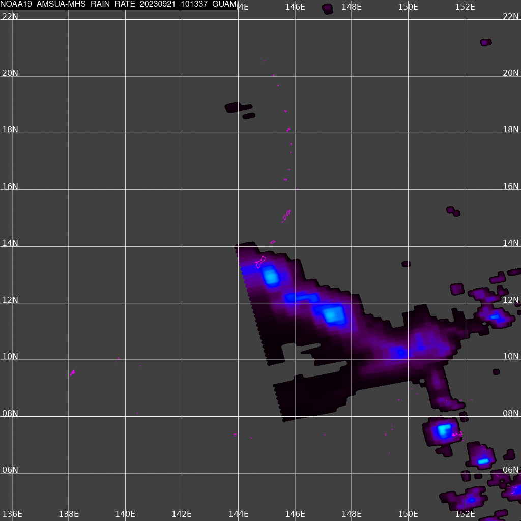
The National Weather Service forecast office on Guam (at 13.4oN, 144.7oW) is paired with an L/X band satellite receiver that can download data from Polar Orbiting satellites, which data can subsequently be processed by Polar2Grid software to produce useful products. The animation above shows 4 different Himawari-9 Band 13 images on 21 September, a day when Guam was experiencing intermittent rains as a feature moved northward. When do you think the rain was heaviest? Did you choose 1130 UTC? That is what the microwave-derived rainrate suggests (see below). A side-by-side comparison of the Himawari Band 13 imagery and Microwave-derived rain rate is here. A meteorogram for Guam International airport is here: Heaviest observed rains were around 1200 UTC; rains ended around 1500 UTC. That is in agreement with the microwave diagnoses.
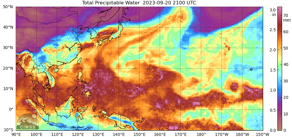
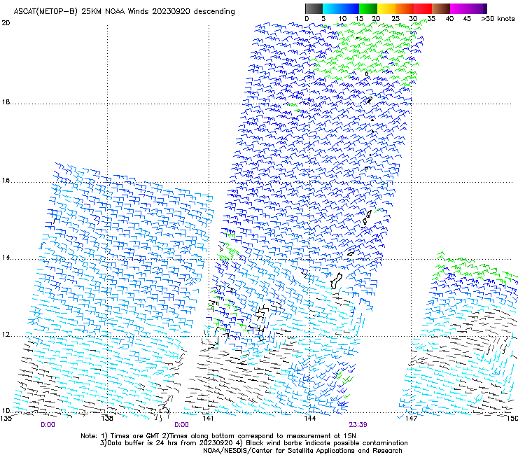
What was the environment around Guam? Microwave estimates of Total Precipitable Water, below, (source), show Guam near the northern edge of a moisture-rich band of tropical origins. Advanced Scatterometer winds, at bottom, from MetopB and MetopC (times as noted in the caption), show a convergence line nearing Guam on 20 September (on 21 September, ASCAT did not sample over Guam).
Thanks to Douglas Schumacher, CIMSS, for supplying the imagery from the Guam Direct Broadcast antenna!