Severe thunderstorms in the Southern Plains (with examples of overshooting tops with “warm trench” signatures)

GOES-16 “Clean” Infrared Window (10.3 µm) images, with time-matched SPC Storm Reports plotted in cyan [click to play animated GIF | MP4]
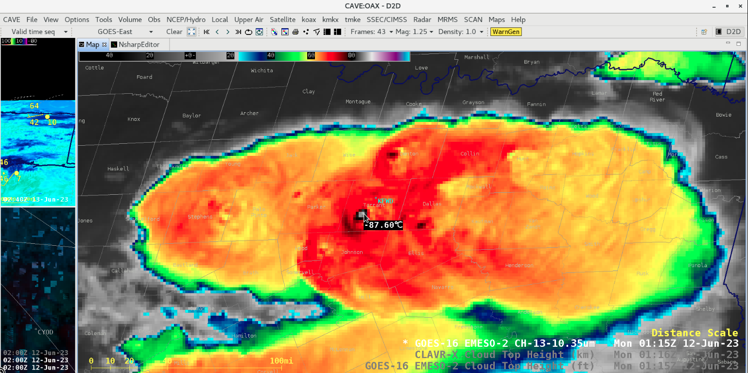
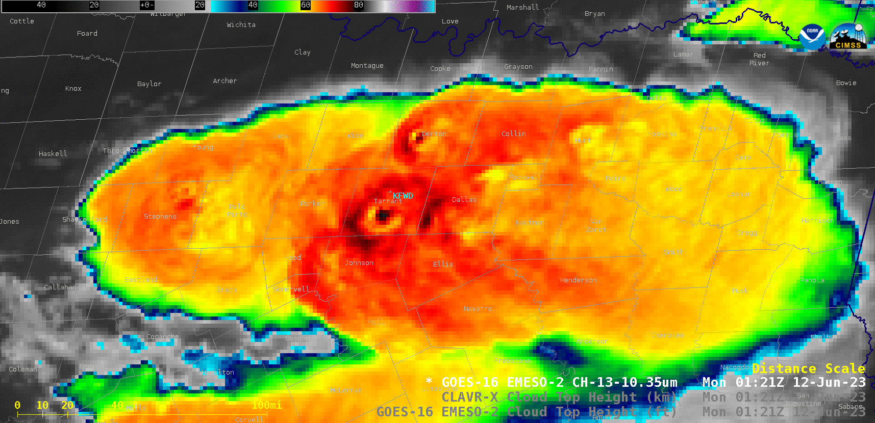
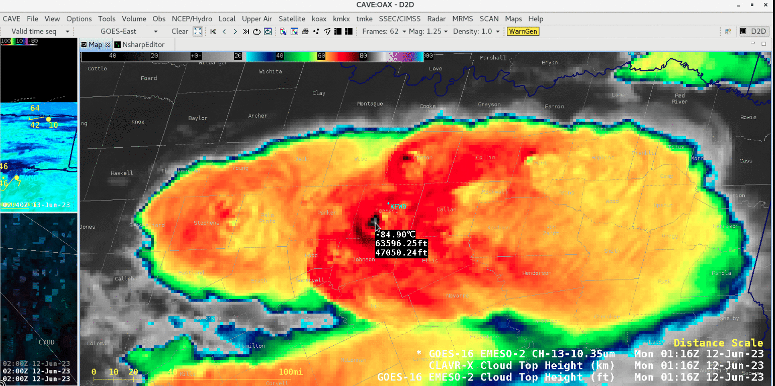
In a closer look at 1-minute GOES-16 Infrared images over the Dallas-Fort Worth, Texas area (rawinsonde site KFWD) from 0000-0200 UTC on 12 June (below), several overshooting top pulses became surrounded by brief “warm trench” signatures — a likely indication of compensating subsidence around the periphery of these vigorous updrafts as they rapidly ascended past the local equilibrium level and/or tropopause. The coldest overshooting top exhibited an infrared brightness temperature of -87.6ºC at 0115 UTC.
GOES-16 “Clean” Infrared Window (10.3 µm) images [click to play animated GIF | MP4]
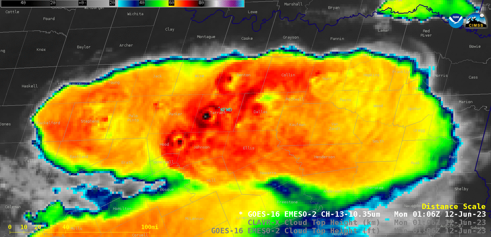
GOES-16 “Clean” Infrared Window (10.3 µm), CLAVR-x Cloud Top Height and Operational Cloud Top Height at 0106 UTC [click to enlarge]
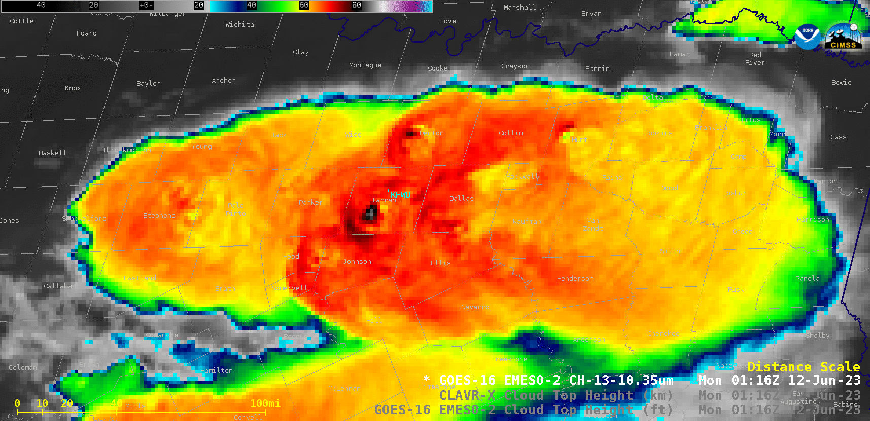
GOES-16 “Clean” Infrared Window (10.3 µm), CLAVR-x Cloud Top Height and Operational Cloud Top Height at 0116 UTC [click to enlarge]_
GOES-16 “Clean” Infrared Window (10.3 µm), CLAVR-x Cloud Top Height and Operational Cloud Top Height at 0121 UTC [click to enlarge]
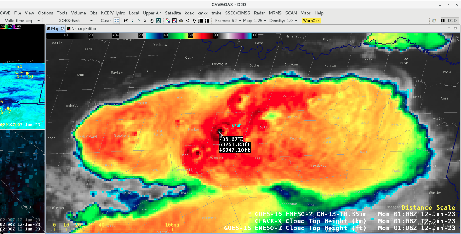
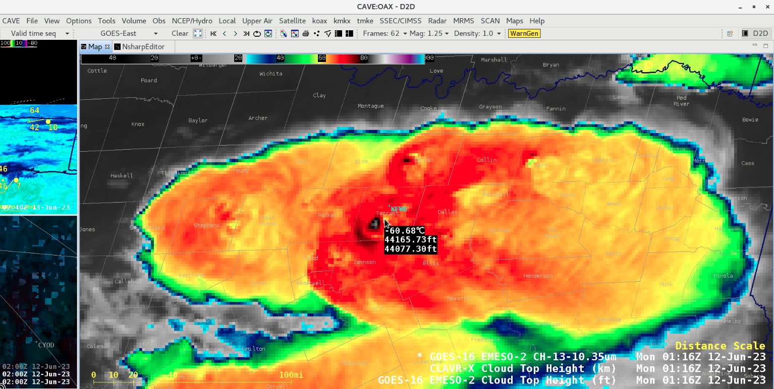
Cursor-sampled values of GOES-16 Infrared (10.3 µm) brightness temperature, CLAVR-x Cloud Top Height and Operational Cloud Top Height for an overshooting top over Tarrant County at 0106 UTC [click to enlarge]

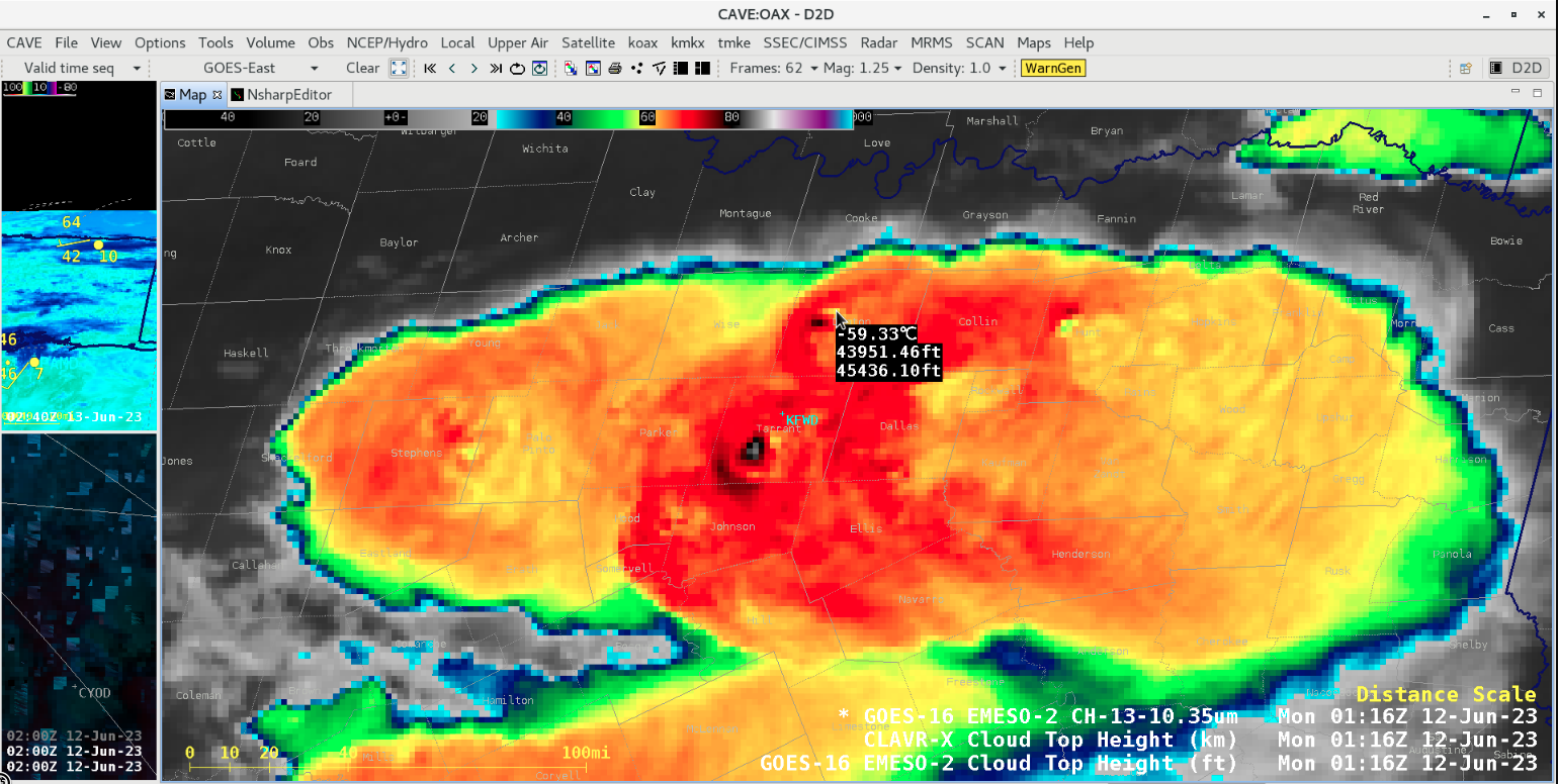
Cursor-sampled values of GOES-16 Infrared (10.3 µm) brightness temperature, CLAVR-x Cloud Top Height and Operational Cloud Top Height for an overshooting top over Tarrant County at 0116 UTC [click to enlarge]
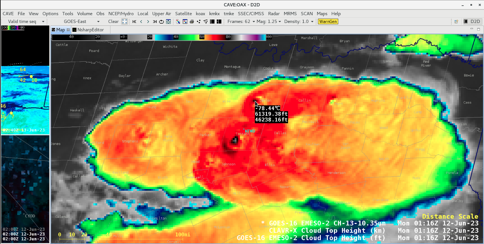
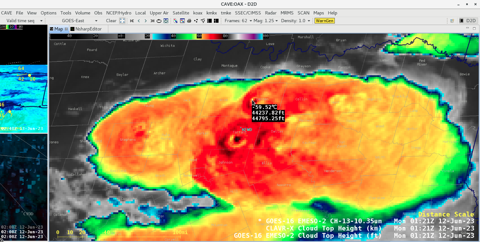
Cursor-sampled values of GOES-16 Infrared (10.3 µm) brightness temperature, CLAVR-x Cloud Top Height and Operational Cloud Top Height for an overshooting top over Denton County at 0116 UTC [click to enlarge]
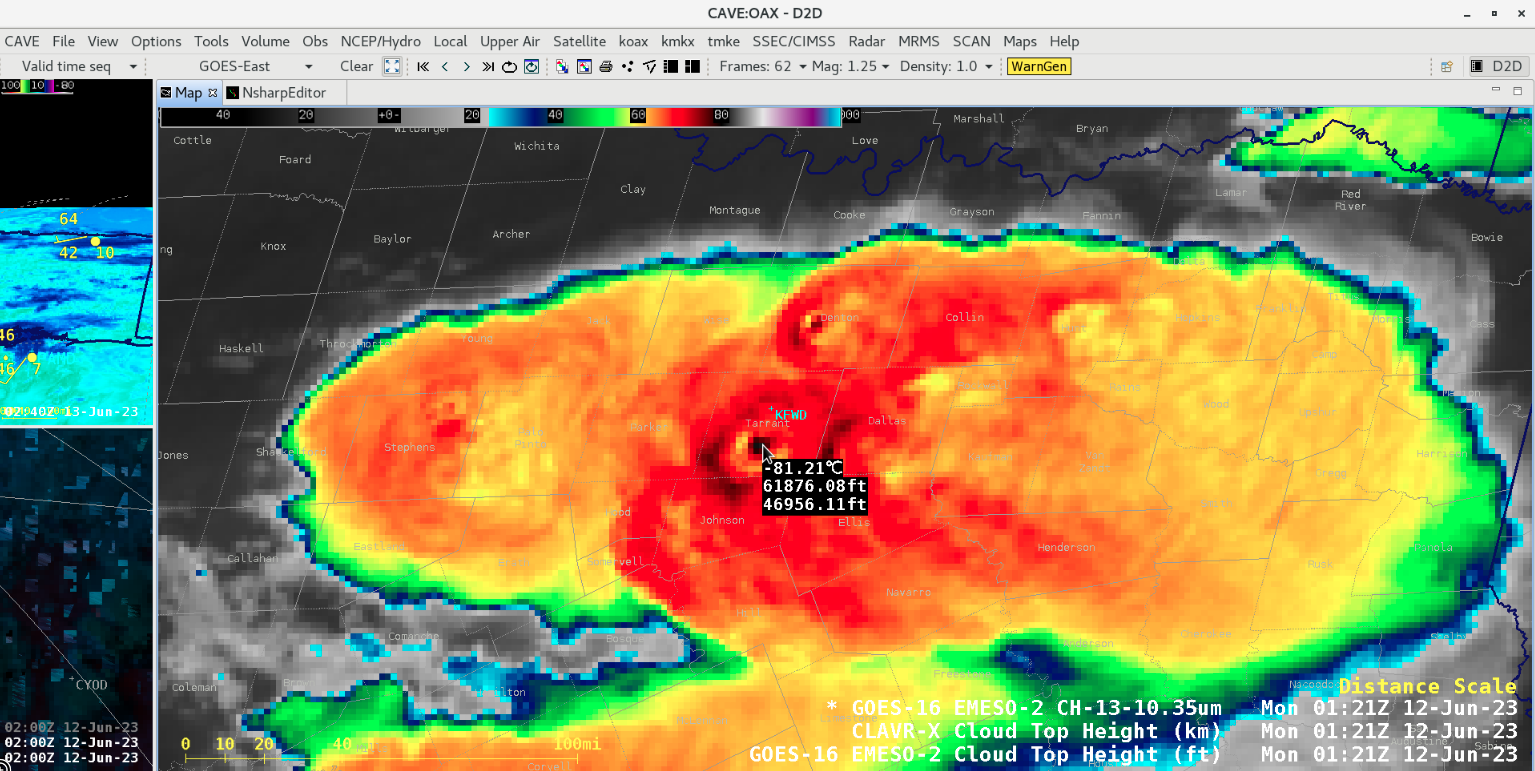
Cursor-sampled values of GOES-16 Infrared (10.3 µm) brightness temperature, CLAVR-x Cloud Top Height and Operational Cloud Top Height for an overshooting top over Tarrant County at 0121 UTC [click to enlarge]

Cursor-sampled values of GOES-16 Infrared (10.3 µm) brightness temperature, CLAVR-x Cloud Top Height and Operational Cloud Top Height for a warm trench feature over Tarrant County at 0106 UTC [click to enlarge]
Cursor-sampled values of GOES-16 Infrared (10.3 µm) brightness temperature, CLAVR-x Cloud Top Height and Operational Cloud Top Height for a warm trench feature over Tarrant County at 0116 UTC [click to enlarge]
Cursor-sampled values of GOES-16 Infrared (10.3 µm) brightness temperature, CLAVR-x Cloud Top Height and Operational Cloud Top Height for a warm trench feature over Denton County at 0116 UTC [click to enlarge]

Cursor-sampled values of GOES-16 Infrared (10.3 µm) brightness temperature, CLAVR-x Cloud Top Height and Operational Cloud Top Height for a warm trench feature over Tarrant County at 0121 UTC [click to enlarge]
Cursor-sampled values of GOES-16 Infrared (10.3 µm) brightness temperature, CLAVR-x Cloud Top Height and Operational Cloud Top Height for a warm trench feature over Denton County at 0121 UTC [click to enlarge]
Cursor-sampled values of Cloud Top Height for the storm over Tarrant County at 0116 UTC [click to enlarge]