Solar eclipse shadow from the South Indian Ocean to the Western Pacific Ocean
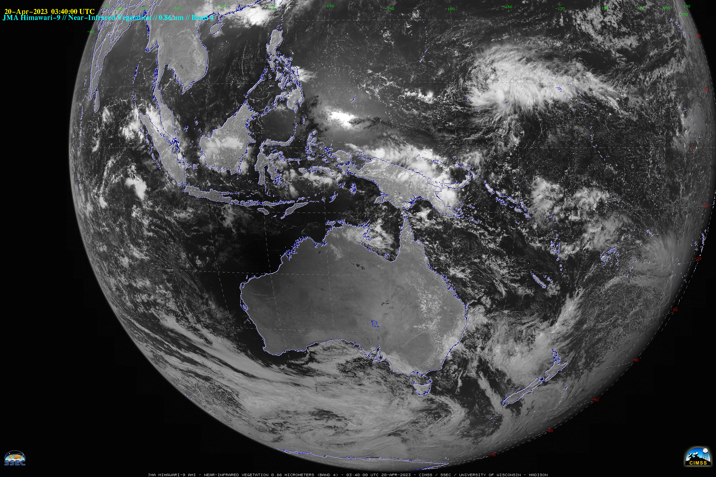
JMA Himawari-9 Near-Infrared “Vegetation” (0.86 µm) images (above) showed the southwest-to-northeast transect of a hybrid solar eclipse shadow as it moved across the South Indian Ocean and passed over parts of Australia, Indonesia and the West Pacific Ocean on 20 April 2023. A portion of the shadow also moved over Tropical Storm... Read More
