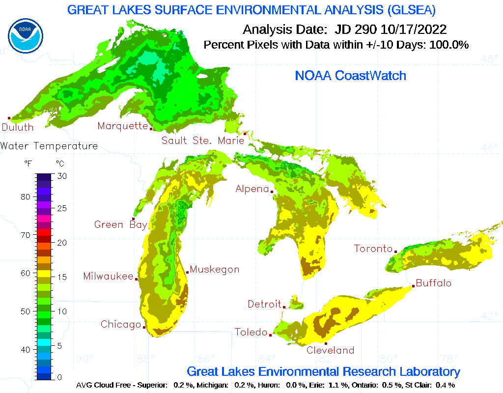
Lake effect convection over southern Lake Michigan
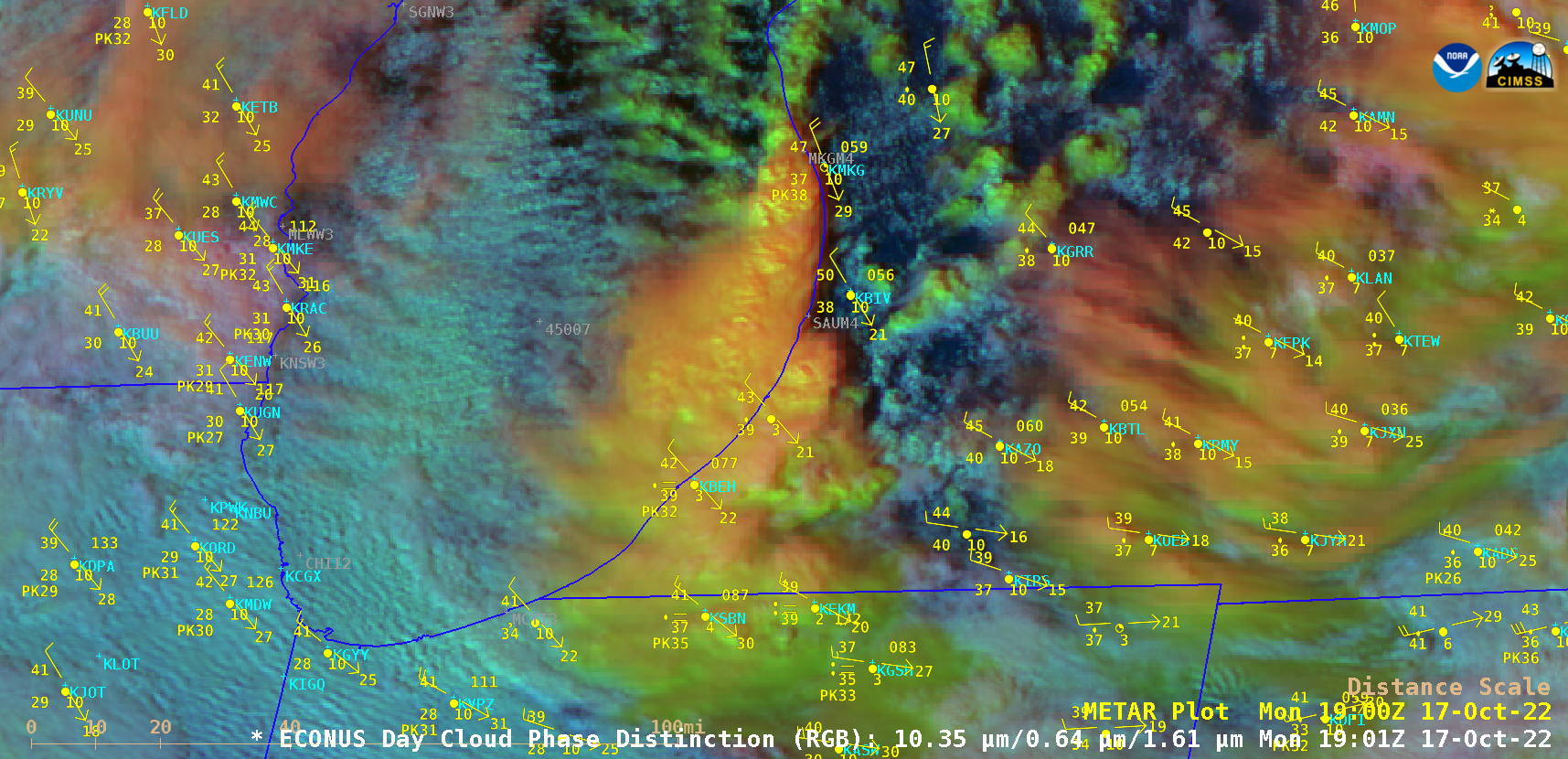
GOES-16 (GOES-East) Day Cloud Phase Distinction RGB images (above) showed convection which developed just off the Lower Michigan coast in southeastern Lake Michigan — where warmer water temperatures existed — on 17 October 2022. As this convection moved inland across southwestern Lower Michigan and northern Indiana it produced a swath of rainfall and snowfall.The GOES-16 Day Cloud Phase Distinction... Read More
