This website works best with a newer web browser such as Chrome, Firefox, Safari or Microsoft Edge. Internet Explorer is not supported by this website.

Archive: Dec 2020

Cyclone Yasa strengthens rapidly in the South Pacific

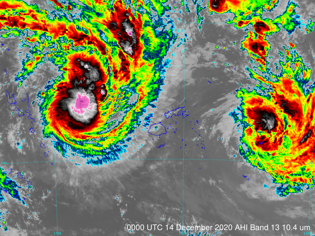
https://cimss.ssec.wisc.edu/satellite-blog/wp-content/uploads/sites/5/2020/12/HIMAWARI-8_AHI_B13_20201214_20201215anim.mp4 Himawari-8 Clean Window Infrared (10.41 µm) imagery, 0000 UTC 14 December to 0000 UTC 16 December 2020 (Click to animate) Himawari-8 Clean Window Infrared (10.41 µm) imagery (courtesy the Japanese Meteorological Agency, JMA) from 14-15 December 2020 (click here for an animated gif) show the development of a... Read More

Blowing dust in Texas

As was seen 2 days earlier, a plume of blowing dust developed across the Texas Panhandle in the wake of a cold frontal passage, and was transported southeastward across western Texas on 15 December 2020 — GOES-16 (GOES-East) Dust RGB images (above) displayed signatures of this airborne dust (brighter shades of pink).GOES-16 True Color RGB images created using Geo2Grid (below) showed the tan-colored... Read More

Stereoscopic views of Cyclones Yasa and Zazu

https://cimss.ssec.wisc.edu/satellite-blog/wp-content/uploads/sites/5/2020/12/Himaw08G17Stereo_ABI_RadF_064_20201213_2100_to_20201214_0550_YasaStereoanim.mp4 GOES-17 (left) and Himawari-8 (right) visible (0.64 µm) imagery over Fiji, 2100 UTC on 13 December through 0500 UTC on 14 December (Click to animate)An active area of tropical weather has spawned two tropical cyclones that bracketed the islands of Fiji early on 14 December. Himawari-8 (data courtesy... Read More