Stereoscopic views of Cyclones Yasa and Zazu
An active area of tropical weather has spawned two tropical cyclones that bracketed the islands of Fiji early on 14 December. Himawari-8 (data courtesy the Japanese Meteorological Agency, JMA) and GOES-17 both viewed the two storms, with Yasa on the left and Zazu on the right, and stereoscopic views are shown above. (To view the imagery in three dimensions, relax/cross your eyes until three images are present, and focus on the image in the center). Click here for a full-sized mp4, and here for an animated gif.
The storms had an interesting development, as shown below in a 3-day Himawari-8 Clean Window infrared imagery mp4 animation (Click here for a large animated gif of the same scene) from 10-13 December 2020. Yasa in particular developed in a region of considerable shear and initially followed a circuitous route (shown in this graphic from RSMC Fiji), but it has since moved into a more favorable environment. Yasa also absorbed the remains of Tropical Storm #4.

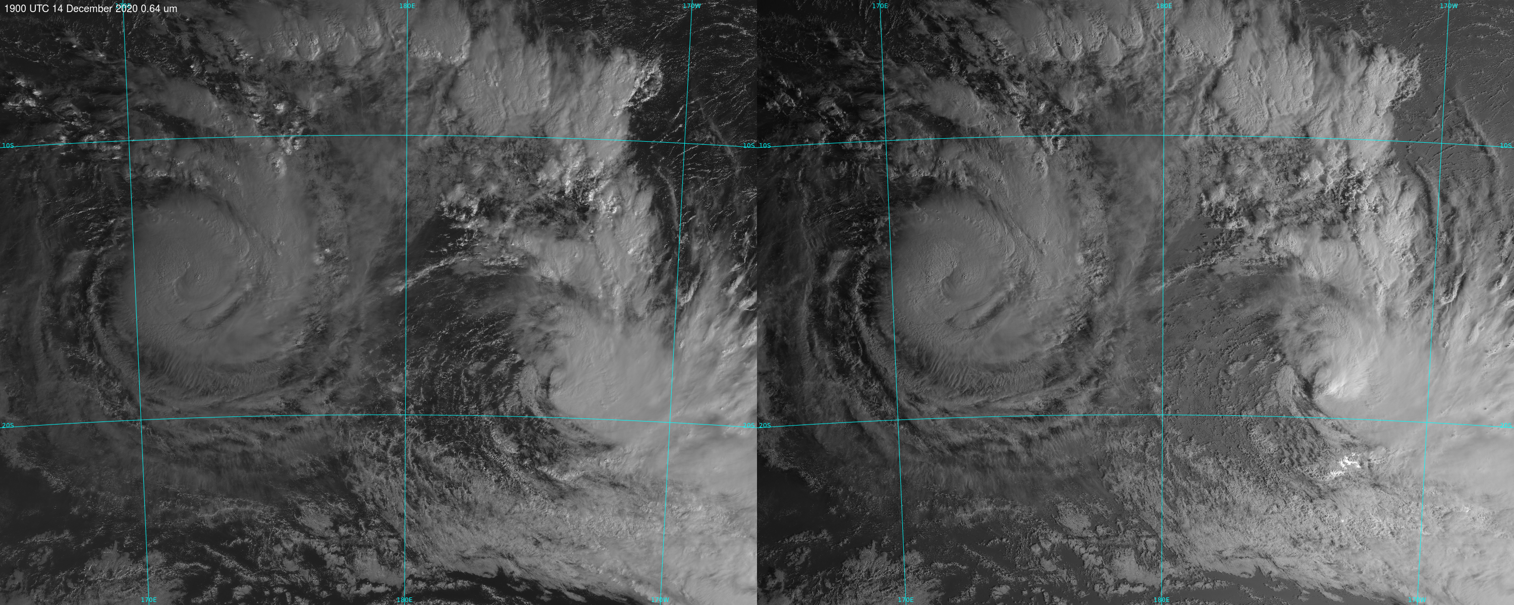
GOES-17 (left) and Himawari-8 (right) visible (0.64 µm) imagery over Fiji, 1900 UTC on 14 December 2020 (Click to enlarge)
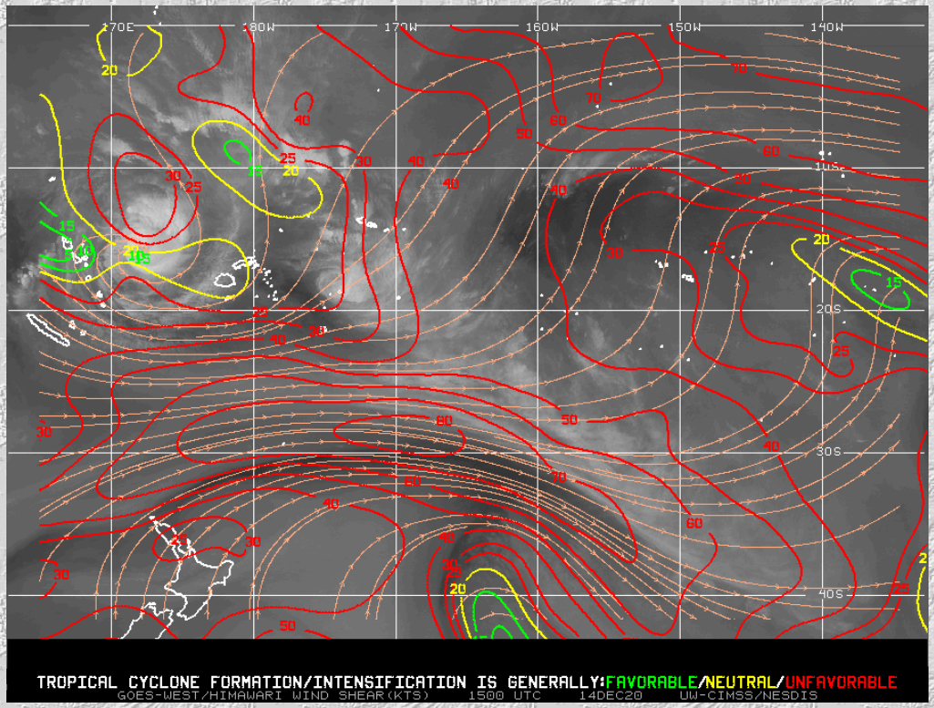
Added: The morning view of the storms, above, from 1900 UTC on 14 December reveals that Zazu is becoming sheared. The low-level center is exposed with convection shifted to the east. This is consistent with shear analyses from the SSEC Tropical website, below, that shows westerly shear over the storm.
For more information on these storms, refer to the SSEC tropical website (link), or to the RSMC in Fiji (link). At present, Yasa is forecast to make landfall in Fiji later this week as a very strong storm. Interests there should monitor this storm closely.


