Exploring the effect of parallax
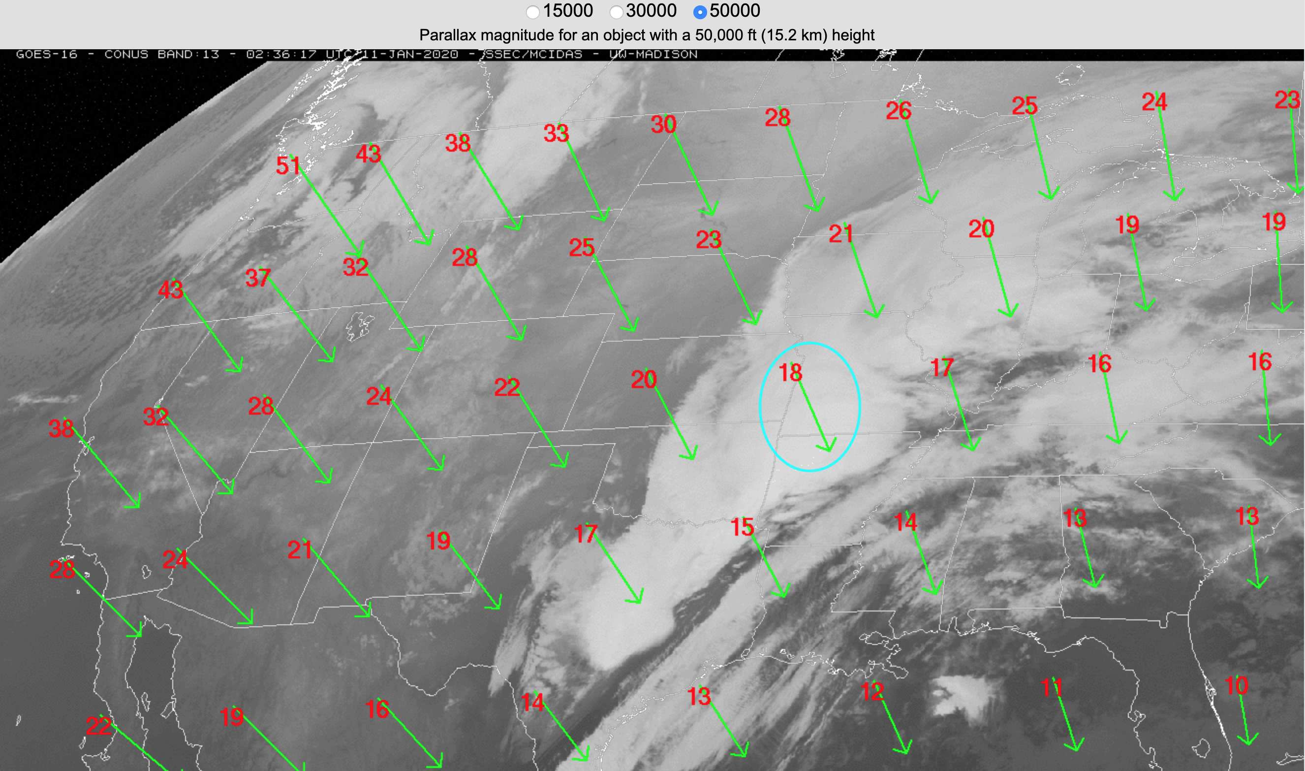
Overlapping 1-minute GOES-16 (GOES-East) Mesoscale Domain Sectors provided images at 30-second intervals over the Kansas/Missouri/Oklahoma/Arkansas area on 10 January 2019 — and “Red” Visible (0.64 µm) images (above) included plots of SPC Storm Reports (with and without parallax correction) during the time period which produced the first 2 tornadoes (1 in southwestern Missouri, and 1 in northeastern... Read More
