This website works best with a newer web browser such as Chrome, Firefox, Safari or Microsoft Edge. Internet Explorer is not supported by this website.

Archive: Mon Feb 2019

Super Typhoon Wutip

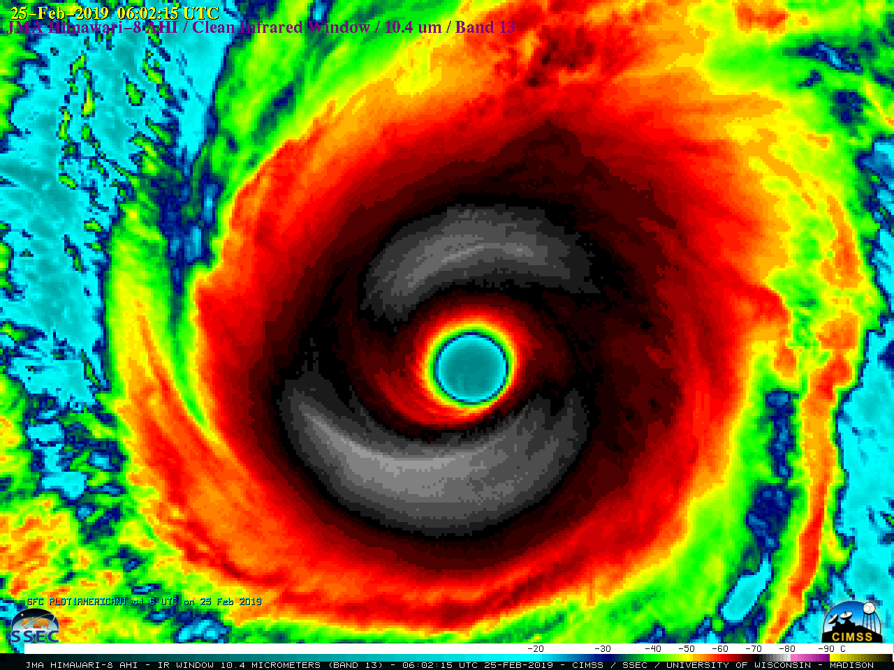
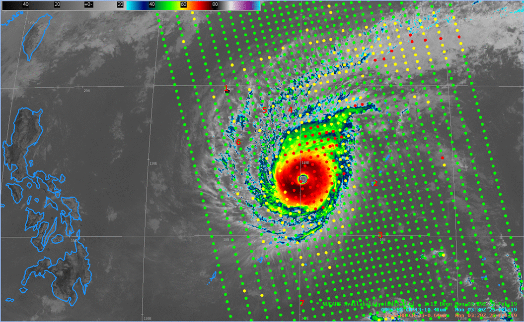
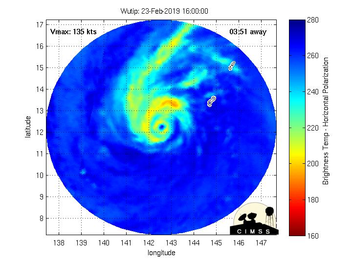
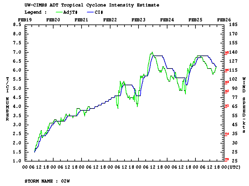
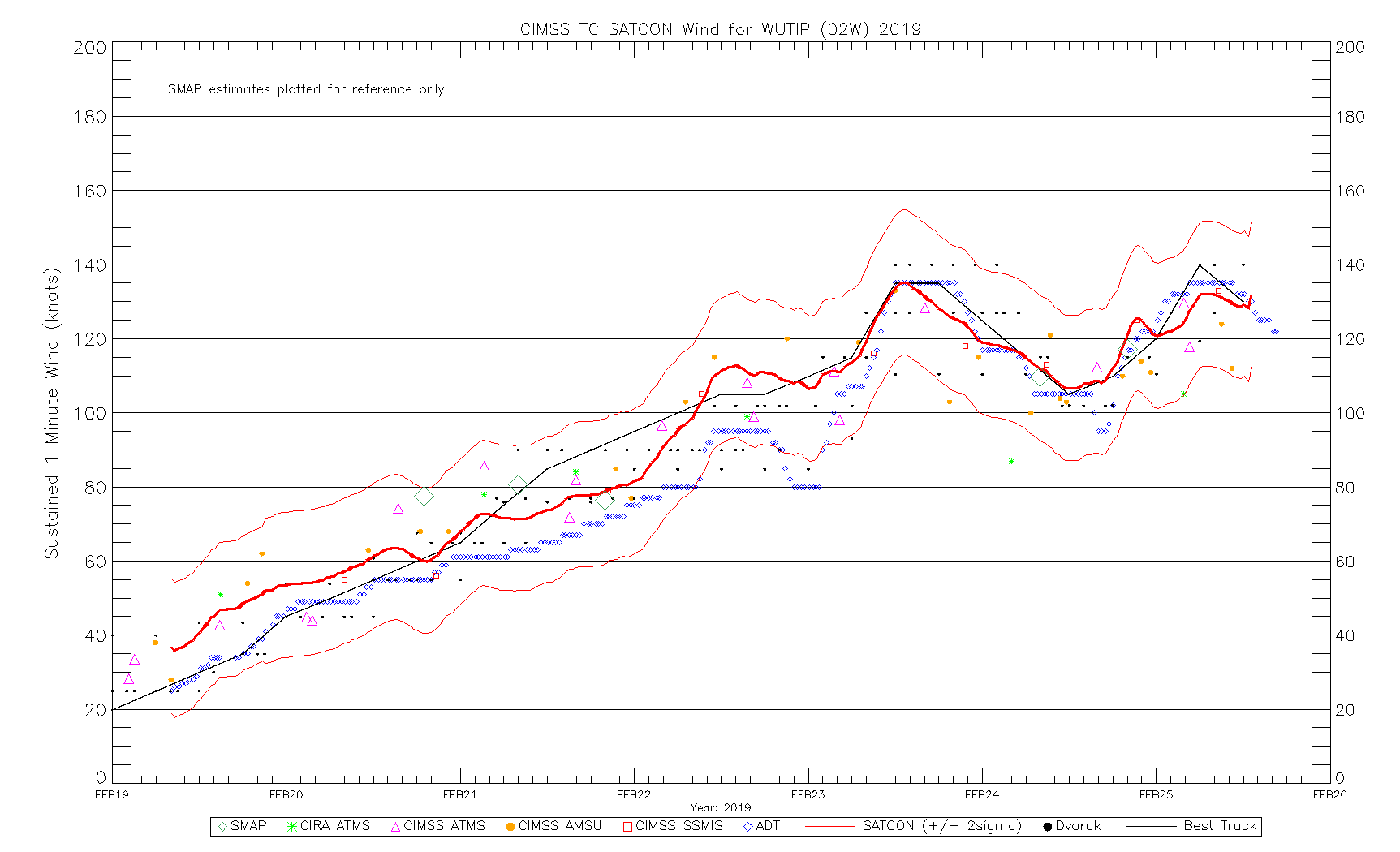
After previously reaching Category 4 intensity on 23 February, Super Typhoon Wutip underwent an eyewall replacement cycle (MIMIC-TC) and emerged to reach Category 5 intensity at 06 UTC on 25 February 2019 (ADT | SATCON) — becoming the strongest (and only Category 5) February tropical cyclone on record for the Northwest... Read More

Using NUCAPS Soundings near Tropical Cyclones

Tropical systems over the western Pacific are in a region where surface observations are few and far between.  Imagers on geostationary satellites, such as the Advanced Himawari Imagery (AHI) on Himawari-8, shown above, capably track such systems, but sounders do a much better job diagnosing the atmosphere through and towards... Read More

GOES-16 Views a House Fire in Rural Wisconsin

GOES-16 viewed the development of a house fire over rural Winnebago County in Nekimi Township, west of Lake Winnebago on late Sunday night 24 February 2019.  The animation above shows warm pixel developing starting at 0439 UTC.  One-minute imagery was available because the county falls within the northern part of... Read More