Wildfires in British Columbia
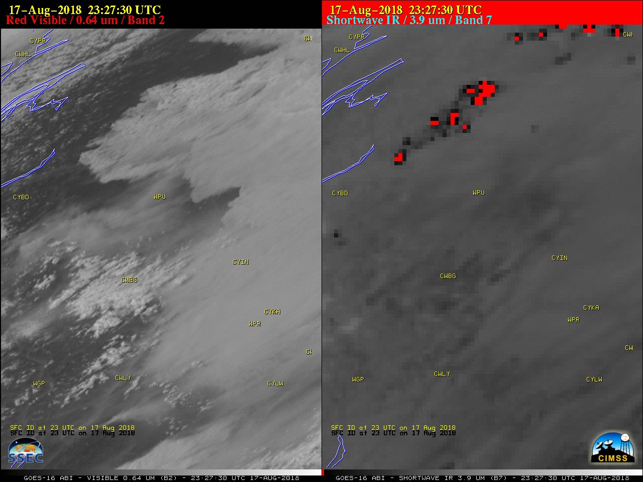
A 2-panel comparison of GOES-16 (GOES-East) “Red” Visible (0.64 µm) and Shortwave Infrared (3.9 µm) images (above) showed the smoke plumes and thermal anomalies or “hot spots” (darker black to red pixels) associated with a flare-up of wildfires in western British Columbia on 17 August 2018.A sequence of Shortwave Infrared (3.7 µm) images from... Read More
