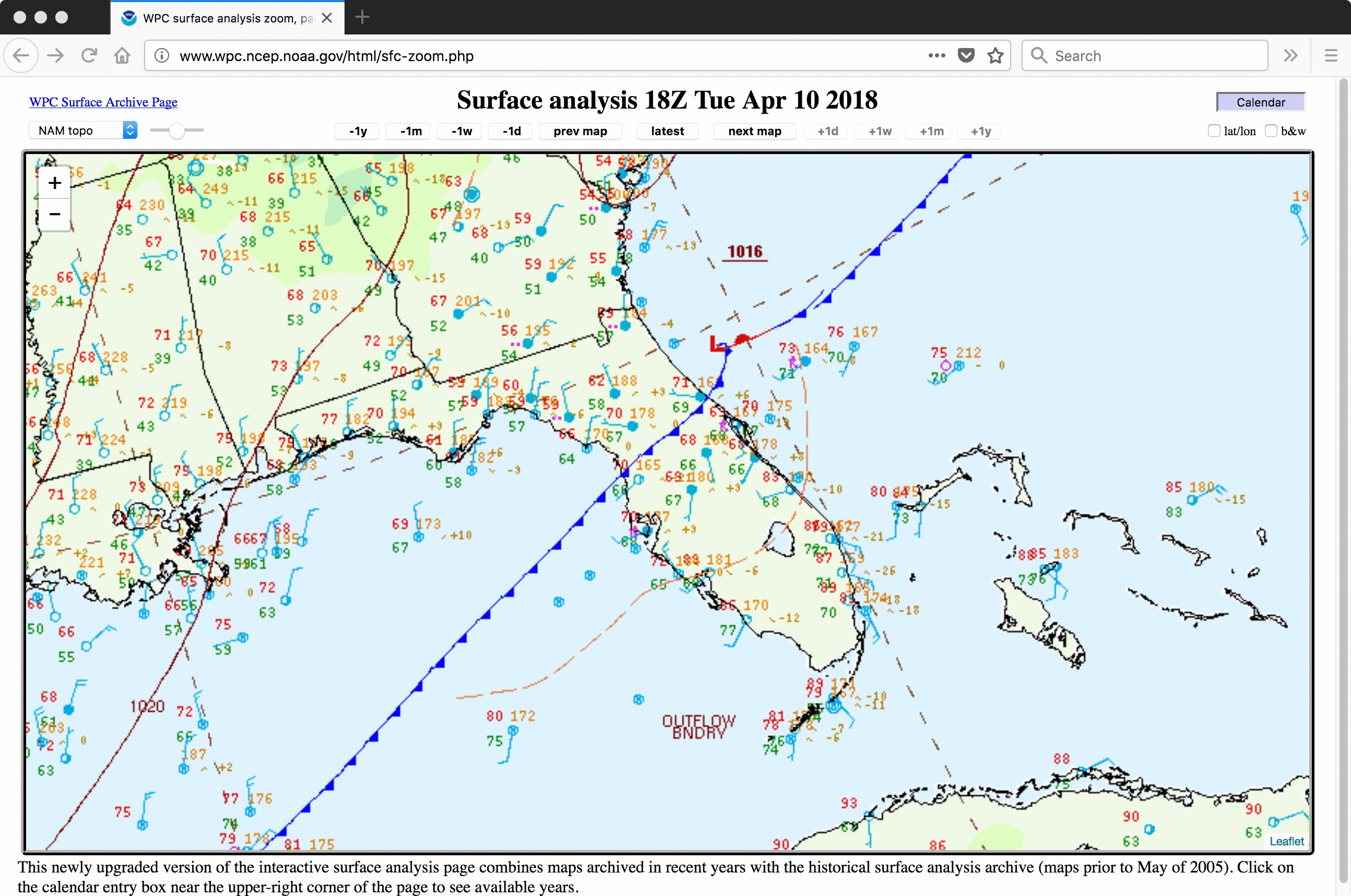
Severe thunderstorms in South Florida
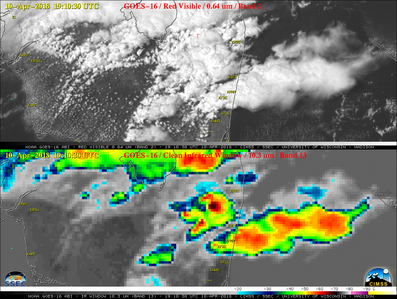
1-minute Mesoscale Sector GOES-16 (GOES-East) “Red” Visible (0.64 µm) and “Clean” Infrared Window (10.3 µm) images (above) showed the southward propagation of a pre-cold-frontal trough axis (surface analyses) which appeared to play a role in enhancing ongoing convection — some thunderstorms then produced weak tornadoes, damaging winds and hail over parts of South Florida... Read More
