Severe weather in the Mid-South, and heavy snow in the Upper Midwest
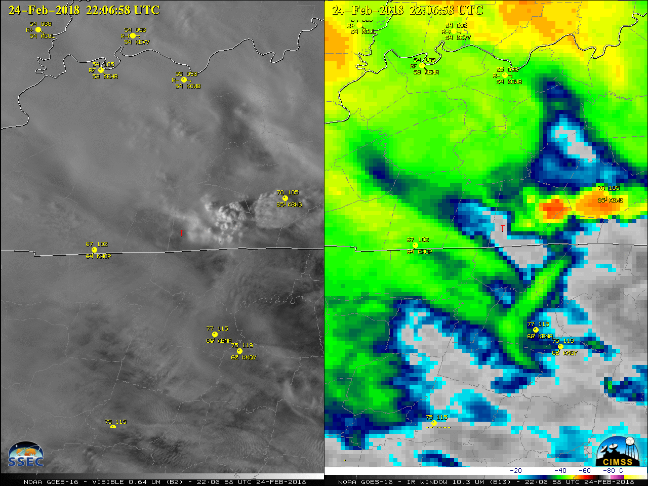
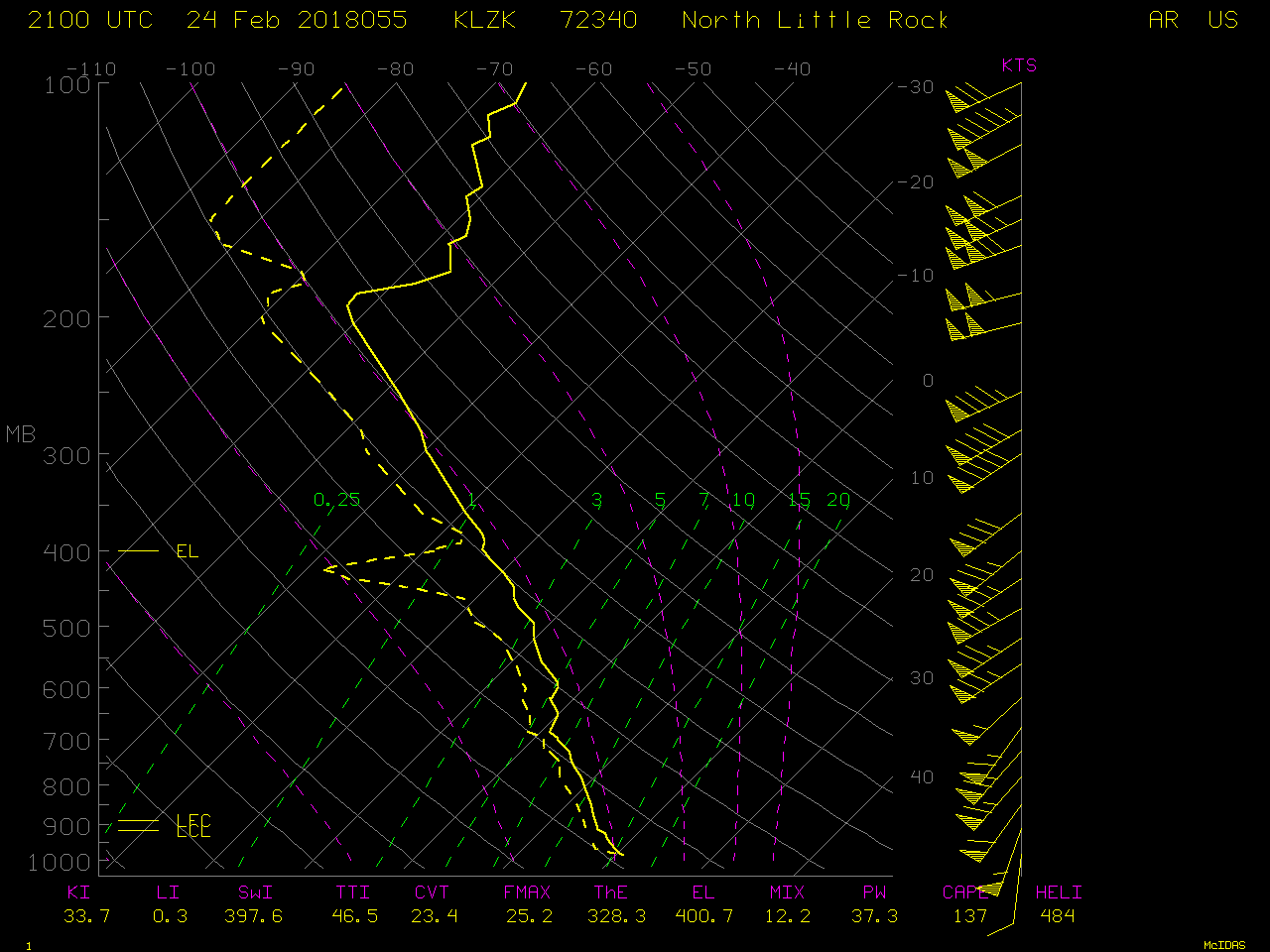
GOES-16 (GOES-East) Mid-level Water Vapor (6.9 µm) images (above) showed the flow of moisture from the lower Mississippi Valley into the Ohio Valley on 24 February 2018 — this fueled the development of flooding rainfall and severe thunderstorms (for more details, see the Satellite Liaison Blog). A special 21 UTC sounding from Little Rock AR indicated 37.3 mm... Read More
