Severe weather in the Mid-South, and heavy snow in the Upper Midwest
![GOES-16 Mid-level Water Vapor (6.9 µm), with hourly plots of surface weather type [click to play Animated GIF | MP4 also available]](https://cimss.ssec.wisc.edu/satellite-blog/wp-content/uploads/sites/5/2018/02/180224_goes16_water_vapor_surface_weather_anim.gif)
GOES-16 Mid-level Water Vapor (6.9 µm) images, with hourly plots of surface weather type [click to play Animated GIF | MP4 also available]
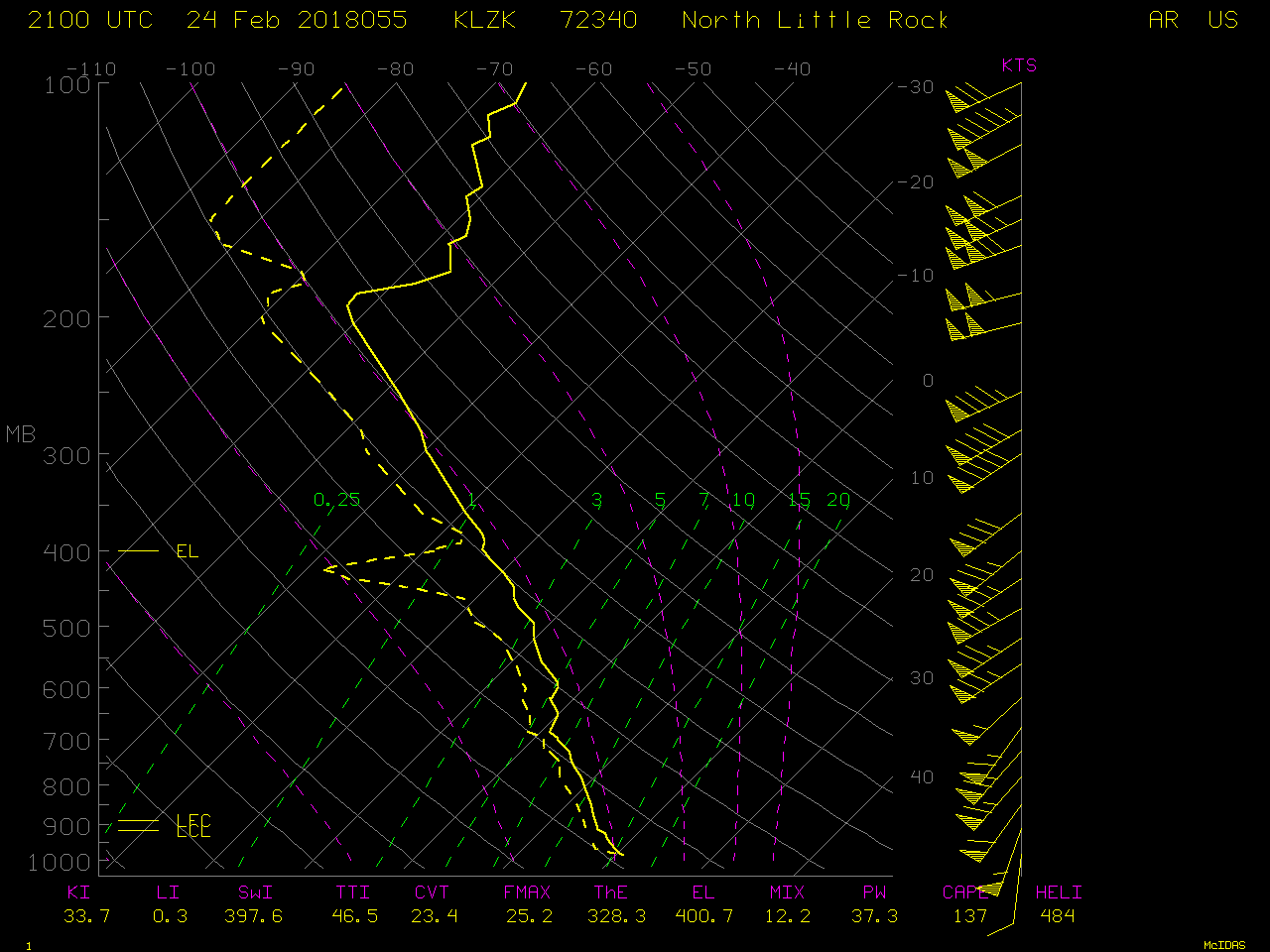
1-minute interval Mesoscale Sector GOES-16 “Red” Visible (0.64 µm) and “Clean” Infrared Window (10.3 µm) images (below) revealed the development of a small supercell thunderstorm just north of the Kentucky/Tennessee border — this storm produced an EF-2 tornado that was responsible for 1 fatality (NWS Louisville damage survey). This (along with another in Arkansas) was the first US tornado-related death in 283 days (a new record in terms of length), with the last occurring in Wisconsin on 16 May 2017.
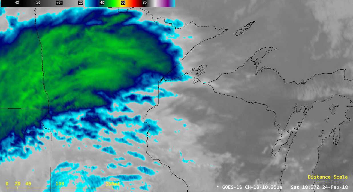
![GOES-16 "Red" Visible<em> (0.64 µm, left)</em> and "Clean" Infrared Window <em>(10.3 µm, right)</em> images, with hourly surface reports plotted in yellow and SPC storm reports plotted in red [click to play Animated GIF | <a href="https://cimss.ssec.wisc.edu/satellite-blog/wp-content/uploads/sites/5/2018/02/180224_goes16_visible_infrared_spc_storm_reports_KY_TN_severe_anim.mp4"><strong>MP4</strong></a> also available]](https://cimss.ssec.wisc.edu/satellite-blog/wp-content/uploads/sites/5/2018/02/180224_goes16_visible_infrared_spc_storm_reports_KY_TN_severe_anim.gif)
GOES-16 “Red” Visible (0.64 µm, left) and “Clean” Infrared Window (10.3 µm, right) images, with hourly surface reports plotted in yellow and SPC storm reports plotted in red [click to play Animated GIF | MP4 also available]

GOES-16 “Red” Visible (0/64 µm) images [click to play animation]
GOES-16 “Clean ” Infrared Widow (10.3 µm) images [click to play animation]
![Terra MODIS Visible (0.65 µm) and Infrared Window (11.0 µm) images [click to enlarge]](https://cimss.ssec.wisc.edu/satellite-blog/wp-content/uploads/sites/5/2018/02/180224_1720utc_terra_modis_visible_infrared_MN_WI_banding_anim.gif)
Terra MODIS Visible (0.65 µm) and Infrared Window (11.0 µm) images [click to enlarge]
![Aqua MODIS Visible (0.65 µm) and Infrared Window (11.0 µm) images [click to enlarge]](https://cimss.ssec.wisc.edu/satellite-blog/wp-content/uploads/sites/5/2018/02/180224_1901utc_aqua_modis_visible_infrared_MN_WI_banding_anim.gif)
Aqua MODIS Visible (0.65 µm) and Infrared Window (11.0 µm) images [click to enlarge]