Canada’s first tornado warning of 2016
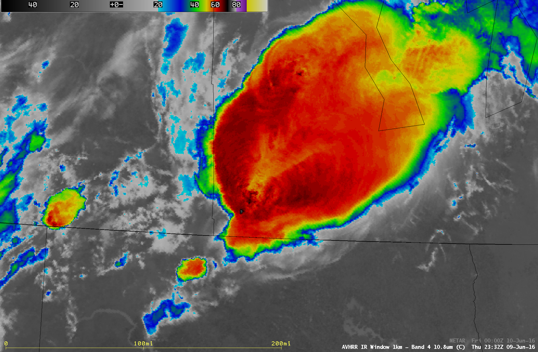
GOES-13 (GOES-East) Visible (0.63 µm) and Infrared Window (10.7 µm) images (above) showed that a cluster of thunderstorms began to develop in far southeastern Saskatchewan around 20 UTC on 09 May 2016, which quickly grew into a large supercell thunderstorm that moved across southwestern Manitoba. This thunderstorm exhibited overshooting tops and a... Read More
