Hurricane Zeta over the Gulf of Mexico
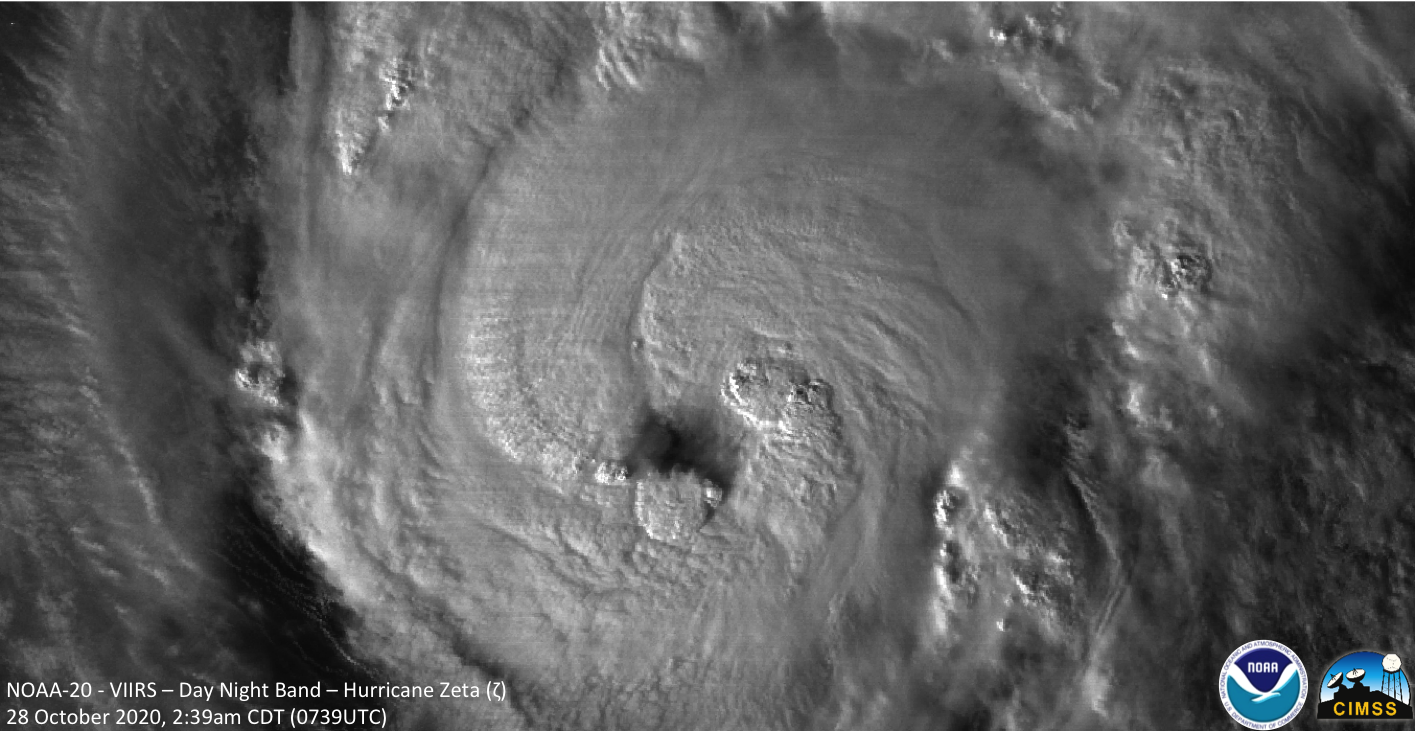
After making landfall as a Category 1 Hurricane along Mexico’s Yucatan Peninsula a day earlier, a weakened Tropical Storm Zeta (NHC advisories) began to slowly re-intensify as it moved northward across the Gulf of Mexico after sunset on 27 October 2020 — 1-minute Mesoscale Domain Sector GOES-16 (GOES-East) “Clean” Infrared Window (10.35 µm) images with an overlay of... Read More