Heavy rainfall and flooding in eastern Kentucky
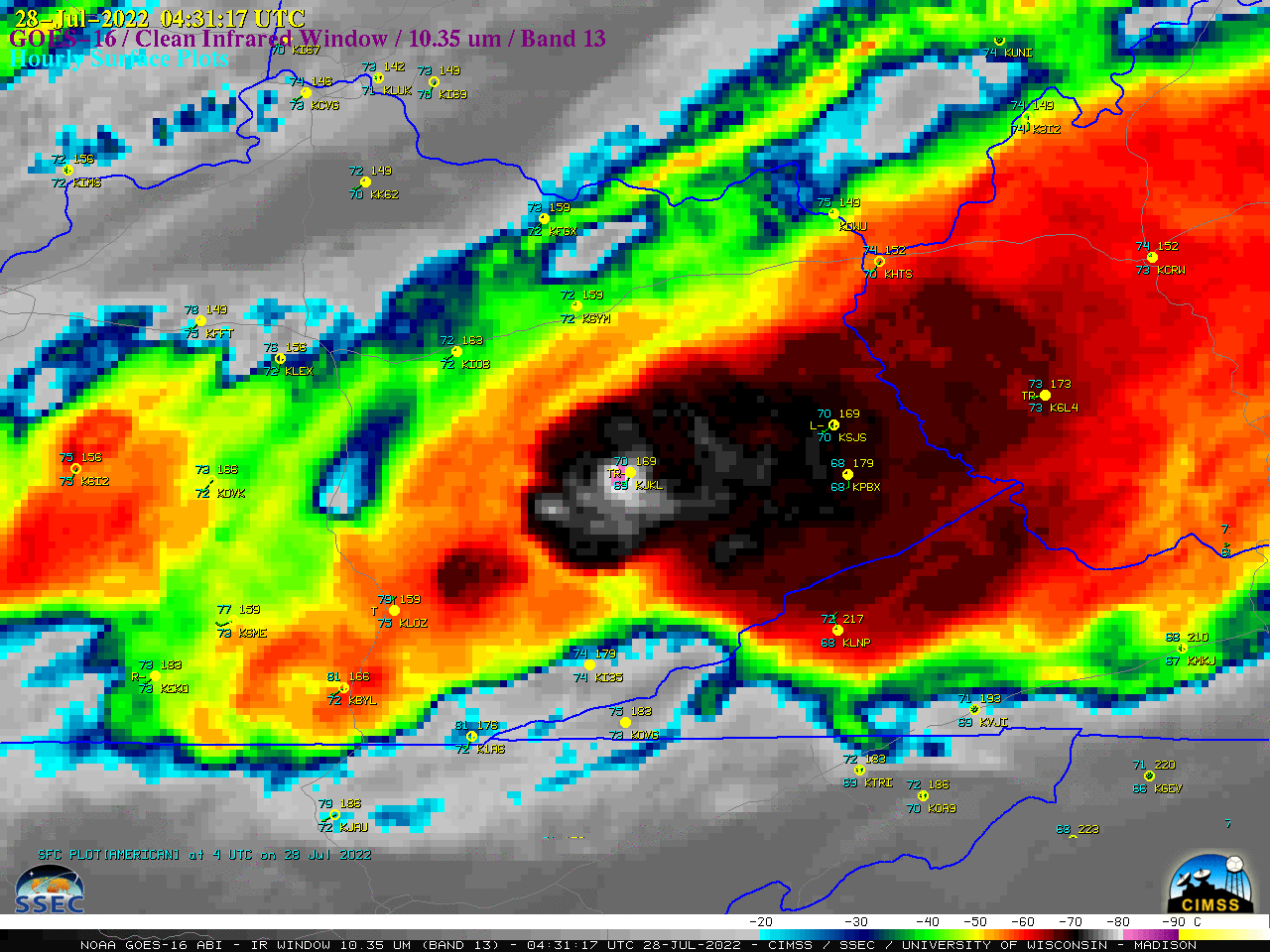
GOES-16 (GOES-East) “Clean” Infrared Window (10.35 µm) images (above) showed the development of multiple clusters of thunderstorms that were responsible for producing heavy rainfall and flash flooding across parts of eastern Kentucky during the nighttime hours leading up to sunrise on 28 July 2022. The coldest GOES-16 cloud-top infrared brightness temperature associated with these thunderstorms was -82.7ºC... Read More
