This website works best with a newer web browser such as Chrome, Firefox, Safari or Microsoft Edge. Internet Explorer is not supported by this website.

Category: VIIRS

Sea ice in the Bering Sea

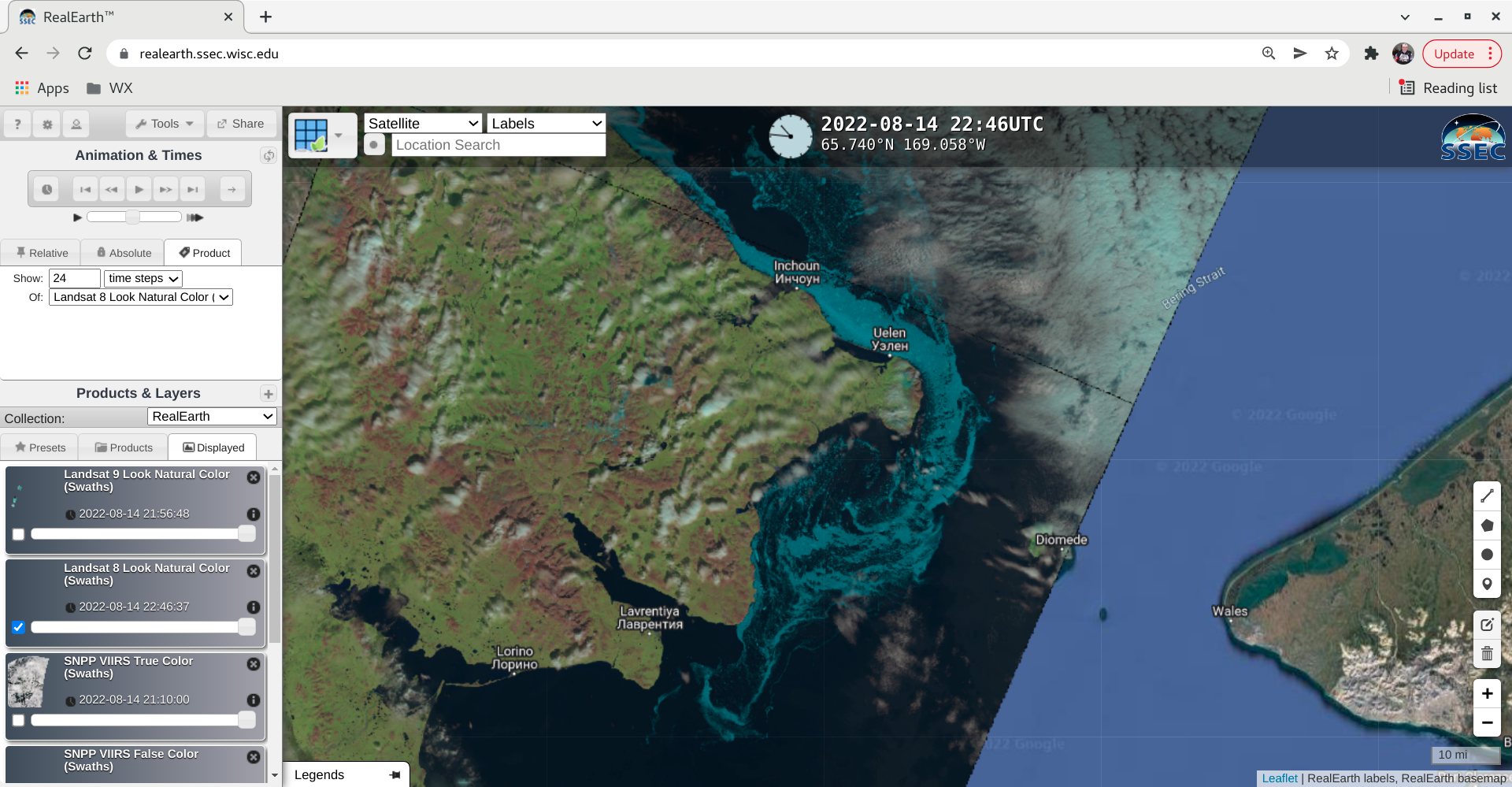
GOES-18 (GOES-West) True Color RGB images viewed using CSPP GeoSphere (above) showed the motion of sea ice filaments that had moved southward through the Bering Strait and into the northwestern Bering Sea (just off the coast of Chokotka Okrug, Russia) on 14 August 2022. A sequence of 375-meter resolution VIIRS False Color RGB... Read More

30-second imagery of severe thunderstorms across the Upper Midwest

Overlapping 1-minute GOES-16 (GOES-East) Mesoscale Domain Sectors provided 30-second “Red” Visible (0.64 µm) images (above), which included time-matched plots of SPC Storm Reports — showing clusters of thunderstorms that moved eastward across parts of Illinois, Indiana and Lower Michigan on 03 August 2022.The corresponding 30-second GOES-16 “Clean” Infrared Window (10.35 µm) images (below) indicated that the coldest... Read More

McKinney Fire in California produces multiple pyrocumulonimbus clouds

1-minute Mesoscale Domain Sector GOES-17 (GOES-West) “Red” Visible (0.64 µm), Fire Temperature RGB, “Clean” Infrared Window (10.35 µm) and Cloud Top Temperature derived product images (above) showed that the rapidly-growing McKinney Fire in far northern California produced multiple (5 or 6) pulses of pyrocumulonimbus (pyroCb) clouds late in the day on 30 July 2022. The coldest pyroCb cloud-top 10.35... Read More