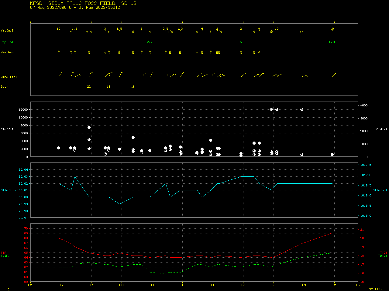
Record 24-hour rainfall in Sioux Falls, South Dakota

GOES-16 “Clean” Infrared Window (10.35 µm) images [click to play animated GIF | MP4]
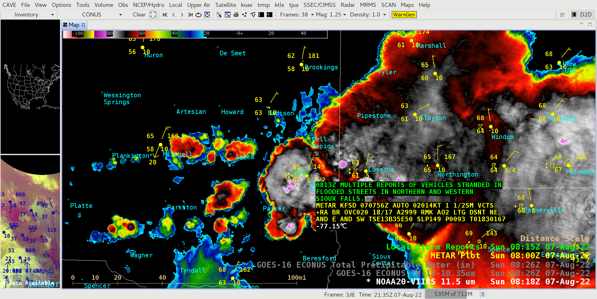
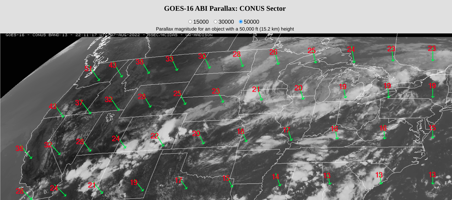
Shortly after flash flooding had been reported in Sioux Falls, a toggle between NOAA-20 VIIRS Infrared (11.45 µm) and GOES-16 ABI “Clean” Infrared Window (10.35 µm) images valid at 0826 UTC (below) revealed that the coldest NOAA-20 cloud-top infrared brightness temperatures near Sioux Falls at that time were -83ºC, compared to -74ºC with GOES-16 (identical color enhancements were applied to both images). The northwestward shift in GOES-16 image cloud-top features was associated with parallax (which in this case was a distance of 22 km for a cloud-top height of 50,000 feet).
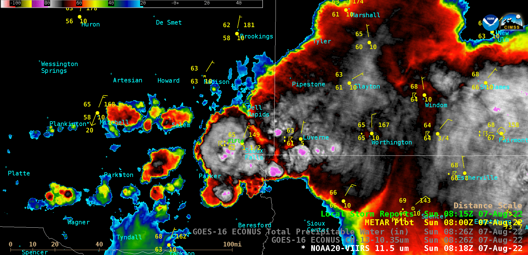
NOAA-20 Infrared Window (11.45 µm) and GOES-16 “Clean” Infrared Window (10.35 µm) images valid at 0826 UTC [click to enlarge]
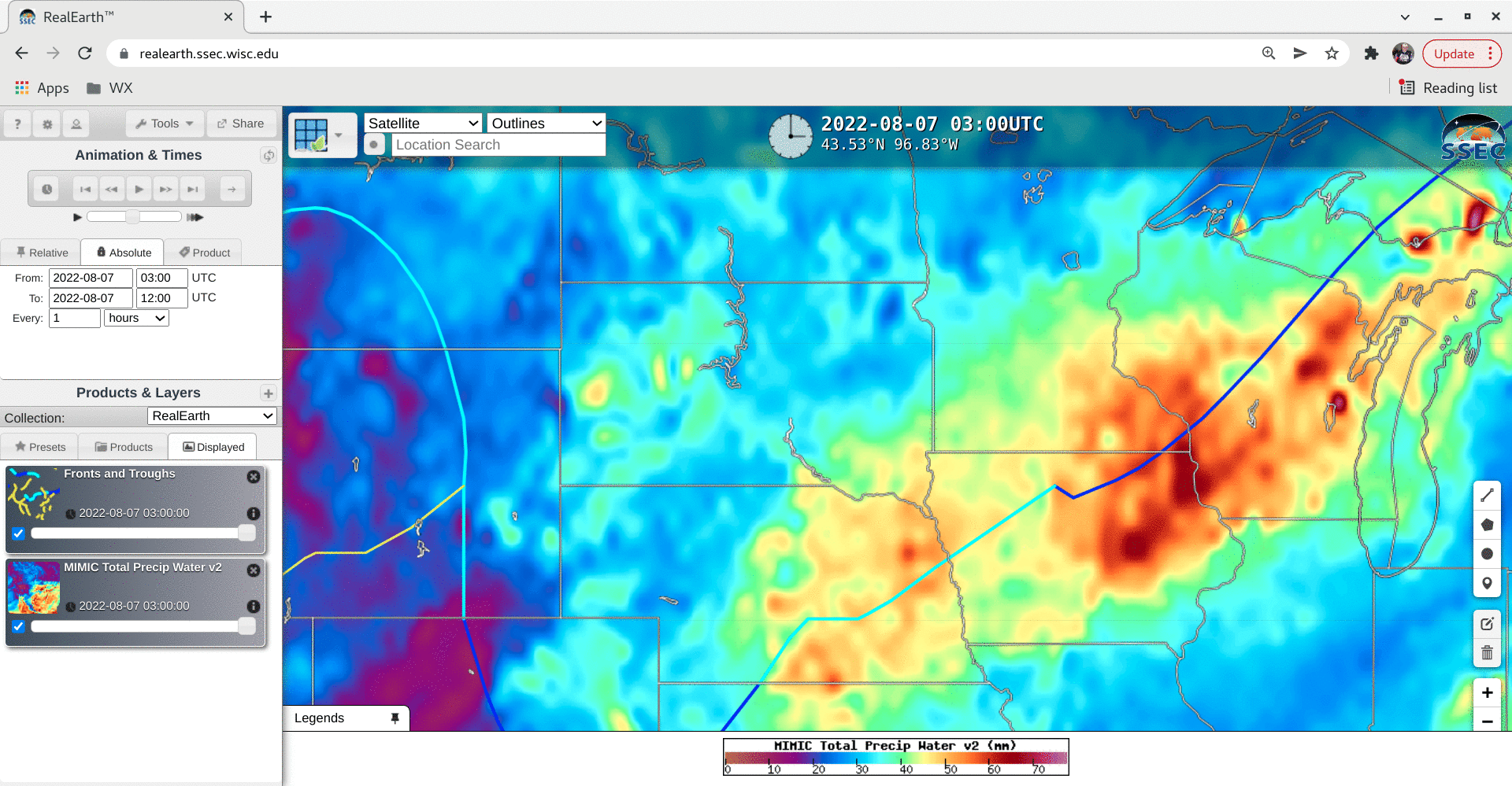
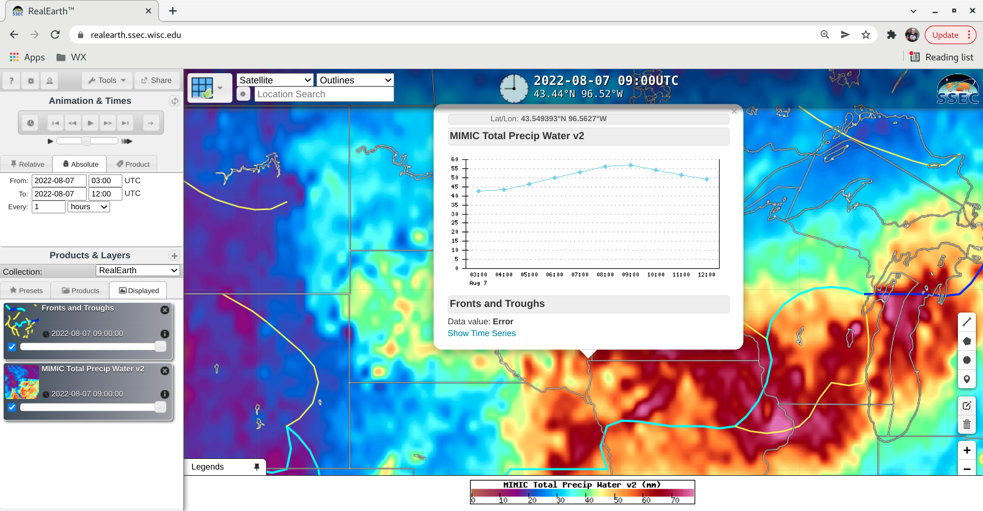
MIMIC Total Precipitable Water product at 03, 06, 09 and 12 UTC (with plots of surface fronts/troughs) [click to enlarge]