This website works best with a newer web browser such as Chrome, Firefox, Safari or Microsoft Edge. Internet Explorer is not supported by this website.

Category: VIIRS

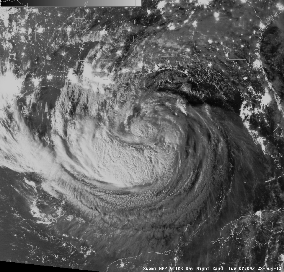
Day-Night Band Imagery of Isaac

The Day-Night Band on VIIRS, flying on the Suomi/NPP satellite gave an excellent view of Isaac at strong tropical storm strength in the northern Gulf of Mexico shortly after midnight on August 28 2012. VIIRS is providing something unique to forecasters: Visible imagery at night that allows easy identification of overshooting... Read More

Wildfires in Idaho

McIDAS images of GOES-13 0.63 µm visible channel data (above; click image to play animation) showed the smoke plumes emanting from a number of large wildfires that were burning in parts of Idaho on 24 August 2012. Note that some of the low-altitude smoke was being channeled southward through valleys... Read More

Fog and Low Stratus Detection

Water clouds, such as those that develop when fog and low stratus form, have different emissivity properties at short IR wavelengths (around 3.9 µm) compared to longer IR wavelengths (around 11 µm). At shorter IR wavelengths, water cloud do not emit as blackbodies, meaning less radiation is emitted than is... Read More