Flooding Rains in Las Vegas
")
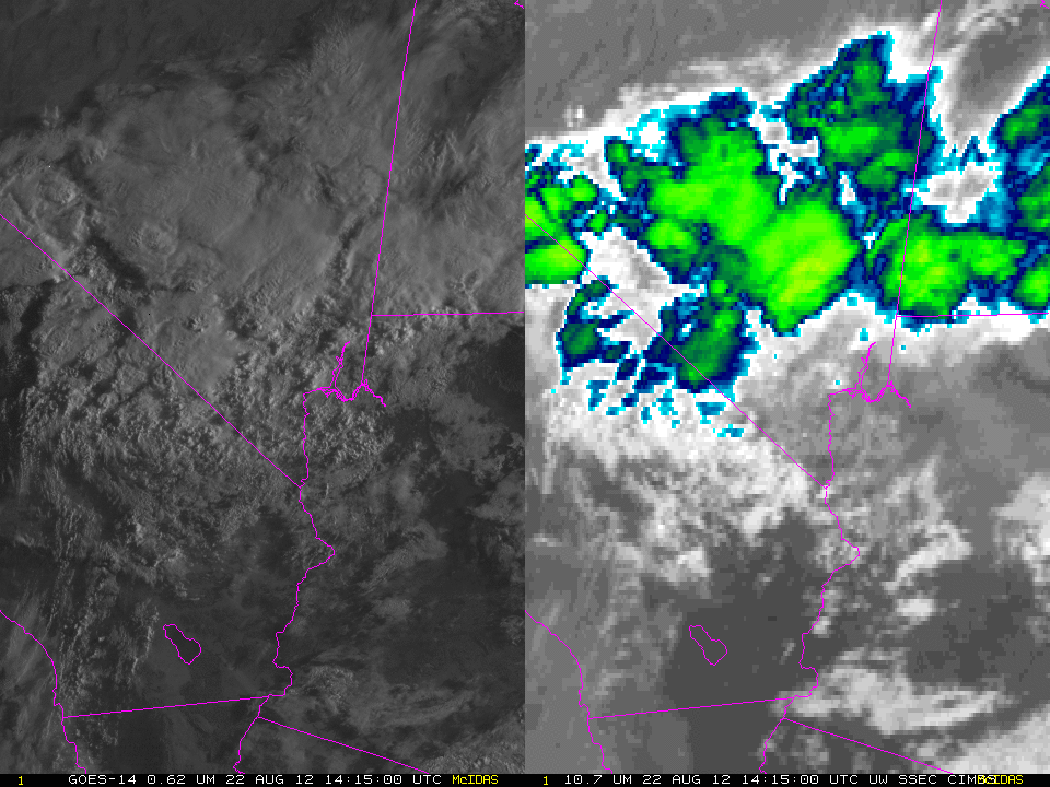
GOES-14 SRSOR 0.62 µm and 10.7 µm Imagery (click image to play animation)
GOES-14 is in SRSOR operations today and was well-positioned to monitor the flooding rains that occurred in Las Vegas (which received a daily record 1.65 inches of rainfall). The animation above shows cold cloud tops northeast of Las Vegas, with more convection moving in from the southwest. Click here for a large (85 M) animated gif file of one-minute imagery from 1415 UTC through 1859 UTC).
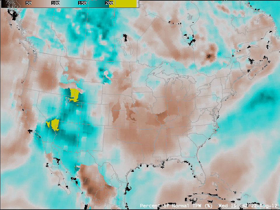
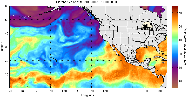
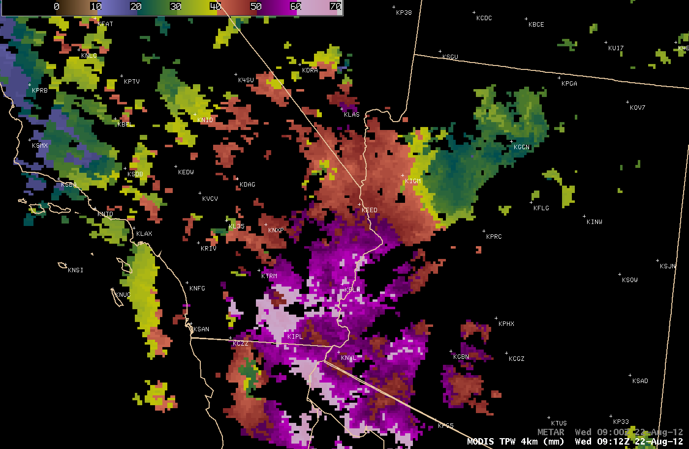
The Blended Total Precipitable Water product (TPW) for this afternoon shows a local maximum in TPW over the southwestern United States. A MIMIC TPW animation suggests that the moisture has originated from a surge up the Gulf of California. During the previous night-time hours, MODIS TPW values of 50-60 mm were seen across far southeastern California, far southwestern Arizona, and in the Las Vegas area as well.
")
Suomi NPP VIIRS 0.64 µm visible channel and 11.45 µm IR channel images (with cloud-to-ground lightning strikes)
AWIPS images of Suomi NPP VIIRS 0.64 µm visible channel and 11.45 µm IR channel data (above) showed the convective cluster in southern California at 20:29 UTC (which was seen early on the GOES-14 image animation). Cloud top IR brightness temperatures were as cold as -69º C (dark red color enhancement), and a number of cloud-to-ground lightning strikes (mostly of negative polarity) were detected within a 15-minute period as this thunderstorm was growing in size and intensity.