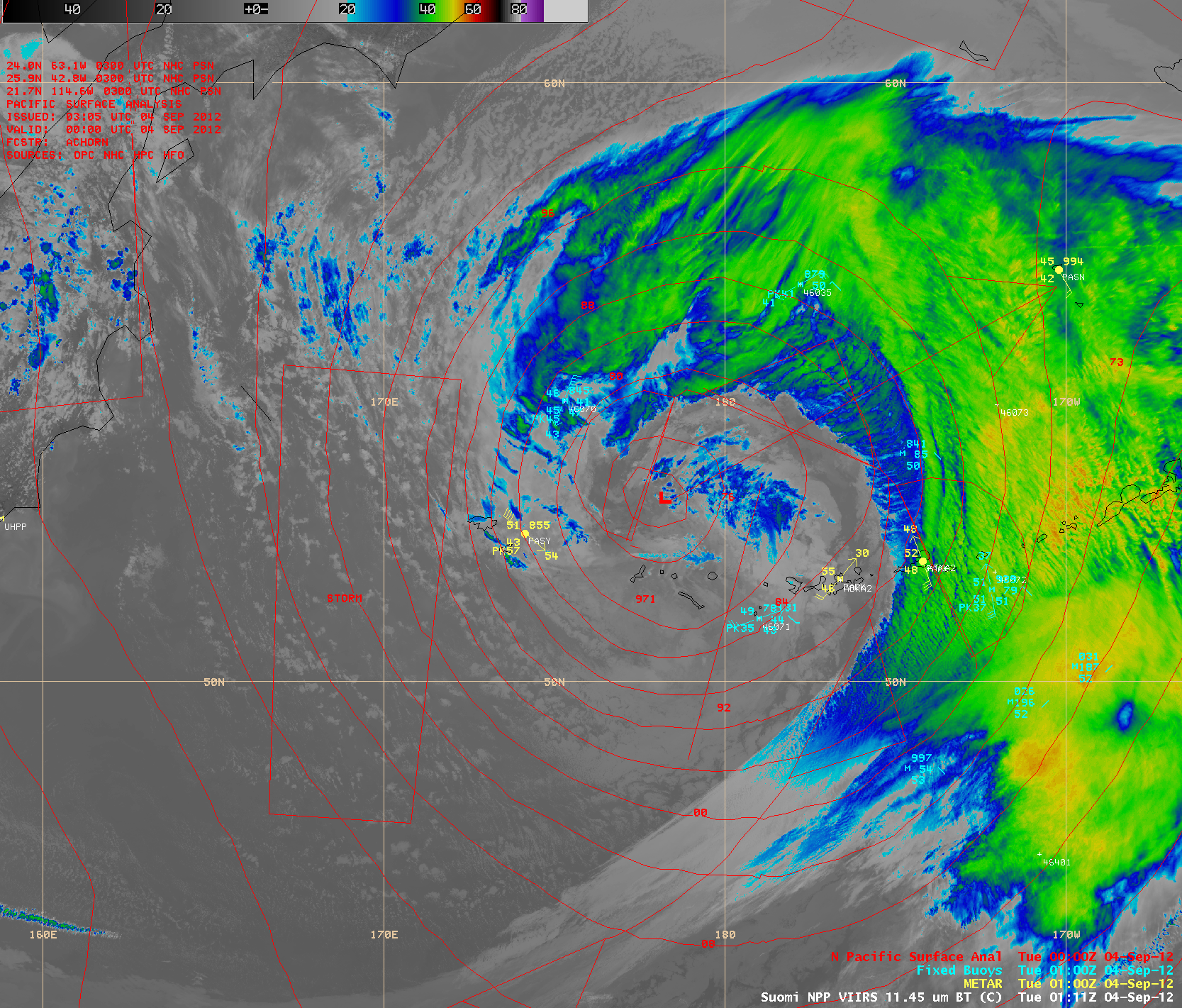
This website works best with a newer web browser such as Chrome, Firefox, Safari or Microsoft Edge. Internet Explorer is not supported by this website.

Category: VIIRS

Wildfires in the northwestern US

McIDAS images of GOES-13 0.63 µm visible channel data during the day and 3.9 µm shortwave IR data at night (above; click image to play animation) revealed a number of very large and dense smoke plumes from wildfires that were burning in parts of the northwestern US (primarily in Idaho)... Read More

Hurricane Isaac

Isaac reached Category 1 hurricane intensity mid-day on 28 August 2012. AWIPS images of 1-km resolution visible and IR data from the VIIRS, AVHRR, and MODIS instruments (below) showed curved banding features and convective bursts with overshooting... Read More