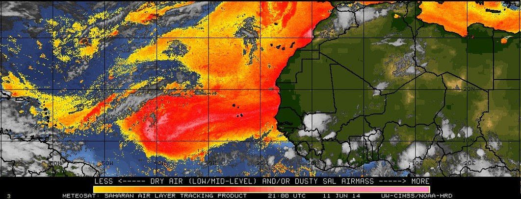
Saharan Air Layer dust over the Gulf of Mexico
McIDAS images of GOES-13 0.63 µm visible channel data on 20 June 2014 (above; click image to play animation; also available as an MP4 movie file) and on 21 June 2014 (below;... Read More
McIDAS images of GOES-13 0.63 µm visible channel data on 20 June 2014 (above; click image to play animation; also available as an MP4 movie file) and on 21 June 2014 (below;... Read More
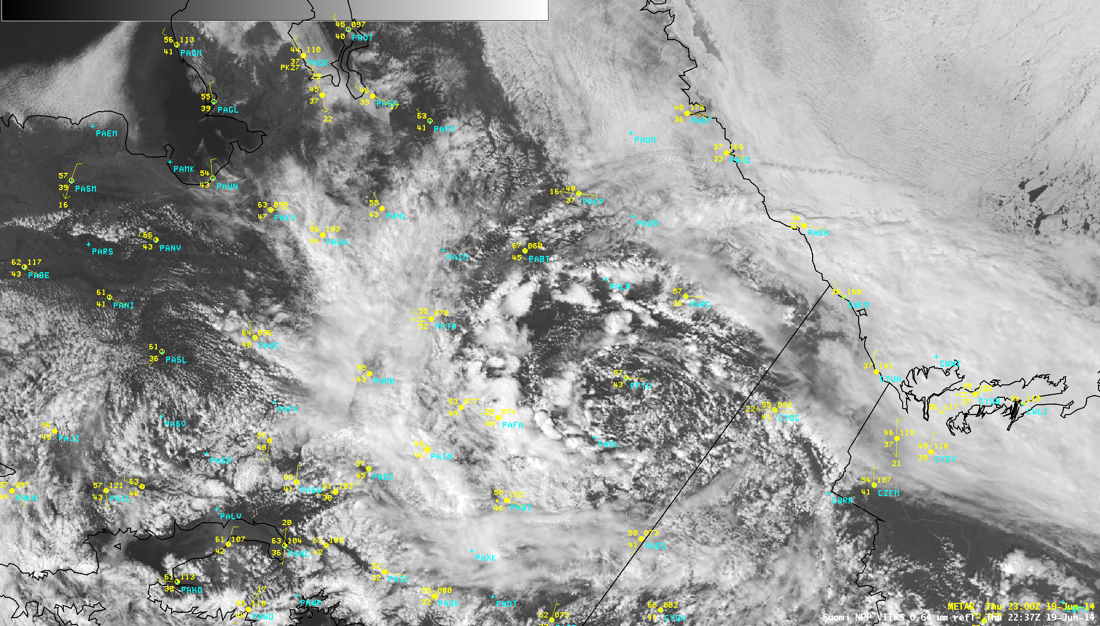
AWIPS images of Suomi NPP VIIRS 0.64 µm visible channel data (above) showed the development of early afternoon thunderstorms over the interior of Alaska as an upper-level low moved westward over the region on 19 June 2014.An animation of VIIRS 11.45 µm IR channel images spanning the 18-19 June period... Read More
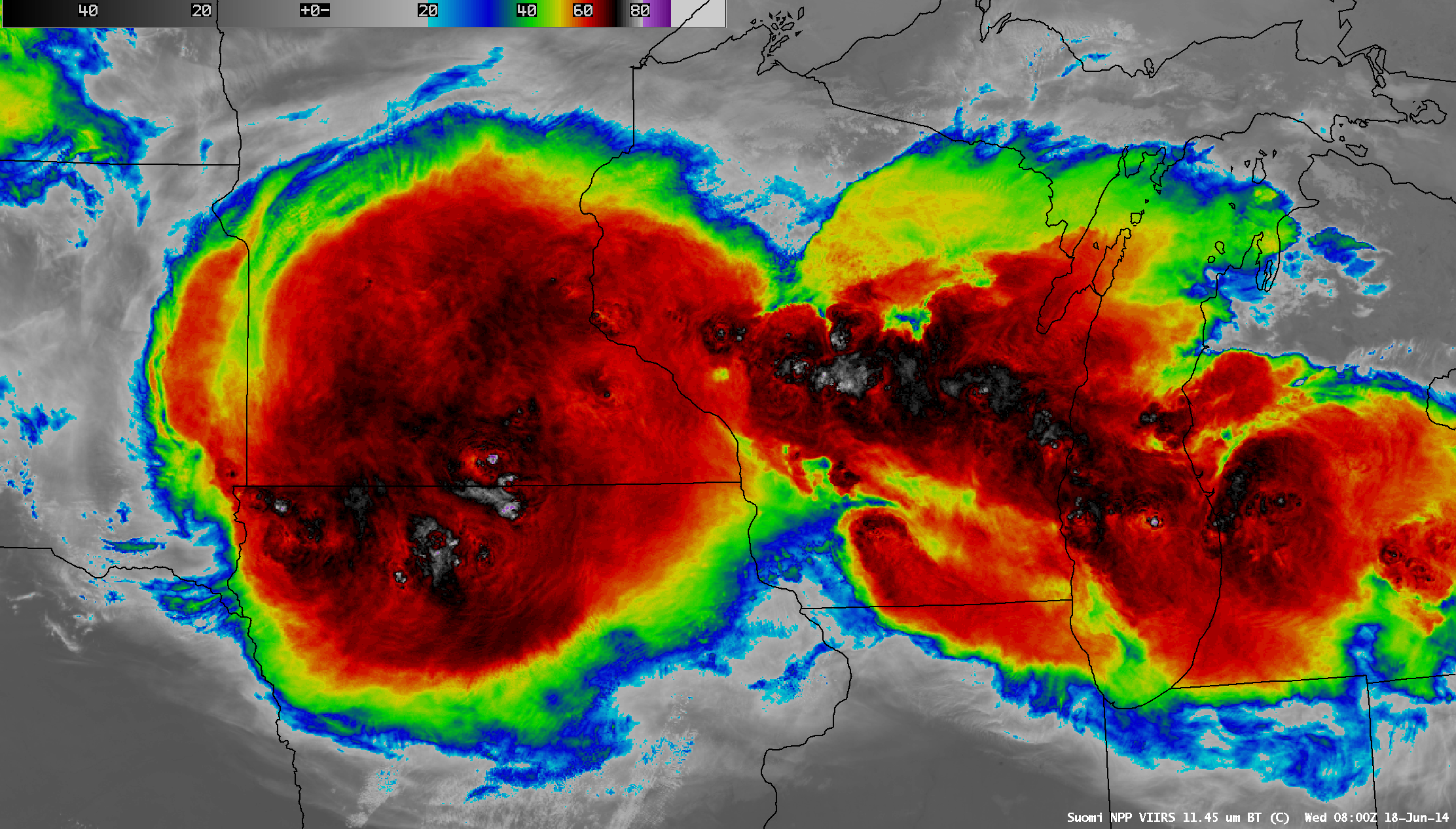
A comparison of AWIPS images of Suomi NPP VIIRS 11.45 µm IR channel and 0.7 µm Day/Night Band data (above) showed very large areas of cold cloud-top IR brightness temperatures associated with Mesoscale Convective Systems (MCSs) over the Upper Midwest region of the US at 08:00 UTC (3:00 AM Central... Read More
Unusual twin tornadoes (click here for a summary of photos/videos from the Capitol Weather Gang) formed in northeastern Nebraska (Storm Reports from SPC) late in the afternoon of the 16th of June 2014. How did satellite data anticipate the development and progression of the severe convection? GOES-13 Sounder data painted a picture of... Read More
