Thunderstorms over the interior of Alaska
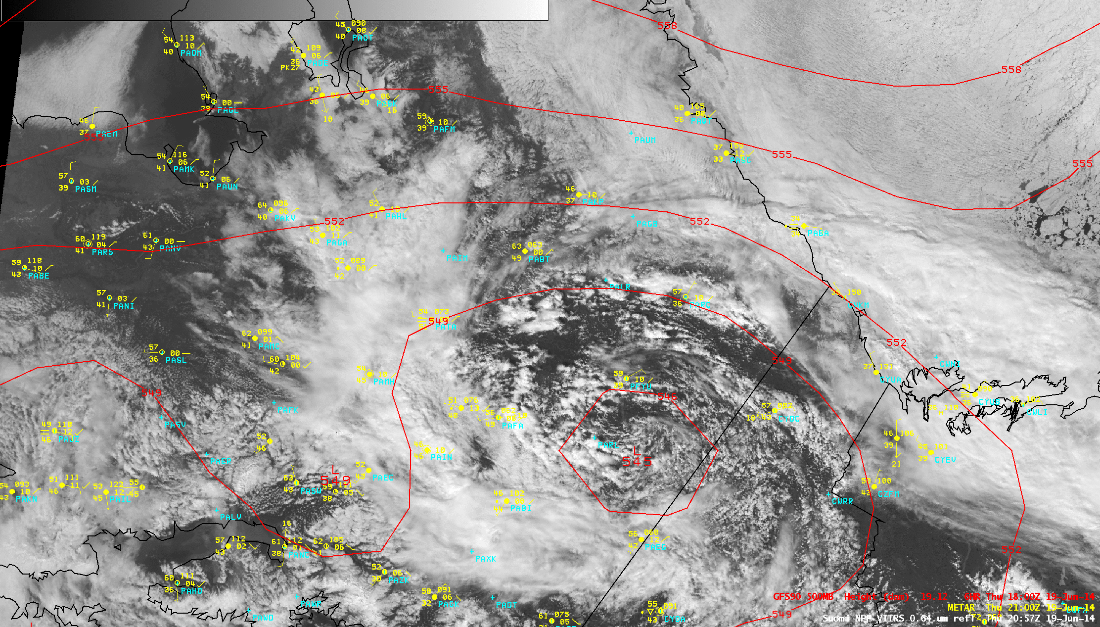
Suomi NPP VIIRS 0.64 µm visible channel images, with contours of GFS90 500 hPa geopotential height
AWIPS images of Suomi NPP VIIRS 0.64 µm visible channel data (above) showed the development of early afternoon thunderstorms over the interior of Alaska as an upper-level low moved westward over the region on 19 June 2014.
An animation of VIIRS 11.45 µm IR channel images spanning the 18-19 June period (below) depicted large areas of cloudiness exhibiting cold cloud-top IR brightness temperature values in the -45 to -50º C range (darker red color enhancement). During this time some locations across the interior of Alaska received over 4 inches of rainfall, prompting the issuance of Flood Warnings for parts of the Goodpaster, Salcha, and Upper Chena Rivers.
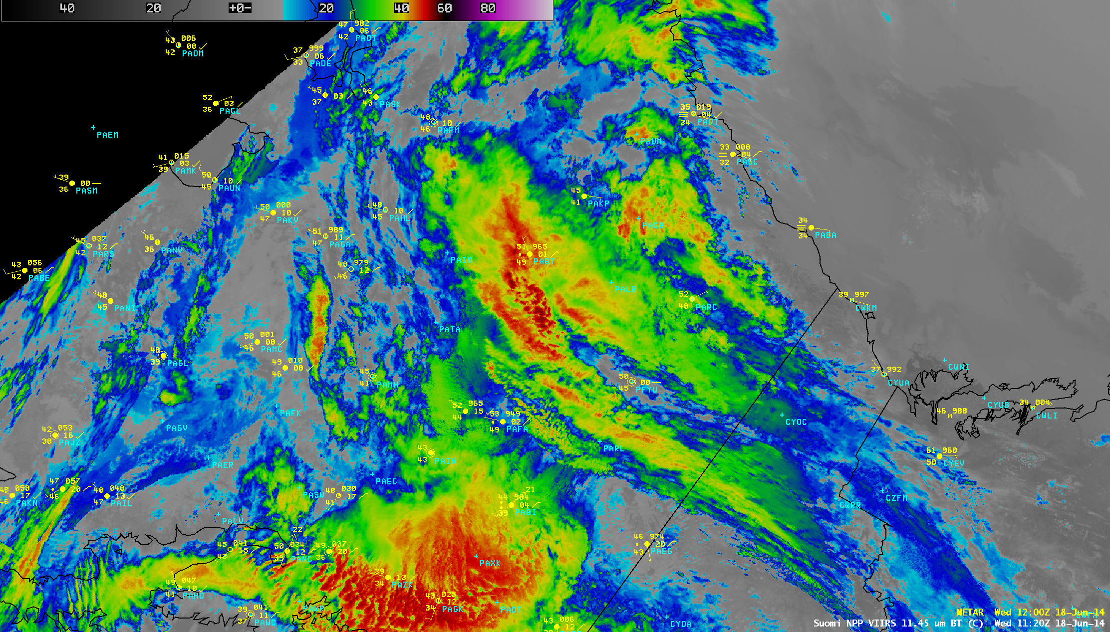
Suomi NPP VIIRS 11.45 µm IR channel images
————————————————————————————-
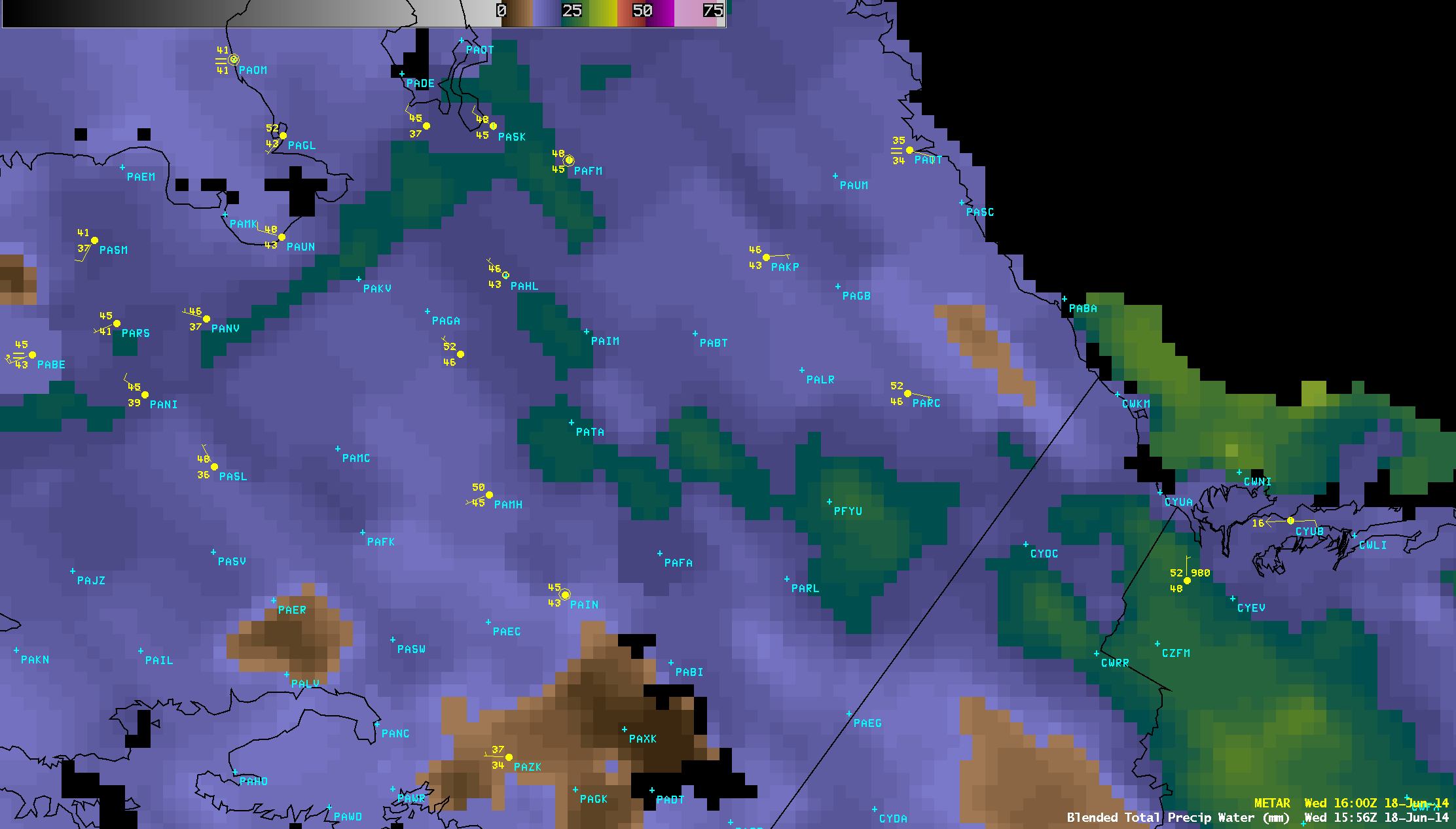
Blended Total Precipitable Water product (click to play animation)
The Blended Total Precipitable Water (TPW) product (above; click image to play animation) showed areas where TPW values were in the 25-30 mm or 1.0 to 1.2 inch range (darker green to yellow color enhancement). The corresponding Percent of Normal TPW product (below; click image to play animation) indicated that these TPW values were generally in the 150-200% of normal range for this region and this time of year.

Percent of Normal Blended Total Precipitable Water product (click to play animation)