Heavy rainfall in Arizona from the remnants of Rosa
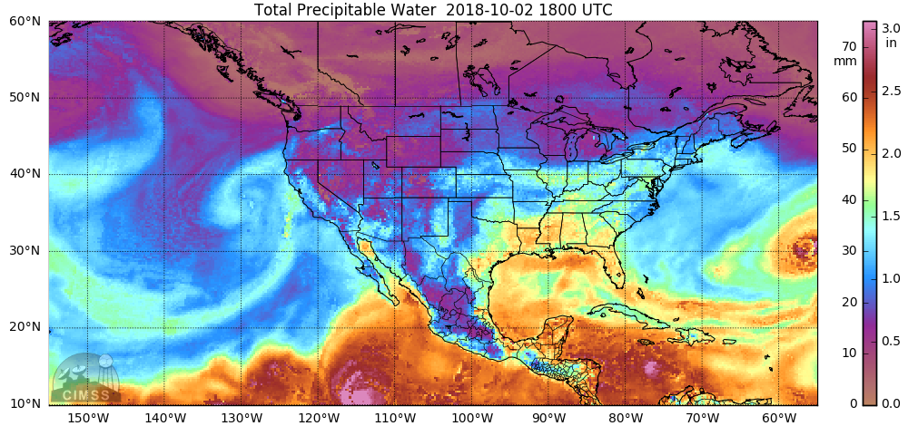
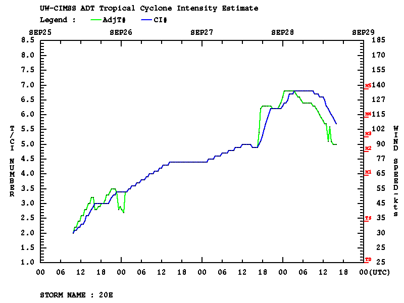
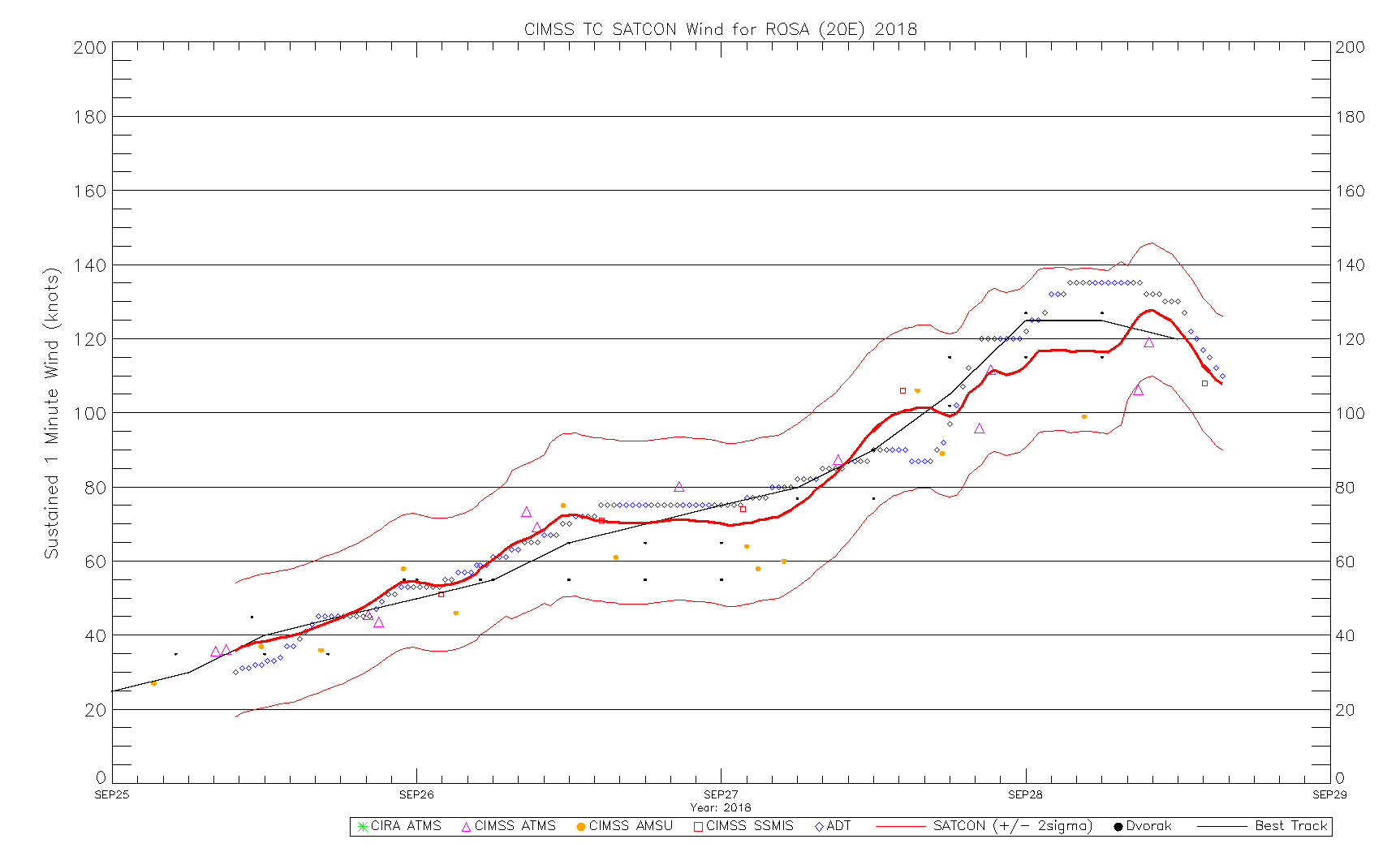
Rosa became a Tropical Storm on 25 September 2018, and reached peak intensity as a Category 4 Hurricane on 28 September. As it gradually weakened and made landfall over Baja California on 02 October, its moisture moved across the US Desert Southwest causing heavy rainfall and flash flooding — parts of... Read More


