This website works best with a newer web browser such as Chrome, Firefox, Safari or Microsoft Edge. Internet Explorer is not supported by this website.

Category: Tropical cyclones

Cyclone Biparjoy in the Arabian Sea

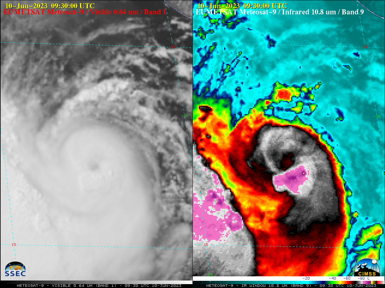
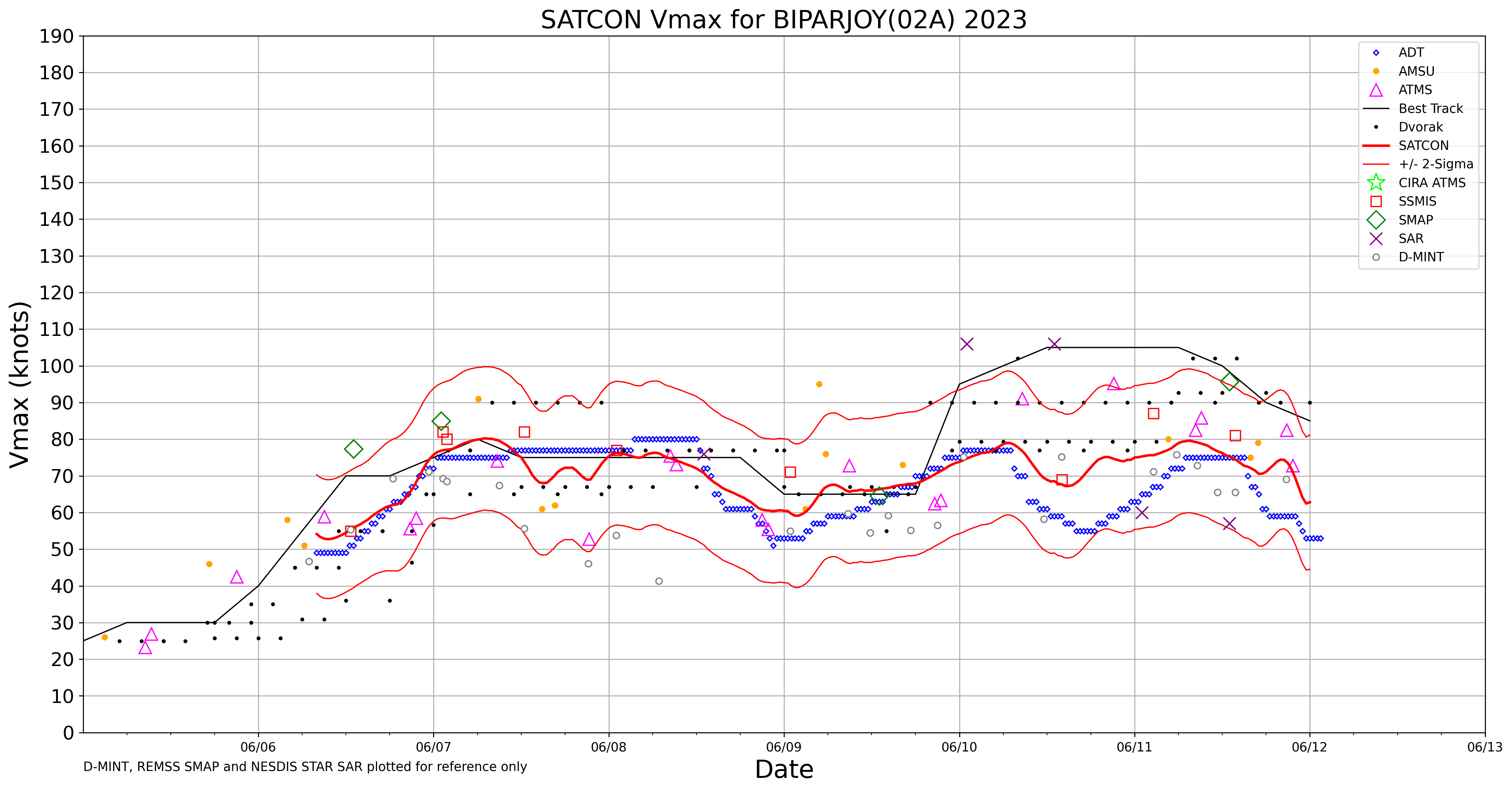
Cyclone Biparjoy in the Arabian Sea began a period of rapid intensification late in the day on 09 June 2023, reaching Category 3 intensity by 12 UTC on 10 June (SATCON) — EUMETSAT Meteosat-9 Visible (0.64 µm) and Infrared Window (10.8 µm) images (above) showed Biparjoy during the 0100-1330 UTC... Read More

Tropical Depression Two develops in the Gulf of Mexico

1-minute Mesoscale Domain Sector GOES-16 (GOES-East) “Red” Visible (0.64 µm) and “Clean” Infrared Window (10.3 µm) images (above) showed Tropical Depression Two as it developed over the northern Gulf of Mexico on 01 June 2023. The low-level circulation center became exposed late in the day, as deep convection remained focused to the northeast of the disturbance center — cloud-top infrared brightness... Read More

Long animations of Typhoon Mawar in the western Pacific

The Himawari-9 Target sector monitored the evolution of Typhoon Mawar from its inception. The animation above (it re-centers occasionally) shows the initial intensification of the system, a brief but notable weakening just prior to moving close to Guam, and then reintensification to the west-northwest of the Marianas. The animation... Read More